
Latest typhoon and tropical depression news at noon on July 23 from the Philippine Atmospheric, Geophysical and Astronomical Services Administration (PAGASA) said that tropical depression Kiyapo accelerated slightly as it moved northwest over the Philippine Sea in the eastern area of Northern Luzon. The center of the tropical depression is 830km east of Northern Luzon. This tropical depression has maximum sustained winds of 45 km/h near the center and gusts of up to 55 km/h.
On the morning of July 23, the Japan Meteorological Agency (JMA) issued the first tropical storm warning for tropical depression Noul - the name given by North Korea, meaning "red sky". JMA's Western Pacific Regional Meteorological Center forecasts that this system will reach tropical storm intensity on July 24. However, unlike other forecasting agencies, JMA does not predict that this storm near the East Sea will reach strong tropical storm intensity.
Hong Kong Meteorological Station (China) said that the tropical depression near the Philippines may strengthen into a storm and move closer to Hong Kong (China) by the end of this week. "The tropical depression over the waters east of the Philippines will enter the northeast of the South China Sea by the end of this week and gradually strengthen, with a high possibility of moving towards the waters east of Guangdong by the end of the week" - the bulletin stated.
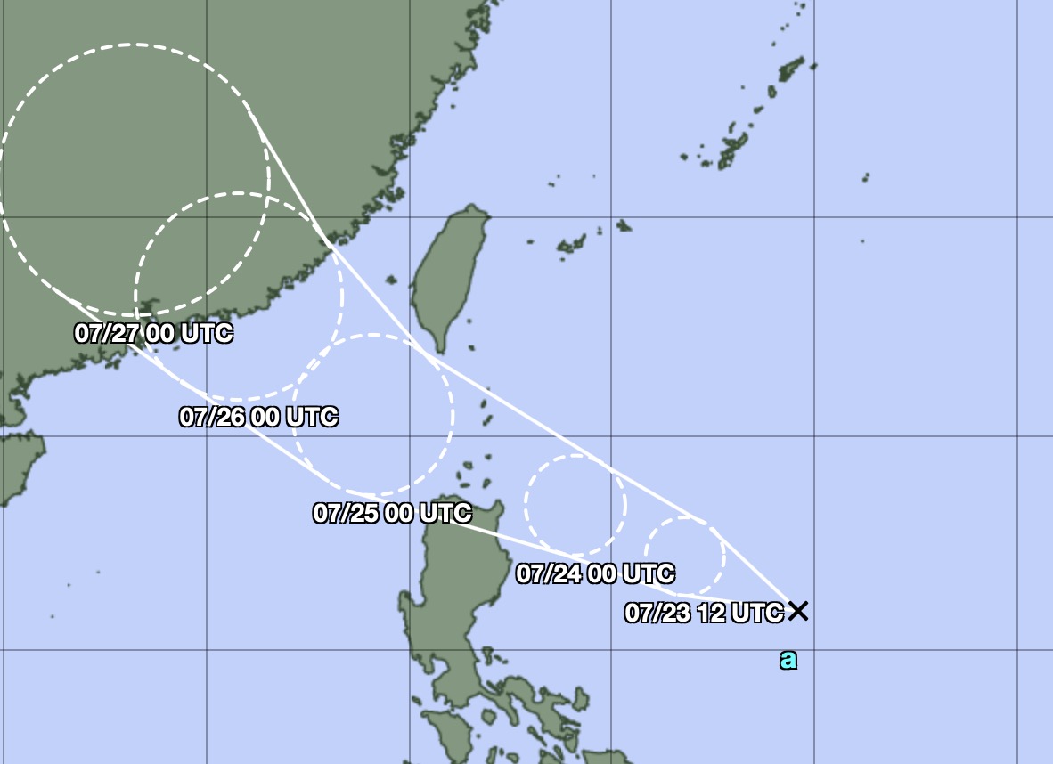
According to the latest forecast path, the latest storm in the East Sea will make landfall on the morning of July 26 in Hui Lai district, Yet Duong city, Guangdong province (China), with strong storm intensity, with maximum sustained winds near the storm center of about 120 km/h. The expected landfall location is less than 400km east of Hong Kong (China). Due to the impact of the latest storm, there will be strong winds, heavy thunderstorms and thunderstorms along the coast of Guangdong from the night of July 25 to July 26.
According to the latest typhoon news from the Taiwan (China) Meteorological Administration CWA, the tropical depression in the sea area east of the Philippines may strengthen into Typhoon Noul in the period from July 23-24. The typhoon is forecast to approach Taiwan (China) closest on July 24 and 25, causing heavy rain in many areas.
CWA noted that the storm was originally forecast to pass through the Philippines before entering the East Sea. However, the latest forecasts from many countries and territories show that the storm's path is more northward, so the storm is likely to pass through the Ba Si Strait, thereby increasing the impact on Taiwan (China). The shift to the north means that this system is less likely to be affected by land and will move in warmer waters, facilitating further strengthening.


