However, regional meteorological agencies confirmed that this is unverified information, and the latest typhoon forecast models have ruled out the possibility of a super typhoon forming next week.
Many websites claiming to be weather maps have posted maps and simulated forecasts predicting that an extremely strong super typhoon will appear in the Pacific Ocean, heading towards the central Philippines and possibly entering the East Sea.
However, according to meteorological experts, this is a long-term forecast with high uncertainty and should not be spread as official information.
Warnings from experts say that such posts can easily cause unnecessary confusion and worry for people. Forecasts beyond 5 days often have large errors, especially in the intensity and direction of the storm.
According to the update on October 27 from two global meteorological models - GFS (US) and ECMWF ( Europe), scenarios that predicted super typhoon formation have been eliminated in the latest model runs.
Even Google's DeepMind AI model, which predicted the possibility of strong typhoon formation, has withdrawn this scenario in the October 27 update.
This shows no reliable signs of a super typhoon in early November, although the Northwest Pacific is still experiencing some weather disturbances that need to be monitored.
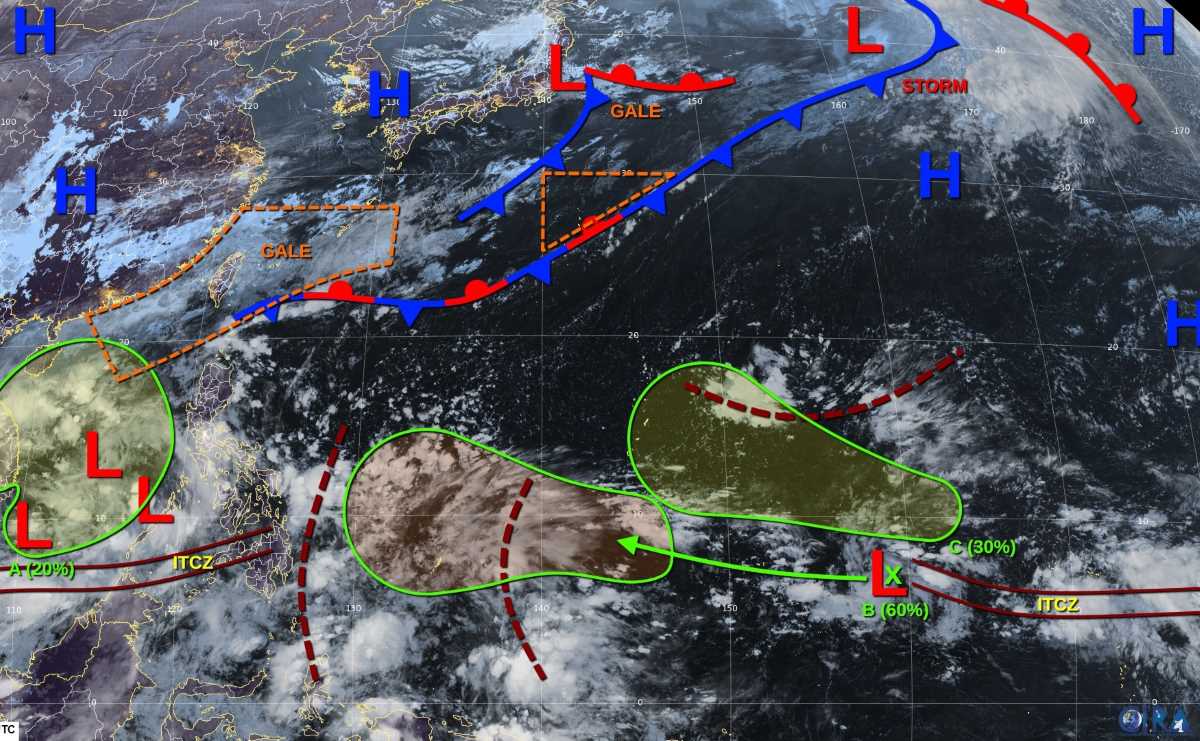
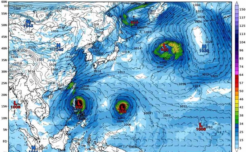
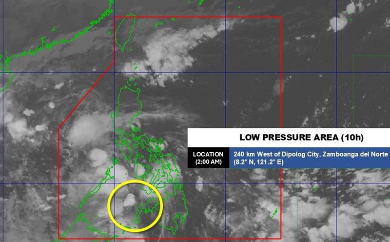
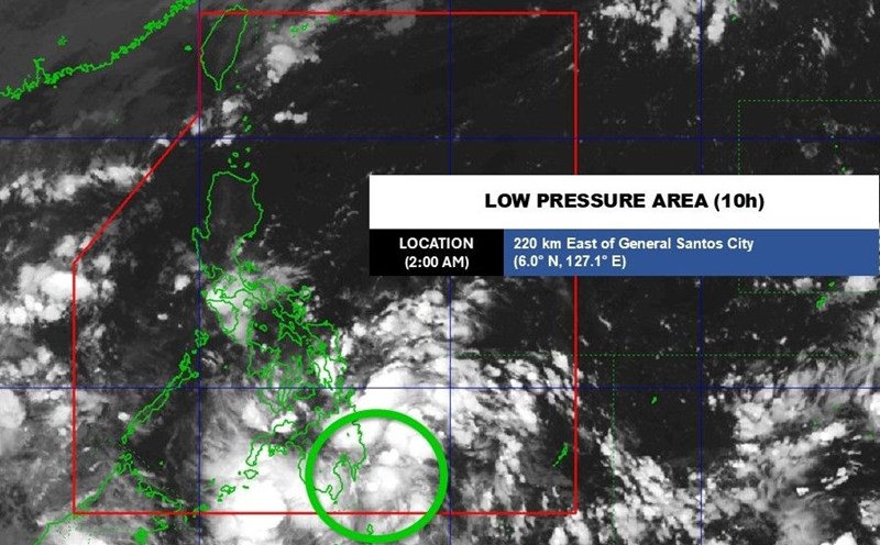
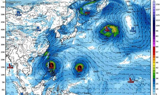
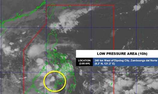
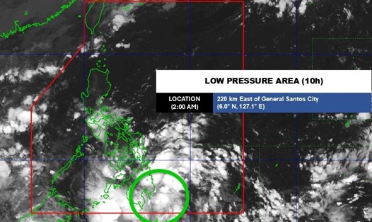
According to the storm/low pressure forecast on October 28 of the US Joint Typhoon Warning Center (JTWC), a large-scale low pressure area (A) is active in the East Sea, near the South Central Coast, causing scattered rain and strong winds due to the impact of the northeast monsoon. This low pressure is unlikely to develop further and is likely to gradually dissipate when it makes landfall from October 30. The likelihood of a tornado forming within the next 7 days is low, 20%.
Low pressure B near Pohnpei is moving westward, possibly strengthening as it passes south of Guam this weekend. Some models suggest that depression B may develop into a tropical depression, but it is too early to confirm whether it will become a storm or not. The chance of formation is average, 60%.
Disturbance C (north of Pohnpei) is expected to form along the trough over the next few days and may develop slowly as it heads towards the Mariana Islands. The chance of formation is low, 30%.
In addition to the above-mentioned disturbances, many coastal areas are being affected by strong northeast monsoons. According to the Vietnam National Center for Hydro-Meteorological Forecasting, on the day and night of October 28, the sea area north of the northern East Sea (including the sea area north of Hoang Sa special zone) will have strong northeast winds of level 6-7, gusting to level 8-9; rough seas, waves 3-5m high.
The Gulf of Tonkin and the sea area from southern Quang Tri to Quang Ngai will have strong northeast winds of level 5, sometimes level 6, gusting to level 7-8; rough seas, waves 1.5-3m high; the area from southern Quang Tri to Quang Ngai will have waves 2.5-3.5m high, high tides.
On October 28, floods on the Huong River (Hue City) are fluctuating at a high level; on the Vu Gia River (Da Nang City), on the Tra Khuc River (Quang Ngai) are receding.
Floods on Thu Bon River (Da Nang City) at Cau Lau Station are fluctuating at the peak level, equivalent to the flood peak in 2007 (5.39m).