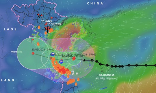
On September 19, according to the Steering Committee for Natural Disaster Prevention and Search and Rescue of Quang Tri province, early on the morning of September 19, the tropical depression in the northeastern area of Hoang Sa archipelago strengthened into storm No. 4.
At 7:00 a.m. on September 19, the center of the storm was at about 17.5 degrees North latitude; 108.7 degrees East longitude, about 165km East Northeast of Quang Tri.
At Con Co Island, the wind is strong at 14.3 m/s (level 7), gusting at 17.8 m/s (level 8). At Cua Viet, the wind is strong at level 4-5, gusting at level 6. It is forecasted that in the next 3 hours, the storm will move westward at a speed of about 20-25 km/h.
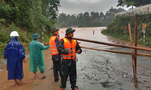
According to Lieutenant colonel Nguyen Dinh Cuong - Chief of Con Co Border Guard Station (Quang Tri Border Guard), from the afternoon of September 18 until now, the island district has had heavy rain and wind in waves.
From September 17, the unit mobilized officers and soldiers to coordinate with the district, units and people to trim trees, use sandbags to support people and agencies to reinforce roofs to prevent strong winds from blowing them off. Bring fishing vessels such as boats and coracles ashore and anchor them to ensure safety. When the storm hits, people will be evacuated to solid houses. In addition, the station has assigned a team of 9 comrades to be on duty in case of any situation.
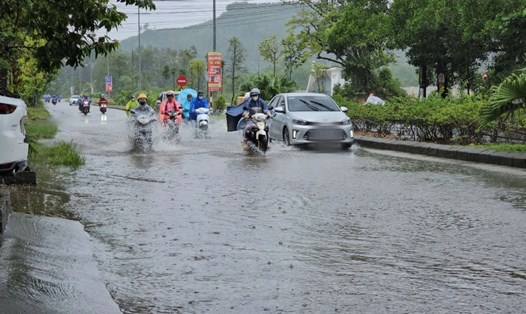
Currently, the rain in Quang Tri province occurs in waves. The spillway of Loa village in Ba Tang commune (Huong Hoa district, Quang Tri province) is 1 meter high. National Highway 15D, Ta Rut - A Vao spillway, Ta Rut commune, A Vao, Ly Ton spillway, Ta Long commune, Dakrong district, the water has started to rise.