According to the National Center for Hydro-Meteorological Forecasting, on the morning of July 5, storm No. 1 (international name Maysak) weakened as it moved on land south of Guangxi province (China).
At 4:00 AM on July 5th, the center of storm No. 1 was at about 21.9 degrees North latitude; 108.0 degrees East longitude, over the southern area of Guangxi province (China).
The strongest wind near the storm center is level 8 (62-74 km/h), gusting at level 10; the storm is moving in the North-Northeast direction at a speed of 5-10 km/h.
Due to the impact of the storm's circulation, strong winds have been recorded in many places in Quang Ninh. Co To Special Zone has strong winds of level 8, gusts of level 10; Cua Ong level 8, gusts of level 9; Mong Cai level 9, gusts of level 12; Quang Ha level 8, gusts of level 9. Bach Long Vi Special Zone recorded strong winds of level 9, gusts of level 11.
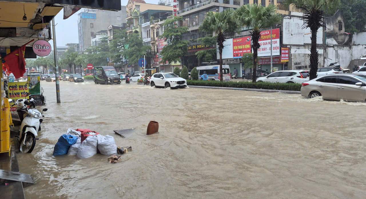
In the afternoon and night of July 4, many places in Quang Ninh province had heavy to very heavy rain. Mong Cai station recorded rainfall of 247.6 mm, Doan Tinh 145.4 mm and many other areas continued to have heavy rain.
It is forecasted that by 4:00 PM on July 5th, the storm will continue to move in a North-Northeast direction at a speed of 10-15 km/h, weakening into a tropical depression, then into a low pressure area over the southern area of Guangxi province (China).
Although the storm has weakened, the Northern Gulf of Tonkin area, including Bach Long Vi, Van Don, Co To, Cat Hai special zones and the coastal sea area of Quang Ninh province, is still affected by strong winds of level 6-7, gusts of level 9-10, sea waves 2-3 m high, strong rough seas. Dangerous weather conditions can cause capsizing, sinking or damage to fishing boats, transport boats, tourist boats; affecting aquaculture activities and coastal works.
On land, the coastal area of Quang Ninh is likely to experience strong winds of level 6-7, gusts of level 9-10, which may cause roofs to be blown off, green trees and billboards to be broken, affecting electricity, communication and traffic systems.
On July 5, the Northeast region will continue to have heavy to very heavy rain, with common rainfall of 100-200 mm, in some places over 300 mm. Heavy rain increases the risk of flooding in low-lying areas, urban areas, and industrial parks; and at the same time, there is a potential risk of flash floods, landslides in mountainous areas and floods on small rivers and streams.
The meteorological agency also warned that due to the impact of the storm's circulation, people need to be wary of thunderstorms, tornadoes and strong gusts of wind occurring before and during the storm's weakening process. Localities continue to closely monitor weather developments, proactively deploy plans to ensure safety for people and vehicles at sea, aquaculture areas, landslide-prone areas and key infrastructure projects.