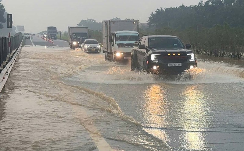
Informing Lao Dong Newspaper, a representative of the Vietnam Road Administration said that the Hanoi - Thai Nguyen expressway alone was flooded 20:30 cm on the evening of October 9, and was flooded more this morning. The authorities are diverting traffic to make it possible. Currently, management area staff are on duty for the latest information.
The Vietnam Road Administration also said that immediately before, during and after storms No. 10 and No. 11, the Department has sent working groups to directly inspect the scene and issued many documents directing and implementing the work of preventing, combating and overcoming the consequences of storms to the Department of Construction of localities and related units with the goal of minimizing damage and overcoming the consequences of natural disasters, opening the route to ensure traffic as soon as possible.
Up to now, basically on national highways and expressways have been opened to traffic; only a few points on national highways managed by localities that are still congested due to deep flooding or large-volume landslides are being actively resolved, at these locations there are plans to remotely organize traffic flow to ensure safety and avoid congestion. Traffic on some routes is informed in detail as follows:
National Highway 3, Thai Nguyen - Cho Moi BOT route, Ho Chi Minh road to connect with Thai Nguyen and Cao Bang provinces are now fully open to traffic.
At 02 locations: Km120+700 Ho Chi Minh Road: 01 lane has been opened to traffic and vehicles can choose to travel along National Highway 3 through TT. Ngan Son (old) to continue to Cao Bang; (ii) Km200+903/National Highway 3 has opened 01 lane for cars, passenger vans, and trucks under 3.5 tons.
On national highways managed by the locality, there are still some locations with traffic congestion due to large landslides or deep floodwaters that have not completely receded, specifically as follows:
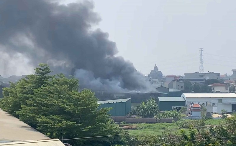
Thai Nguyen: There are also 07 traffic jams including: 04 points on the section Km116+300- Km122+800/QL.1B (Tan Ky commune), Km52+230 (Ba Be commune), Km 275+600-Km276+660/QL.279 (Hiep Luc commune), Km116+330/QL.1B (Tan Ky commune).
Cao Bang: There are still 09 road congestion points due to landslides at Km124+100/QL.34 (Bao Lac), Km52+600/QL.34B (old Cao Bang City), Km162+200 (Ha Lang), Km314+550 (Ha Quang), Km316+100, Km316+300, Km332+100, Km317+280 Km340+800/QL.4A (Bao Lac) and 02 flooded congestion points at Km83+150/QL.34 (Bao Lam) and Km3+600/QL.34B (Thach An).
Lang Son: There are still 02 traffic jams due to flooding at Km50 and Km52/QL.1B (Tan Tien commune), the water is gradually receding.
Tuyen Quang: There is still 01 traffic jam at Km63+710-Km63+900/QL.34 in the Bac Me hydropower area, expected to open onto the positive slope to temporarily clear the road before October 15, 2025.