Adjusting drainage planning
On March 22, the Management Board of Da Nang City Priority Infrastructure Investment Projects (PMU) announced the public consultation on the project to adjust the urban elevation and surface drainage planning to 2030, with a vision to 2045. This project is expected to be a key solution to the flooding problem affecting many areas in the city, implemented by the Joint Venture of Binh Dinh Irrigation - Hydropower Investment Joint Stock Company and the Center for Construction Planning & Inspection. This project focuses on researching elevation of foundations, drainage systems, canals, regulating lakes and rivers across the city, including urban, rural areas, industrial parks, high-tech zones and industrial clusters.
According to the project's analysis, the rapid urbanization process along the Vu Gia - Thu Bon river basin and Cu De river has significantly changed the current situation of elevation in Da Nang. Many urban areas such as Hoa Xuan Cam Le, urban areas along the Co Co River, high-tech parks, Golden Hills and Thuy Tu are all affected. The construction of major traffic routes such as ADB road, National Highway 14, Da Nang - Quang Ngai Expressway and Hoa Phuoc - Hoa Khuong road has unintentionally created "dyks" blocking the flow, changing the distribution of floods and increasing flooding on these routes as well as in front of urban areas along both banks of Cam Le river.
The project also pointed out the unoptimal performance of some existing pumping stations such as Truong Chi Cuong, Thanh Huy, Ong Ich Khiem, Dao Xanh and Thuan Phuoc. To solve these problems, consultants propose orientations for elevation to level the Vu Gia - Thu Bon, Cu De basins and Phu Loc river to meet the flood frequency of 5% - 1%. At the same time, many specific drainage solutions are also proposed, including solutions for the Me Suot - Cau Da Co road area, Phu Loc river, airport basin and neighboring areas, as well as the central axis from the two lakes Thac Gian - Vinh Trung to Ong Ich Khiem discharge gate and expansion of the culvert to the Thuan Phuoc pumping station area.
Proposal to build tunnel and overpass on Han River
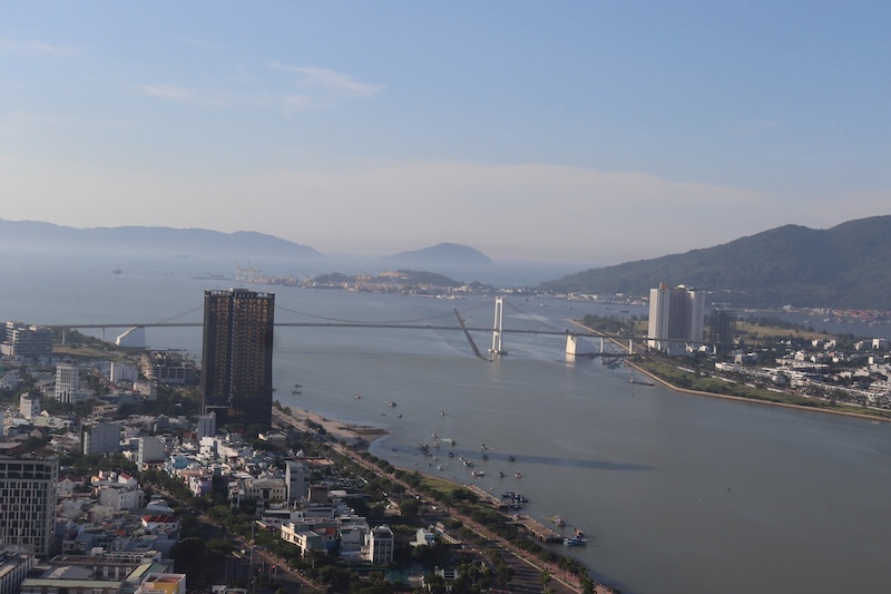
In addition to adjusting drainage planning, Da Nang is considering investing in key transport infrastructure projects, contributing to reducing traffic pressure and supporting flood prevention. The Department of Construction of Da Nang City has just proposed a plan to build a tunnel across the Han River and a route connecting traffic in the East - West direction through Da Nang airport in mid-March.
The Han River tunnel project has a total main route length of about 1.67km, including a 600m closed river tunnel, a 380m closed underpass on the bank and 415m open tunnel. The starting point connects with Dong Da Street (Hai Chau District), the end point connects with Van Don Street (Son Tra District). The total estimated investment is VND6,880 billion.
For the route connecting traffic through the airport, the Department of Construction proposed a tunnel longer than 2.9km, with two options: the metro line (MRT) goes together with the road and a separate MRT line. The Department of Construction recommends not combining MRT and roads in this tunnel due to differences in technical standards and the difficulty in handling the structure.
Da Nang is also considering two options to build a bridge across the Do To River, connecting 29/3 Street (Cam Le District) with Bui Ta Han Street (Ngu Hanh Son District). The two proposed options are the prestressed reinforced concrete bridge and the steel arch bridge. The project has a total estimated investment of about 732 billion VND.