On June 12, information from the Dak Lak Provincial Hydrometeorological Station said that from the evening of June 11 to the early morning of June 13, a widespread rainstorm will occur in the province.
Forecasts show that the flood situation is complicated, many areas are at high risk of landslides.
Speaking to Lao Dong Newspaper, Mr. Doan Quang Hung - Chief of Office of the Steering Committee for Natural Disaster Prevention, Control and Search and Rescue of Dak Lak province said that there were places with moderate to heavy rain, with common rainfall from 20 - 50mm.
Some areas such as Ea Sup district, Buon Don, Cu M'gar, Krong Ana, Cu Kuin, Lak and Buon Ma Thuot city may record rainfall from 50 - 100mm.
Heavy rain is likely to cause flash floods on small rivers and streams; landslides on steep slopes and flooding in low-lying areas.
In the face of unfavorable weather developments, the Provincial Steering Committee for Natural Disaster Prevention and Control and Search and Rescue has requested the People's Committees of districts, towns and Buon Ma Thuot city to seriously implement the directives of the Provincial People's Committee on natural disaster prevention and control in 2025.
Localities are required to closely monitor weather conditions, promptly update information to people, and organize inspections and reviews of high-risk areas.
Localities need to proactively clear the flow, develop evacuation plans and ensure traffic safety.
According to the records, units under the provincial Department of Agriculture and Environment are coordinating with localities to implement measures to protect production and ensure safety for degraded and damaged irrigation works.
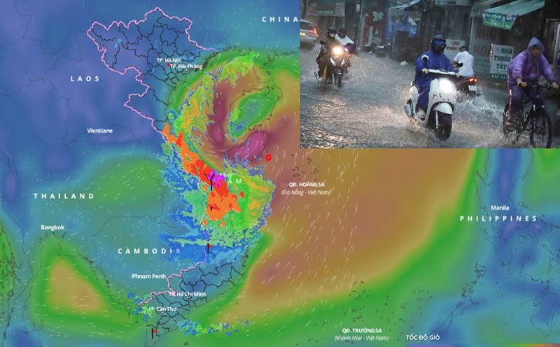
According to the National Center for Hydro-Meteorological Forecasting, on the morning of June 12, storm No. 1 WUTIP was at about 17.0 degrees North latitude, 110.4 degrees East longitude, just west of Hoang Sa archipelago.
The strongest wind near the storm center is level 89, gusting to level 11. The storm is moving in a West-Northwest direction at a speed of 1015km/h.
Forecast in the next 24 hours, storm No. 1 will move northwest at a speed of about 10km/h, likely to strengthen.
Due to the impact of the storm, from June 11, the Central Highlands region will have moderate rain, heavy rain and thunderstorms, locally very heavy rain.