The Department of Dyke Management and Natural Disaster Prevention (Ministry of Agriculture and Environment) has just issued a quick report on natural disaster prevention and control.
Forecast of rain and floods due to storm No. 3
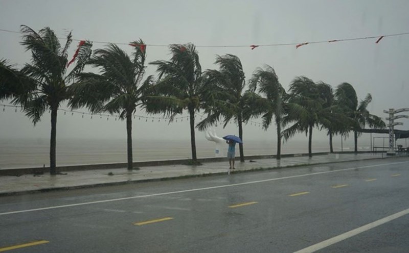
On the morning of July 21, storm No. 3 entered the Gulf of Tonkin. Forecast until 7:00 p.m. on July 22, Location 19.9 degrees North latitude, 105.5 degrees East longitude; on land from Hai Phong to Thanh Hoa; moving in the West Southwest direction, about 10-15km/h and gradually weakening into a tropical depression; wind force level 6, gust level 8.
At 7:00 a.m. on July 23, Location 19.6 degrees North latitude, 103.8 degrees East longitude; in the Upper Laos area; moving in the West Southwest direction, 10-15km/h and gradually weakening into a low pressure area; wind power below level 6.
Forecast of the impact of the storm: The northern sea area of the Gulf of Tonkin (including the special areas of Bach Long Vi, Co To, Van Don, Cat Hai, Hon Dau island) has waves 2.0-4.0m high, the area near the storm center has 3.0-5.0m; the sea is very rough. The southern Gulf of Tonkin (including Hon Ngu Island) has waves 2.0-4.0m high; rough seas.
It is forecasted that from July 22-23, the Northern Delta, Thanh Hoa and Nghe An will have heavy to very heavy rain and thunderstorms with common rainfall of 100-200mm, locally over 300mm; other places in the Northern region and Ha Tinh will have moderate rain, heavy rain, locally very heavy rain and thunderstorms with common rainfall of 50-100mm, locally over 150mm. Warning of the risk of heavy rain (>150mm/3 hours).
From July 22-25, 2025, on rivers in the North, Thanh Hoa, Nghe An, a flood will occur, with a flood amplitude on rivers from 3-6m. During this flood, the flood peak on small rivers, upstream of the Ma River is likely to reach level BD2-BD3; the flood peak on Thao River, Lo River, Da River at Hoa Binh Lake, Thai Binh River, Hoang Long River, upstream of the Ca River will rise to level BD1-BD2, with rivers above level 2; the flood peak in the downstream of the Red River is below level BD1; the downstream of the Ma River, Ca River fluctuates at level BD1.
Ship situation and ban on the sea
a) Ship situation: All ships operating in the Gulf of Tonkin have entered a safe shelter.
b) Sea ban: All 7 coastal provinces from Quang Ninh to Ha Tinh have implemented sea ban.
Aquaculture situation
- Coastal provinces and cities from Quang Ninh to Ha Tinh currently have: 29,259 cages; 3,906 aquaculture cages; 149,870 hectares of aquaculture (25,389 hectares of brackish water shrimp farming, 22,772 hectares of molluscum farming, 101,709 hectares of freshwater aquaculture) at risk of being affected by storms and floods.
- The four provinces of Hung Yen, Ninh Binh, Thanh Hoa, Nghe An, Ha Tinh have evacuated all people in canh and cages to safe places; Quang Ninh province has evacuated 7,590 people to shore; Hai Phong city has evacuated all people in canh and cages at sea to safe places, and 1,354 people are still in canh and cages on the river.
Tourists on the islands
Currently, there are 326 tourists staying on the islands (Quang Ninh: 47 people, Hai Phong: 279 people); localities have plans to organize and control tourists' travel during their time on the island.
Regarding population relocation
The provinces and cities of Quang Ninh, Hai Phong, Ninh Binh have organized the evacuation of 975 households/6,194 people in degraded and dangerous apartment buildings and houses to safe places before the storm made landfall; Thanh Hoa province has evacuated 98 households/449 people from areas at high risk of landslides.
Damage situation
1. Initial information in localities affected by storm No. 3: As of 4:00 a.m. on July 22, 2025, in provinces and cities, there has been no recorded information on damage and no related incidents.
2. Other damages:
According to a quick report from Lam Dong, An Giang, Dong Thap provinces from 20-21.7.2025, thunderstorms with tornadoes have caused the following damage:
- Regarding people: 1 person injured (Lam Dong);
- Regarding housing: 12 houses collapsed (An Giang 11, Dong Thap 1), 143 houses had their roofs blown off (Lam Dong 30, An Giang 88, Dong Thap 25);
- Other damage: 12 electric poles were broken (Lam Dong 11, Dong Thap 1), 01 ship sank in An Giang.
Immediately after the natural disaster occurred, the locality organized and directed the implementation of response and overcoming measures to overcome the consequences of natural disasters.