According to the National Center for Hydro-Meteorological Forecasting, on the morning of June 11, the tropical depression in the East Sea strengthened into storm No. 1 (international name: WUTIP).
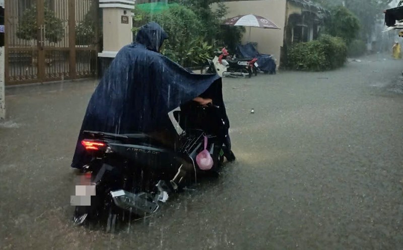
The center of the storm is near Hoang Sa archipelago with strong winds of level 8, gusting to level 10, moving in the West Northwest direction. It is forecasted that from June 11 to 13, Hue City will have heavy to very heavy rain, with common rainfall of 70 - 200mm, some places over 300mm. On the morning of June 11, many places were partially flooded, especially on inner-city roads.
In the face of complicated weather developments, the Steering Committee for Disaster Prevention and Control of Hue City issued a telegram requesting localities to proactively plan response. The City Border Guard has reviewed all 1,126 ships, requiring vehicles operating at sea to monitor the storm, quickly return to shore or seek safe shelter.
Flood prevention, protection of reservoirs, aquaculture ponds, cages, and Summer-Autumn rice are being vigorously implemented. Localities seriously implement the "four on-site" motto, ensuring the safety of people and production.