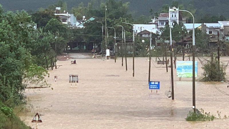
In less than 20 days, the Vu Gia - Thu Bon river basin continued to experience the 4th major flood, causing many residential areas in the south of Da Nang to be deeply submerged in water. On the morning of November 27, in many low-lying areas of Dai Loc, Thuong Duc, Dai Lanh, Que Phuoc, Vu Gia communes, the water rose rapidly in just a few hours, leaving people unable to react.
According to the Central Hydrometeorological Station, from 9:00 a.m. on November 16 to 9:00 a.m. on November 27, Da Nang area recorded very heavy rain: Kham Duc 296mm, La Ai 297.6mm, Thanh My 270mm, Tra Don 202.6mm, Hiep Duc 217.2mm... Floods on Vu Gia River are at level 3 warning, Thu Bon River is above alert level 2, while Han and Tam Ky rivers are below alert level 1 but continue to increase.
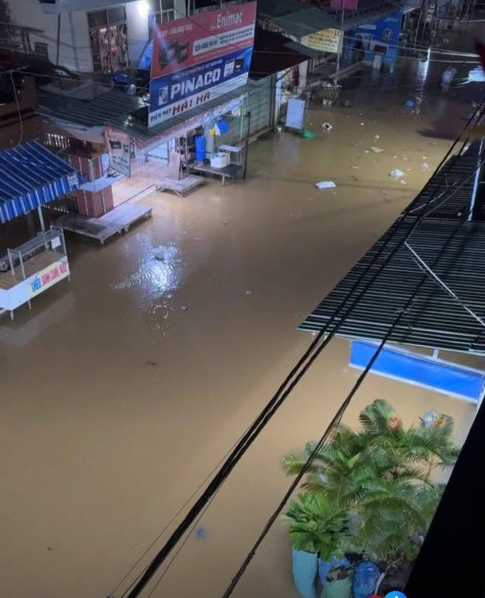
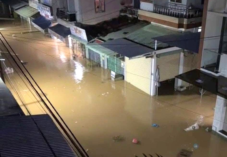
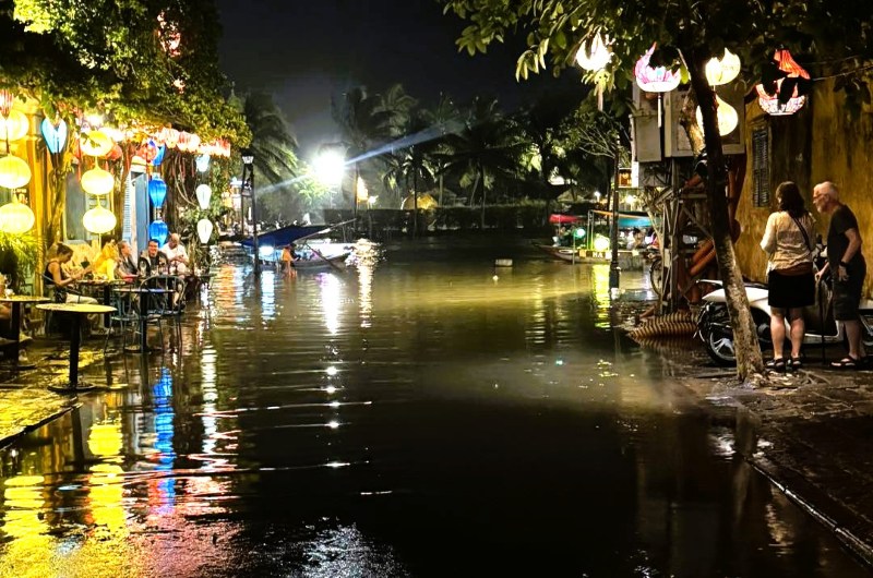
Many roads in the area have turned into "rivers", a series of houses have water that has flooded up to the windows. In some markets, flooding caused the roadside stalls to be damaged, and furniture floated.
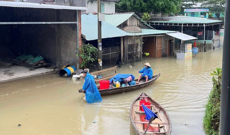
Many people in Dai Loc and Thuong Duc areas stayed up all night to move their belongings. Mr. Tran Thanh Hung - a trader in the Que Phuoc area, shared: "In the evening, I can still travel, just over an hour later the water has reached the edge of my house. This is the 4th time in more than half a month that we have had to clean up to flee the flood. It's very tiring but who knows what to do".
According to people in the upper reaches of the Vu Gia and Thu Bon rivers, although they are used to floods, this year the flood is too intense. The water quickly flooded into the house, and the furniture could not be moved in time. People had to use boats to move. Local forces actively support the bringing of the elderly and children to safe areas.
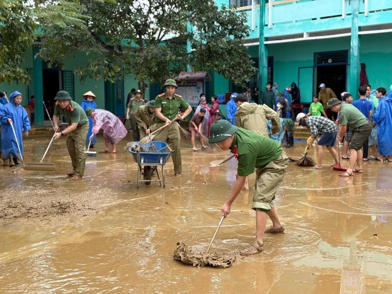
Local authorities have mobilized forces to be on duty 24/7, put up warning signs, and blocked off deeply flooded areas to prevent people from risking their lives crossing the rushing water.
However, due to prolonged heavy rain from upstream, cong reasoning with many hydropower reservoirs operating to release water to regulate flood drainage, causing slow drainage, leading to the risk of continued flooding - a leader of Thuong Duc commune worried.

In the next 24 hours, the meteorological agency warns of natural disaster risk level due to floods: Level 3. prolonged deep flooding in many communes/wards along the river:
Common flooding of 0.251.25m: Hoi An, Hoi An Dong - Tay, Duy Nghia, Thang An, An Thang, Que Phuoc, Hoa Tien, Cam Le, Hoa Xuan, Ngu Hanh Son...
Flooded 0.51.5m, some places over 2.5m: Hoa Tien, areas in Dien Ban, Go Noi, Nam Phuoc, Dai Loc...
Flooded 12.5m, the deepest place is over 3m: Thuong Duc, Vu Gia, Phu Thuan, Thu Bon, Nong Son, Nam Dien Ban, Nam Dai Loc...
Previously, the Dai Loc flood center area experienced 3 consecutive floods, the heaviest of which was the flood at the end of October, which caused more than 76,000 Da Nang households to be deeply submerged in water, 14 people dead and missing.


