On July 22, Mr. Dau Duc Truyen - Chairman of Yen Hoa Commune People's Committee - said that heavy rain lasting for the past two days has caused the water level of rivers and streams in the area to rise, flooding many spillways and roads. Notably, the spillway on the only road leading to Xop Coc and Tat villages was flooded about 1m deep, causing more than 200 households with more than 900 people to be completely isolated.
"The commune has sent forces to be on duty 24/7 and put up signs prohibiting the road, not allowing people and vehicles to pass through the dangerous area. For cases where it is really necessary, the authorities will support the movement of people to ensure safety," said Mr. Truyen.
The authorities also inspected the scene and discovered that some households in these two villages were in areas at high risk of landslides. That same night, the commune organized the evacuation of households to safe places before, during and after the storm.
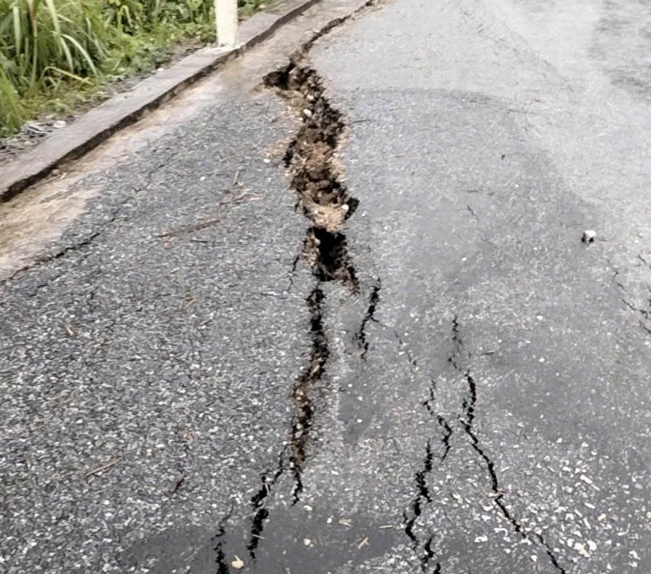
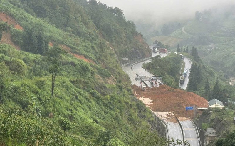
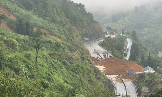
In Tri Le commune, the impact of storm No. 3 also caused serious damage to many roads. At Km298+180 on National Highway 16, the section passing through the commune, a crack about 15m long, deep and subsided, endangering vehicles passing by.
Chairman of Tri Le Commune People's Committee - Mr. Lo Minh Diep - said: "In addition to the above cracks, there are many other landslides along National Highway 16. Soil and rocks from the positive slope overflowed onto the road, causing local traffic congestion, especially during the period of prolonged heavy rain".
The commune government has set up barriers, warning signs and advised people not to travel through dangerous routes, and sent an urgent report to the authorities to soon have a solution to overcome the situation, ensuring safety for people and vehicles.
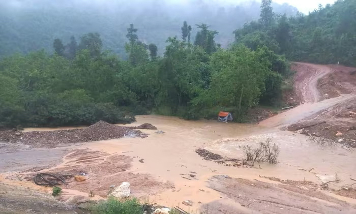
In Muong Tap commune, while checking the landslide on provincial road 543D, through Xop tip village, the working group of Muong Tap commune police almost had an accident when rocks and soil suddenly continued to slide.
Speaking to reporters, Major Le Hong Viet - Head of Muong Tap Commune Police - said: At around 8:00 a.m. on July 22, receiving a report from people about a landslide on Provincial Road 543D through Xop Tap village, the Commune Police sent a working group of 3 comrades to the scene to check, assess the situation and deploy a temporary warning plan to ensure traffic safety for people passing by.
As soon as they arrived at the scene, rocks and soil suddenly continued to slide down from a high mountain, right next to the area where the working group was standing. Fortunately, the comrades withdrew safely in time and there were no casualties.
According to records, at the location of the landslide, a large amount of rock and soil from the positive slope collapsed onto the road, causing the provincial road 543D to be completely cut off. This is a vital traffic route connecting the commune center with remote villages such as Xop tip, Vang Phao, Na My and the entire old Muong Ai commune - home to thousands of people mainly ethnic minorities. The cutting-off makes travel, food supply, medicine and rescue work in emergency situations very difficult.
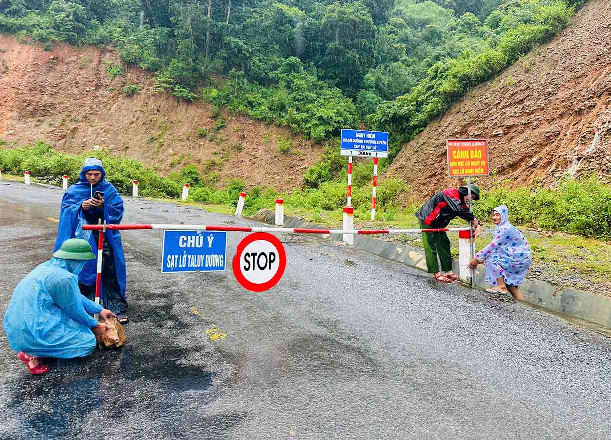
In that situation, the working group of Muong Tap Commune Police quickly warned the local authorities and people, and at the same time proposed a plan to put up ropes, place warning signs and organize checkpoints to prevent people from moving through the dangerous area. Muong Tap Commune People's Committee has also sent forces to be on duty 24/7 at the landslide site to monitor the situation and be ready to deploy remedial measures when weather conditions allow.
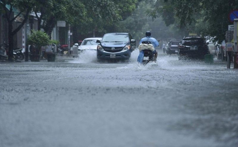
According to the hydrometeorological agency, due to the strong circulation of storm No. 3 combined with the tropical convergence zone, the western area of Nghe An is at high risk of flash floods, landslides and flooding in low-lying areas. Localities are urgently reviewing, making plans to evacuate people and responding to natural disasters that may continue to occur in the coming days.