In March and April 2024, the water level of the Red River (Thao River) in Phu Tho was at a record drought, the water level recorded at 7:00 p.m. on March 27 at Phu Tho station was 10.47 m, the lowest level in the monitoring data series of the same period.
In the following days, the river continued to dry up, until April 2024, the lowest water level in history appeared, the flow on the Red River (and the lower reaches of the Lo River) was 60-80% below the average of many years...
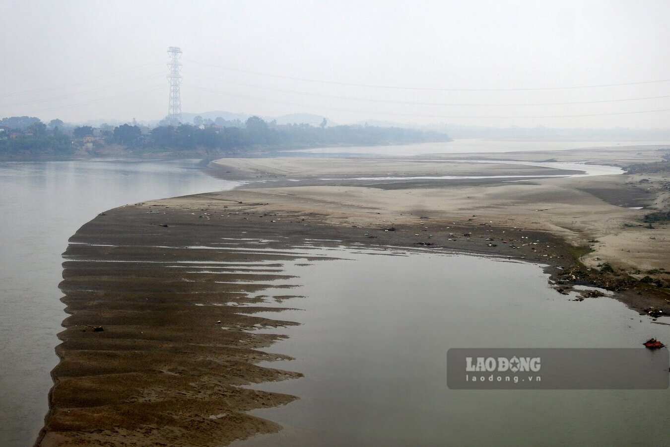
Currently, the water level of the Red River passing through Phu Tho province has also decreased. According to the National Center for Hydro-Meteorological Forecasting's Short-Term Water Forecast bulletin No. 45 dated February 14, the actual water level of the Red River measured at Phu Tho station was 10.89 m, only 42 cm higher than the 10.47 m level at 7:00 p.m. on March 27, 2024.
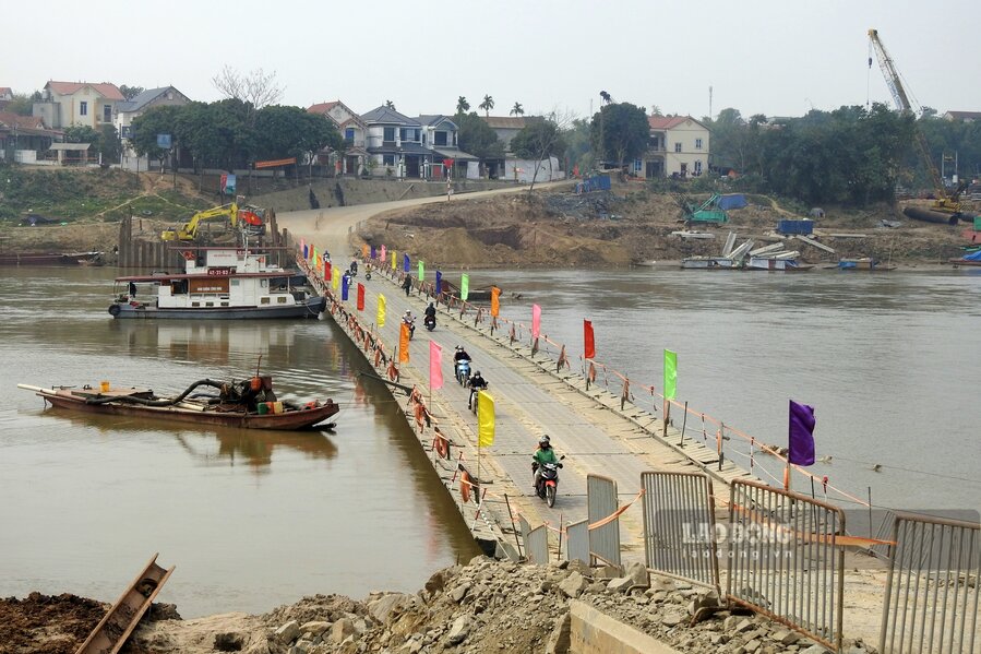
According to the reporter of Lao Dong Newspaper on the afternoon of February 14, in the Phong Chau bridge area (nearly 20 km downstream from Phu Tho station, through Tam Nong and Lam Thao districts), the Red River water in this section has clearly dried up, the flow is narrowed, large sand dunes appear adjacent to the left bank of the river.
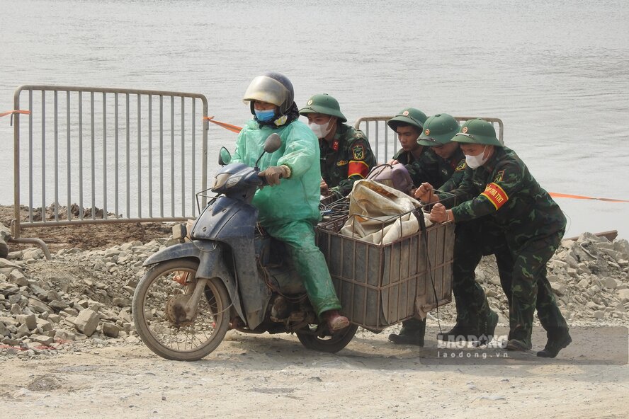
At Phong Chau pontoon bridge, the low water also caused the bridge to slide up and down the higher bridge. Except for cars, some weak vehicles or vehicles carrying a lot of goods have difficulty going uphill, having to rely on the support of soldiers on duty on the bridge.
Mr. Bui Van Tuyen - owner of a mobile phone store at the beginning of Phong Chau bridge in Van Xuan commune, Tam Nong district - shared: "My house is in Viet Tri, so every day I cross Phong Chau pontoon bridge at least 2 trips back and forth. It is true that the Red River water has been much drier than a few months ago, which is clearly seen in the fact that the two ends of the pontoon bridge have been longer to the river than when the bridge was first installed. However, because the river is low, I feel more secure when traveling."
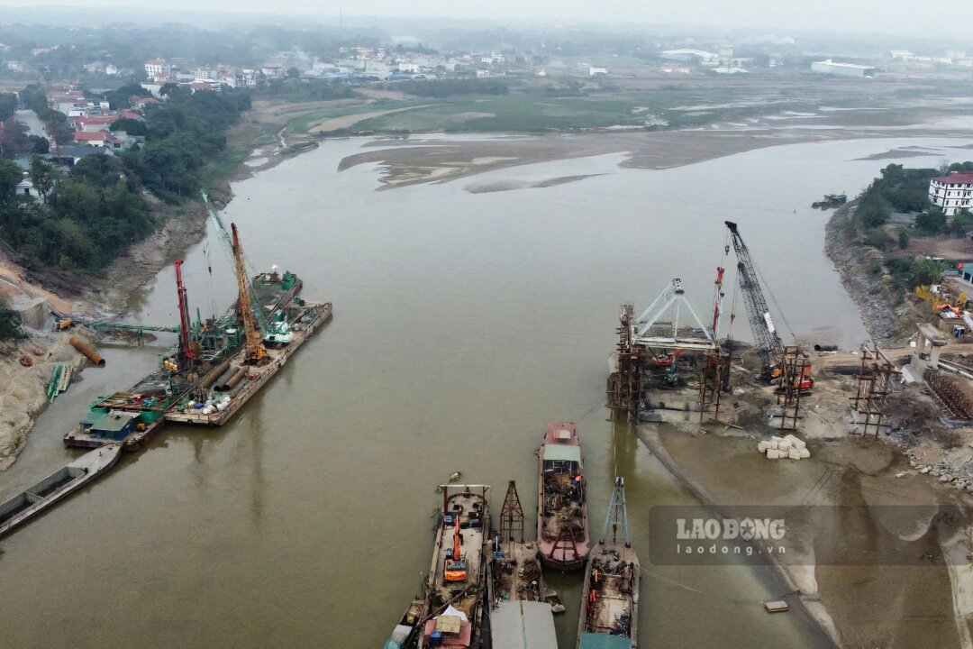
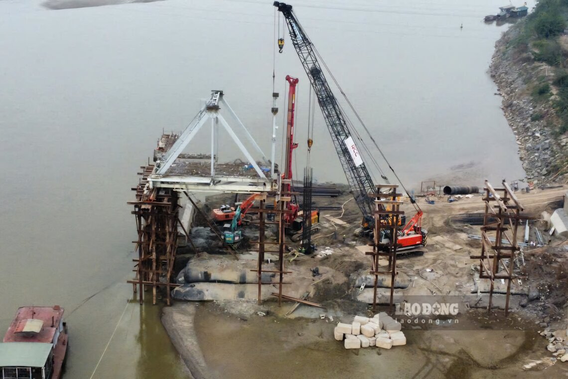
The rising river water also makes the work of dismantling and salvaging the old Phong Chau bridge sections and building the new bridge go smoothly. On the river, the work of salvaging the N6 span of the old bridge is still being carried out; the girder from pier T5 to pier T6 of the old bridge with a very large amount of steel and concrete has been almost completely dismantled; the bored piles in the middle of the river are also gradually being completed...
Also according to the bulletin of the National Center for Hydro-Meteorological Forecasting, the water level of the Red River at Phu Tho station at 1:00 p.m. on February 14 is forecast to be 10.85 m, by 7:00 p.m. it will be 10.80 m, by 1:00 a.m. on February 15, it will be 10.75 m, by 7:00 a.m. on February 15, it will be 10.70 m.


