Thao River is the main stream of the Red River, flowing through Lao Cai and Phu Tho provinces. Thao River converges with the Da River and Lo River at the Bach Hac intersection (Bach Hac ward, former Viet Tri city, now Thanh Mieu ward).
In April 2026, the water level of the Thao River section passing through Lao Cai and Phu Tho provinces reached a record low. At Yen Bai station (now Lao Cai province), on April 27, the water level dropped to 22.81m - the lowest level in history.
Similarly, at Phu Tho station, the lowest water level in history was also recorded. At 13:00 on April 16, the measured water level was only 10.14m.
At the present time, although there have been fluctuations and changes, the water level of the Thao River section passing through Lao Cai and Phu Tho provinces is still very shallow.
According to the Forecast Bulletin, short-term hydrographic warning on May 3, 2026 of the National Center for Hydro-Meteorological Forecasting, the water level of the Thao River at Yen Bai station at 7:00 AM on May 3 was 22.91m, at Phu Tho station at the same time was 10.65m.
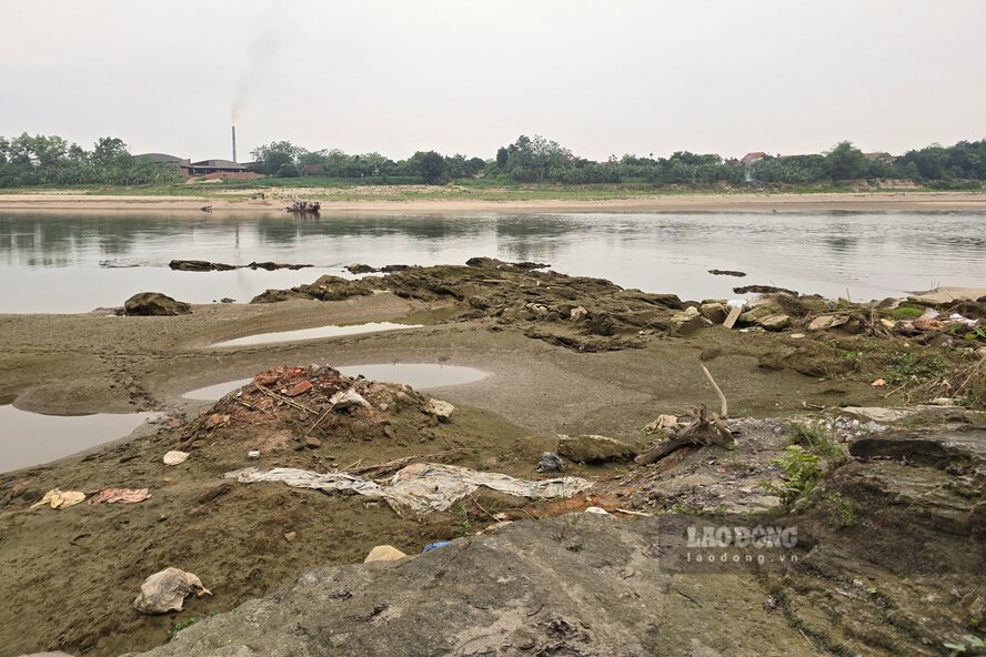
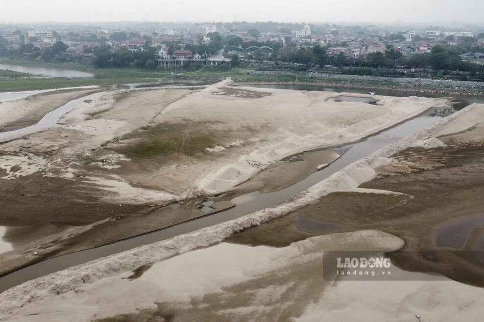
Records of Lao Dong Newspaper reporters in early May showed that in Phu Tho, when the Thao River dried up, the narrow flow gave way to rocky beaches, alluvial grounds, and giant sand dunes.
Sand dunes in the middle of the river have been formed through many months of accretion, now weeds are breeding. In the section of the river passing through Lam Thao commune, reporters even recorded images of people releasing buffaloes in the alluvial ground on the river.
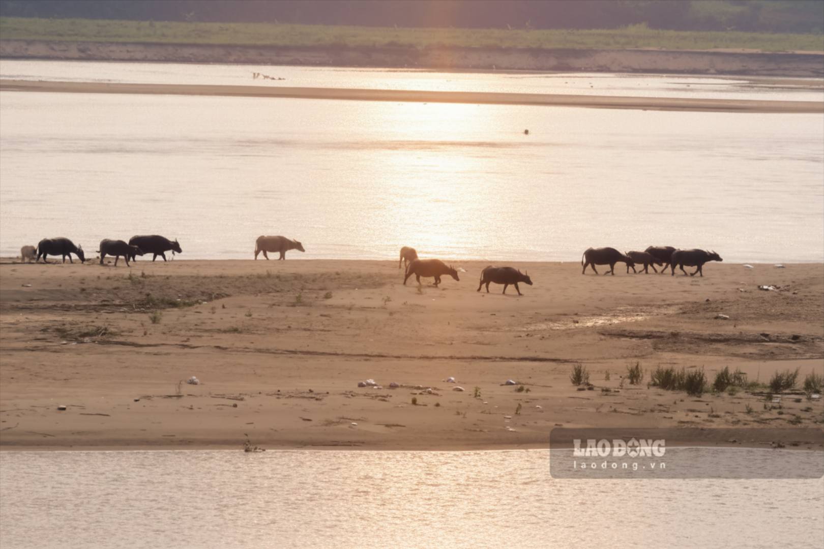
However, sand dunes and river alluvial grounds are special terrain areas, formed by the accumulation of sand and mud over time, weak geology, and the above actions pose a risk of subsidence and drowning.
Mr. Vu Dinh Thinh - a resident of Ngoc Thap area, Phong Chau ward - shared: "When summer comes, I am only worried that young children will go to the alluvial ground to play or swim in the river, which is very dangerous. At the end of 2025, a tragic drowning incident occurred on the other side of the river in Hien Quan commune, killing 5 students.
The shallow and increasingly silted river water also causes difficulties for the operation of riverside pumping stations. To maintain operation, irrigation enterprises must continuously dredge the pumping gates, lower the drainage beds, and create flows to bring water to the field pumping station.
The ferry/boat business is also affected by the shallow river. According to Mr. Tran Van Ton - owner of Tinh Cuong ferry wharf (connecting Hung Viet commune with Chi Tien commune), the low river water level has caused him to spend more on reinforcement and changing wharves to pick up and drop off passengers continuously.
According to the Forecast Bulletin, long-term hydrological warning (from May 1 to 31, 2026), the water level of the Thao River is likely to fluctuate 1-2 times, especially in the last 10 days of the month.
For Yen Bai station, it is forecast that in the last 10 days of May, the average water level will be at 24.30m, the lowest at 23.50m, the highest at 25.50m. It is forecast that for the whole month of May, the average water level will be 23.60m, the highest at 25.50m, and the lowest at 22.60m.
For Phu Tho station, it is forecast that in the last 10 days of May, the average water level of the Thao River will be at 11.50m, the lowest at 11.00m, and the highest at 12.20m. For the whole month of May, the average water level is forecast to be 10.95m, the highest at 12.20m, and the lowest at 10.15m.


