Southern coastal road
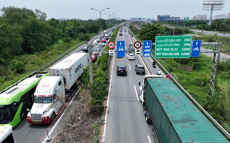
The southern coastal route in the Ho Chi Minh City Master Plan adjustment project to 2040, with a vision to 2060, has just been submitted by the Ho Chi Minh City People's Committee to the Prime Minister for approval.
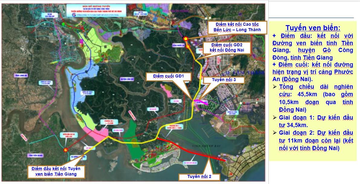
This route is one of the planned sections on the coastal traffic axis with a total length of more than 940 km, passing through 9 provinces and cities: Ba Ria - Vung Tau, Ho Chi Minh City, Tien Giang, Ben Tre, Tra Vinh, Soc Trang, Bac Lieu, Ca Mau and Kien Giang.
The section passing through Ho Chi Minh City is about 45.5 km long and the section passing through Dong Nai province is 10.5 km long. The route will start from National Highway 50 (Tien Giang), cross the Soai Rap River to Can Gio District, connect with Can Gio International Transit Port, Phuoc An Port and extend to Ben Luc - Long Thanh Expressway (Dong Nai).
The route has a scale of 8 lanes, and will initially implement phase 1, including two parallel routes with two lanes on each side. Currently, there are three investment options being considered:
Option 1 (optional): Invest in the main route divided into two phases, with a total initial capital of more than 31,500 billion VND; then complete it to 8 lanes with an additional cost of about 6,400 billion VND.
Option 2: Connecting the route to Ba Ria - Vung Tau via Can Gio overpass, with a total preliminary investment of more than 62,000 billion VND.
Option 3: Combining investment in the main route and road to Cai Mep port, the total cost is nearly 42,300 billion VND.
When completed, this route will become a coastal economic corridor, effectively exploiting the seaport system such as Can Gio, Cai Mep - Thi Vai, and at the same time connecting the economy - traffic between Ho Chi Minh City and neighboring localities such as Tien Giang, Dong Nai, Ba Ria - Vung Tau.
2-storey elevated road connecting the South to Long Thanh airport
In parallel with the coastal route, Ho Chi Minh City is also studying investment in a 2-storey high-speed route, to create a quick connection axis from the South to Long Thanh International Airport.
This route is part of the Phu My 2 bridge project - a new bridge across the Dong Nai river, jointly implemented by Ho Chi Minh City and Dong Nai.
According to the planned route, the route will start from Nguyen Huu Tho Street (District 7), run east, connect with Hoang Quoc Viet Street, go through Dao Tri and cross Dong Nai River to Nhon Trach area (Dong Nai), where the route continues to Lien Cang Street, Road 25C and leads directly to Long Thanh Airport.

The total length of the route is about 16.7 km, with a scale of 8 lanes (including 6 lanes for motor vehicles and 2 lanes for non-motorized vehicles), with a total preliminary investment of nearly VND 21,500 billion.
Because the route passes through many crowded urban areas with limited land, Ho Chi Minh City is considering the option of building a 2-storey elevated road. This solution both ensures traffic volume and reduces compensation and site clearance costs.
At a meeting between the two localities in April 2025, Ho Chi Minh City and Dong Nai agreed to assign the Department of Construction of both sides to coordinate in reviewing and updating the location of the bridge and the route into the relevant urban planning.
The Departments of Construction and Finance of the two localities are also chairing research and proposals for investment plans, selecting forms and sources of capital for implementation. It is expected to be completed in the third quarter of 2025 to serve as a basis for submitting an investment policy. The goal is to approve the policy in the fourth quarter of 2025 and officially start the project in 2027.