Ho Chi Minh City will build underground traffic axes to reduce traffic jams

MINH QUÂN |

Ho Chi Minh City will develop underground traffic routes along the Saigon River, Ben Thanh Station, Bach Dang Wharf and Tan Son Nhat Airport to reduce traffic congestion.

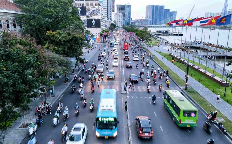
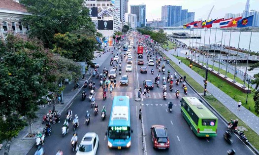
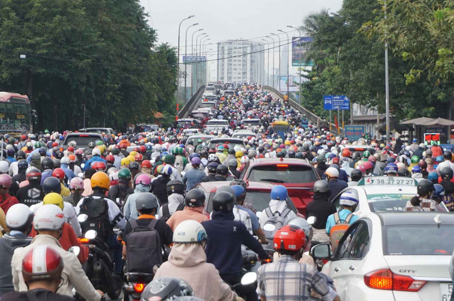
According to the Ho Chi Minh City Department of Transport, the city currently manages more than 9.5 million vehicles, including more than 1 million cars and nearly 8.5 million motorbikes. If all of these vehicles were placed on the road, the area required would be double the current road surface area.

Each year, the number of vehicles increases by an average of 6.5%, while the road surface area increases by only 0.2%. In particular, in the inner city area, the road surface area has not expanded over the past 5 years.

TPHCM hien co hon 9,5 trieu oto va xe may.  Anh: Minh Quan
Ho Chi Minh City currently has more than 9.5 million cars and motorbikes. Photo: Minh Quan

According to the Ho Chi Minh City Planning for the 2021-2030 period, with a vision to 2050, recently approved by the Prime Minister, the city will develop a multifunctional underground space system.

This system not only serves transportation but also supports disaster prevention, climate change response and national security.

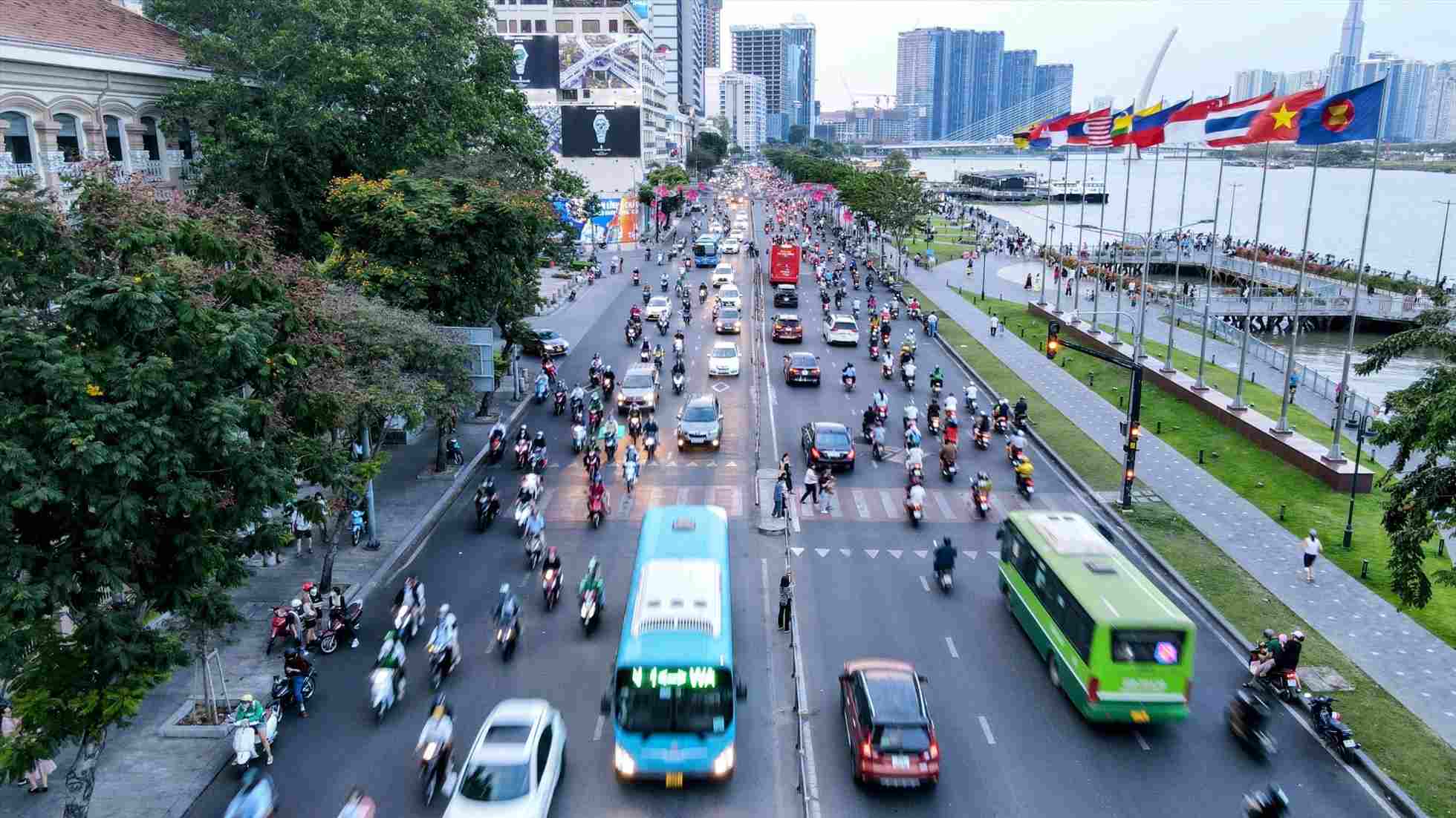
Ho Chi Minh City People's Committee stated that the central area cannot currently expand roads, while transportation demand is increasing.

If the development of elevated traffic will affect the urban landscape architecture. Therefore, utilizing underground space is considered the optimal solution to develop traffic infrastructure.

TPHCM da len ke hoach lam duong ham duoi duong Ton Duc Thang (Quan 1).  Anh: Anh Tu
Ho Chi Minh City has planned to build a tunnel under Ton Duc Thang Street (District 1). Photo: Anh Tu

Ho Chi Minh City plans to build underground roads depending on the conditions of each area, such as: combining roads and electrical and information infrastructure; combining roads with railways; combining roads with urban drainage.

In particular, Ho Chi Minh City has determined to prioritize the construction of underground roads combined with urban drainage, due to the increasing flooding caused by rain and high tides in the city.

Ho Chi Minh City also plans to establish an underground space network linking urban railway stations with underground commercial spaces and access routes to buildings located in the area.

Notably, the city will propose a number of underground traffic routes such as: the route along the Saigon River through District 1, District 4 and District 7; the Ben Thanh station area and Ham Nghi street; the Bach Dang wharf area and Ton Duc Thang street; the area connecting Tan Son Nhat airport.

Mo hinh duong ham tai Vu Han, Trung Quoc.  Anh: So Quy hoach - Kien truc TPHCM
Tunnel model in Wuhan, China. Photo: Department of Planning and Architecture of Ho Chi Minh City

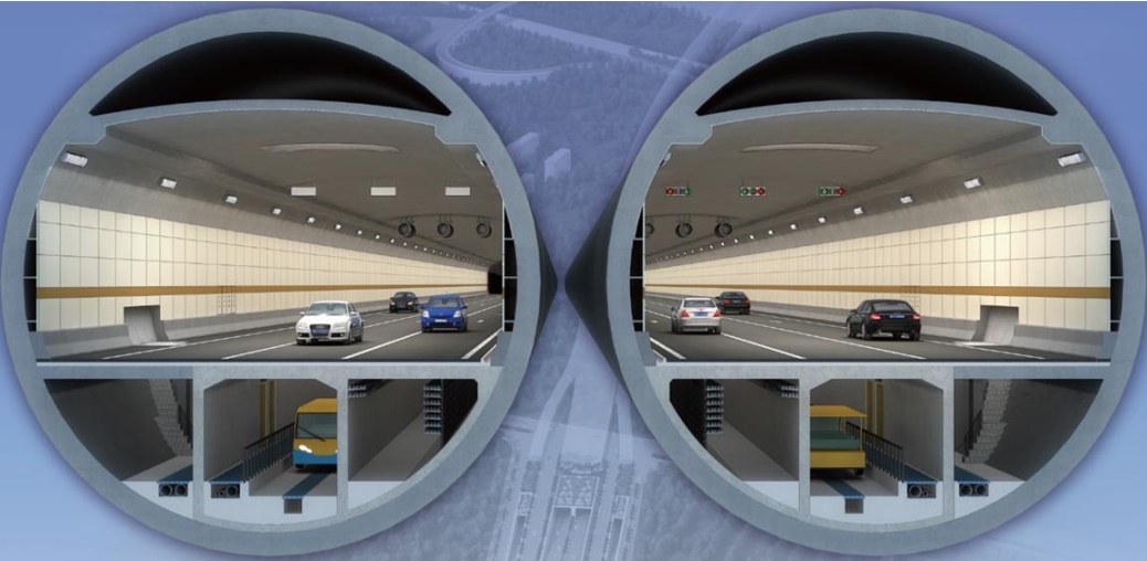
Ho Chi Minh City has consulted some effective tunnel models in the world.

In Wuhan, China, two road tunnels connecting Hankou and Wuchang districts are 4,660m long, with an outer diameter of 15.2m each.

The tunnel perfectly integrates a three-lane one-way expressway and a subway in one tube, greatly reducing traffic pressure across the Yangtze River. The two-way metro design under the six-lane expressway is only 40m wide, saving 120,000m² of land, reducing environmental impact, impact on residents and construction costs.

Mo hinh duong ham thong minh tai Kuala Lumpur, Malaysia.  Anh: So
Smart tunnel model in Kuala Lumpur, Malaysia. Photo: Ho Chi Minh City Department of Planning and Architecture

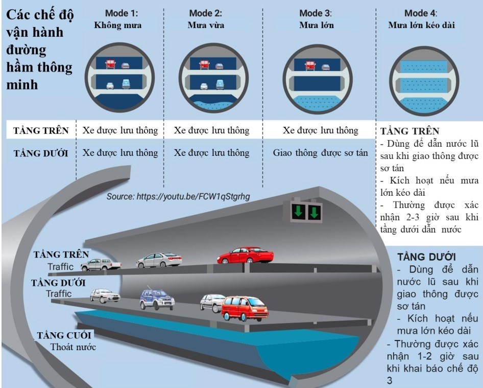
In Kuala Lumpur, Malaysia, the 9.7km long, 13m wide Smart Traffic and Flood Control Tunnel (SMART), completed in 2007 at a cost of $500 million, simultaneously solves flooding and traffic congestion problems.

This tunnel allows cars to travel one way per level, reducing travel time from the southern suburbs to the city center from 30 minutes to just 5 minutes. Notably, since SMART came into operation, Kuala Lumpur has not been flooded as before.

MINH QUÂN
RELATED NEWS

Two routes to relieve traffic jams in Ho Chi Minh City are only half open to traffic

|

HCMC - The road connecting Tran Quoc Hoan - Cong Hoa (Tan Binh district) and Duong Quang Ham street (Go Vap district) is only partially open to traffic due to land clearance and electricity poles.

Ho Chi Minh City builds a 78.2km long, 4-8 lane wide Saigon River road

|

Ho Chi Minh City will build a 78.2km long Saigon River road, from the Ben Luc - Long Thanh expressway intersection with Rung Sac road to the Tay Ninh province border, with 4 - 8 lanes wide.

The 14km long elevated road connecting Ho Chi Minh City and Binh Duong is gradually emerging

|

HCMC - The 14km-long, 4-lane elevated road passing through Thu Duc City (belonging to Ho Chi Minh City's Ring Road 3) is expected to be completed and put into operation by the end of 2025.

Live volleyball VTV Binh Dien Long An vs Binh Chung Thong Tin

|

Live volleyball match between VTV Binh Dien Long An and Binh Chung Thong Tin, taking place at 5:30 PM today (April 18).

Gia Lai drought, people dredge to find water sources to save crops

|

Gia Lai - The western region of the province is entering the dry season, many localities are facing severe water shortages.

Hanoi Traffic Police show trainees videos of accidents before driving test

|

Hanoi - Before the test, traffic police show trainees videos recording serious traffic accidents, thereby making them more aware of their responsibilities when holding the steering wheel.

Salary reform from the Central to local levels, implemented in all 3 blocs

|

The Ministry of Home Affairs is assigned to carefully prepare the reform of salaries, allowances and other regimes from the Central to local levels, implemented in all 3 blocs.

Forecast of the risk of receiving strong storms and super typhoons in 2026

|

According to a representative of the meteorological agency, ENSO phase transition along with the impact of climate change leads to the risk of strong storms and super typhoons in 2026.

Two routes to relieve traffic jams in Ho Chi Minh City are only half open to traffic

MINH QUÂN |

HCMC - The road connecting Tran Quoc Hoan - Cong Hoa (Tan Binh district) and Duong Quang Ham street (Go Vap district) is only partially open to traffic due to land clearance and electricity poles.

Ho Chi Minh City builds a 78.2km long, 4-8 lane wide Saigon River road

MINH QUÂN |

Ho Chi Minh City will build a 78.2km long Saigon River road, from the Ben Luc - Long Thanh expressway intersection with Rung Sac road to the Tay Ninh province border, with 4 - 8 lanes wide.

The 14km long elevated road connecting Ho Chi Minh City and Binh Duong is gradually emerging

TÚ QUÂN |

HCMC - The 14km-long, 4-lane elevated road passing through Thu Duc City (belonging to Ho Chi Minh City's Ring Road 3) is expected to be completed and put into operation by the end of 2025.