Land inventory is an urgent step
The Ministry of Agriculture and Environment has sent a document to the People's Committees of provinces and cities on synthesizing land inventory data and maps the current land use status in 2024 of all levels after the arrangement of administrative units.
This ministry requires the inventory to be completed and all results sent to the ministry via the online system before August 20, 2025. The inventory results are of great significance, contributing to the effective implementation of state management of land and meeting the requirements of socio-economic development in the coming period.
Sharing with Lao Dong, Dr. Tran Xuan Luong - Deputy Director of the Vietnam Institute for Real Estate Market Research and Evaluation - emphasized that land inventory is an urgent step towards digitalizing and transparency the real estate market. In particular, after the whole country implemented administrative boundary adjustments from July 1, 2025, the need for land data updates became more urgent than ever.
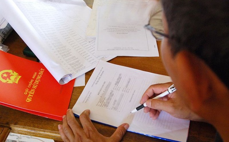
Mr. Luong also said that for land inventory to be effective, the necessary data must include both mechanical information and socio-economic data. However, currently, the data sets for encryption are still lacking and unclear, so it is necessary to deploy a "data revolution". This process includes the registration and declaration of land use rights by all people, then encrypting data and combining it with planning information. In particular, the collection needs to be carried out synchronously and methodically from the local to central levels.
"When completing this process, the management agency can clearly determine how many houses each person has, land, where they are located, the area, price and specific characteristics. Initially, the data is collected in raw form, then filtered into status data - determining whether the land or house is used for the right purpose or abandoned, or is it generating cash flow or not. When we have fully built these layers of data, we can effectively regulate and manage the real estate market, while ensuring publicity and transparency" - Dr. Tran Xuan Luong commented.
Land inventory needs to avoid being formal and transparent from the data source
Prof. Dang Hung Vo - Former Deputy Minister of Natural Resources and Environment (now the Ministry of Agriculture and Environment) - said that the biggest challenge in the current 5-year land inventory is how to ensure substance, avoiding formality. He said that before arranging new administrative units (before removing the district level), the land inventory process still relied on the vertical reporting system from the commune level to the district, from the district to the province and finally the Central level.
"The problem is whether the commune level reports correctly or not, because the data of all levels depends on reports from the commune level. In fact, many communes are still "hiding land", meaning that the report is not in accordance with the actual land use situation. However, the data reported by the commune is often considered the "oreal data" of the land. There are places where the reality shows that the commune has more land than the report; between types of land is also unclear, not transparent - reporting is this type but is actually being used for other purposes - Prof. Dang Hung Vo emphasized.
Meanwhile, Professor. Dang Hung Vo said that the district level had not previously been really strict in inspecting and examining the reporting process of the commune level. Therefore, according to many opinions, the 5-year periodic land inventory data may not accurately reflect reality and be difficult to meet the requirements for policy making as well as developing socio-economic development plans.

The time of changing administrative boundaries from July 1, 2025 is an opportunity for provinces to check and review land data of new commune-level administrative units after the merger, with the expectation that the data quality will be more accurate than the old method.
However, for land inventory to achieve real results, there needs to be a stricter control mechanism. Previously, the commune level had prepared a report but the district level did not monitor closely, leading to a situation of shirking responsibility. After implementing the two-level government, if the provincial level seriously implements periodic inspection and examination and ensures the accuracy of data, it can completely overcome the long-standing shortcomings.
Mr. Dang Hung Vo also said that international experience has proven that, in addition to the administrative inspection system, people being able to participate in supervision on the condition that land data is public and transparent and administrative agencies are responsible for explaining to people's supervisory opinions will be an important factor to improve the quality of land inventory data. This is also the basis for expecting a substantial, transparent general inventory, effectively serving management and development.