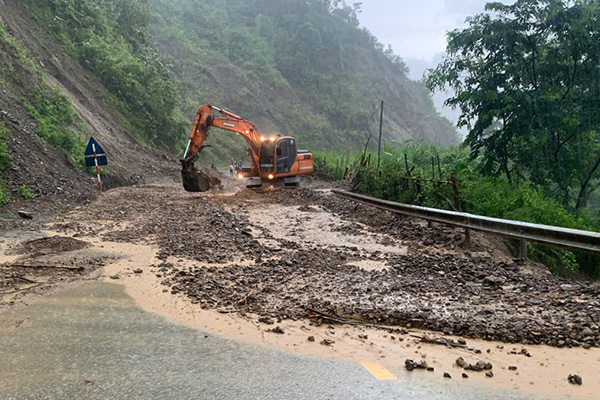
On the morning of July 31, speaking with Lao Dong, a representative of Road Joint Stock Company 226 (the unit managing the routes in the area) said that due to the impact of heavy rain, many important roads in Dien Bien were flooded with soil and rocks from the embankment with a large volume, causing danger to people and vehicles participating in traffic.
Specifically, at Km397+150 National Highway 6 (Tuan Giao Commune to Muong Lay Ward), landslides caused traffic jams. Also on this route, in the Nam Nen bridge area (Km433), rising floodwaters have touched the bridge girder, threatening the safety of the structure.
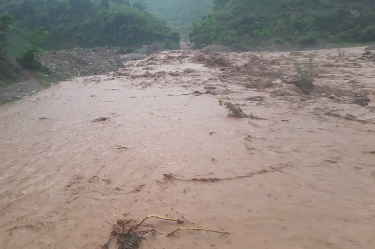
On Provincial Road 140, at Km1+520 (Muong Sun Commune), rising water caused flooding, creating a flow on the road surface for vehicles to cannot move.
On National Highway 12, Km113+230 (Muong Tung commune) was also affected by a landslide with a large amount of rock and soil spilling onto the road.
A representative of Road Joint Stock Company 226 said that immediately after receiving information about the landslides, the company deployed maximum machinery, equipment and human resources to the scene to clear the rock and soil, to open the road as soon as possible.
According to the National Center for Hydro-Meteorological Forecasting, in the past 6 hours (from 0:00 to 6:00 on July 31), Dien Bien province has had moderate rain, heavy rain, and some places with very heavy rain such as Hoa Ngai 82.8mm.
Soil moisture models show that some areas are nearly saturated (over 85%) or have reached a saturated state.
In the next 6 hours, there is a risk of flash floods on small rivers and streams, landslides on steep slopes in many communes/wards: Nam Nen, Pa Ham; Cha To, Chieng Sinh, Muong Cha, Muong Mon, Muong Tung, Na Bung, Na Hy, Pu Nhung, Sang Nhe, Si Pa Phin, Sin Chai, Trung Phinh, Tua Chua, Tuan Giao.
Warning level of natural disaster risk due to flash floods, landslides, land subsidence due to heavy rain or water flow level 1.