In the Risk Level Disaster response Plan issued by the People's Committee of Dong Thap province, there are identified areas vulnerable to natural disasters. People can learn to proactively prevent.
Accordingly, vulnerable areas in Dong Thap province are mainly concentrated in the areas along the Tien and Hau rivers.
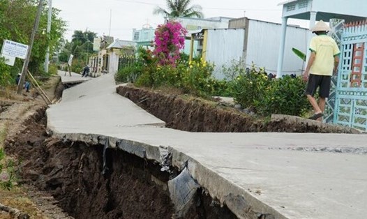
Areas vulnerable to flooding and riverbank landslides are communes along the Tien River and Hau River in the districts of Hong Ngu, Tam Nong, Thanh Binh, Lap Vo, Lai Vung, Hong Ngu City, Cao Lanh City and Sa Dec City. Some communes along axis canals, level I canals and inland areas are also significantly affected.
Areas vulnerable to droughts and water shortages are some communes in Tan Hong, Thanh Binh and Cao Lanh, Lap Vo districts.
Areas vulnerable to thunderstorms and lightning are almost everywhere in the province.
Areas vulnerable to heavy rain combined with high tides occurring in the southern part of the province such as the districts of Lap Vo, Lai Vung, Chau Thanh, Cao Lanh, Sa Dec city and Cao Lanh city.
The area affected by the forest fire includes the districts of Tan Hong, Tam Nong, Thap Muoi, Cao Lanh.
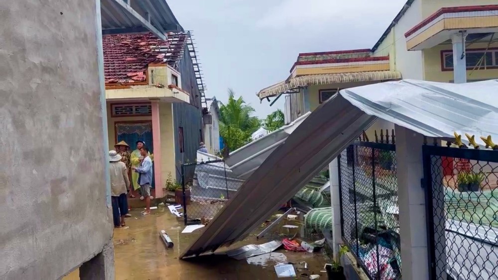
In recent years, the natural disaster situation in Dong Thap province has been complicated, with frequent types of natural disasters affecting people such as tropical depressions, thunderstorms, tornadoes, lightning, landslides, saltwater intrusion, droughts, and floods causing significant damage to people's lives and production.
The above plan aims to help authorities and people at all levels be more proactive in response work, minimizing damage to people, property, infrastructure and production activities of the state and people, and activities to overcome the consequences of natural disasters.
Organizations and individuals also need to regularly monitor information on mass media about natural disaster risk situations and proactively prevent them.