According to the National Center for Hydro-Meteorological Forecasting, this afternoon (July 5) storm No. 1 (Maysak) has weakened into a tropical depression over the southern area of Guangxi province (China). Tonight, storm Maysak continues to weaken and gradually dissipate, no longer affecting Vietnam.
In addition to storm No. 1 (Maysak) which has weakened and dissipated, at this time in the Northwest Pacific region, a super typhoon is operating, super typhoon Ba Vi (international name Bavi). This is the 3rd super typhoon operating in the Northwest Pacific region (super typhoon No. 1 is Sinlaku, super typhoon No. 2 is Mekkhala).
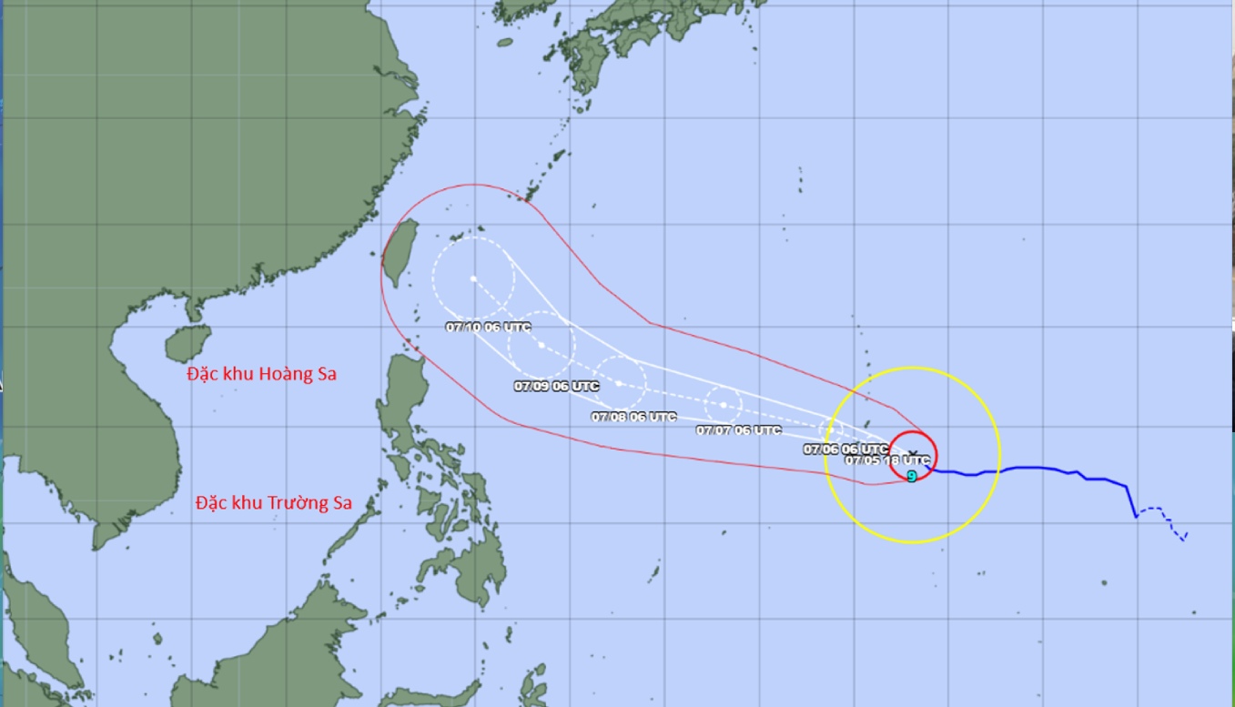
At 4 pm this afternoon (July 5), the center of the super typhoon was located at about 13.6 degrees north latitude - 147.6 degrees east longitude. Typhoon intensity is strong at level 17 (highest wind level on the Beaufort wind scale), gusts above level 17. Currently, super typhoon Bavi is about 2,500km east of the Central Philippines.
Calculations of forecast models as well as world storm forecasting centers show that in the next 24 hours, super typhoon Bavi will move in a West-Northwest direction at an average speed of about 20km/h. From July 6-9, 2026, typhoon Bavi will still maintain super typhoon intensity, the main direction of movement will still be West-Northwest. From June 10, super typhoon Bavi is likely to change direction to the Northwest, towards Taiwan (China).
Vietnam's meteorological agency assesses that the possibility of the storm moving into the East Sea area is not high, the current probability is below 10%. However, with super strong intensity, super typhoon Bavi may also impact the northeastern sea area of the northern part of the East Sea in the periods from November 9-11. 7.
In addition, due to the impact of super typhoon wind absorption, southwest winds in the central and southern areas of the East Sea (including the Truong Sa special zone sea area) from July 9 also tend to strengthen. Southwest wind intensity on July 9-11 in the north, central and southern areas of the East Sea (including the Hoang Sa and Truong Sa special zone sea areas) can strengthen to level 6-7, sea waves are 3-5m high, and the sea is very rough.
The Center for Hydro-Meteorological Forecasting is still closely monitoring the diễn biến of super typhoon Bavi.


