The latest storm and low pressure information on June 27 said that no storms are forecast to appear in the next 7 days, but the US National Hurricane Center (NHC) is monitoring 4 low pressure areas operating in the Atlantic basin, including 2 in the Caribbean.
According to the NHC, the interaction between the two low pressure areas in the Caribbean, along with abundant tropical moisture, is likely to bring heavy rains across the western Caribbean and parts of Central America through June 27. The heaviest rainfall is expected near the eastern coast of northern Nicaragua, Honduras, Guatemala and Belize.
The locations of the depressions include: The western Atlantic depression is far from the shore in the area along 28 degrees West and 14 degrees South, moving west at a speed of about 27 km/h.
The eastern Atlantic depression is located along 43 degrees West and 15 degrees North latitude, moving at a speed of about 18 km/h.
The low pressure in the central Caribbean is at nearly 78 degrees west and 17 degrees north, moving west at a speed of 18 to 27 km/h.
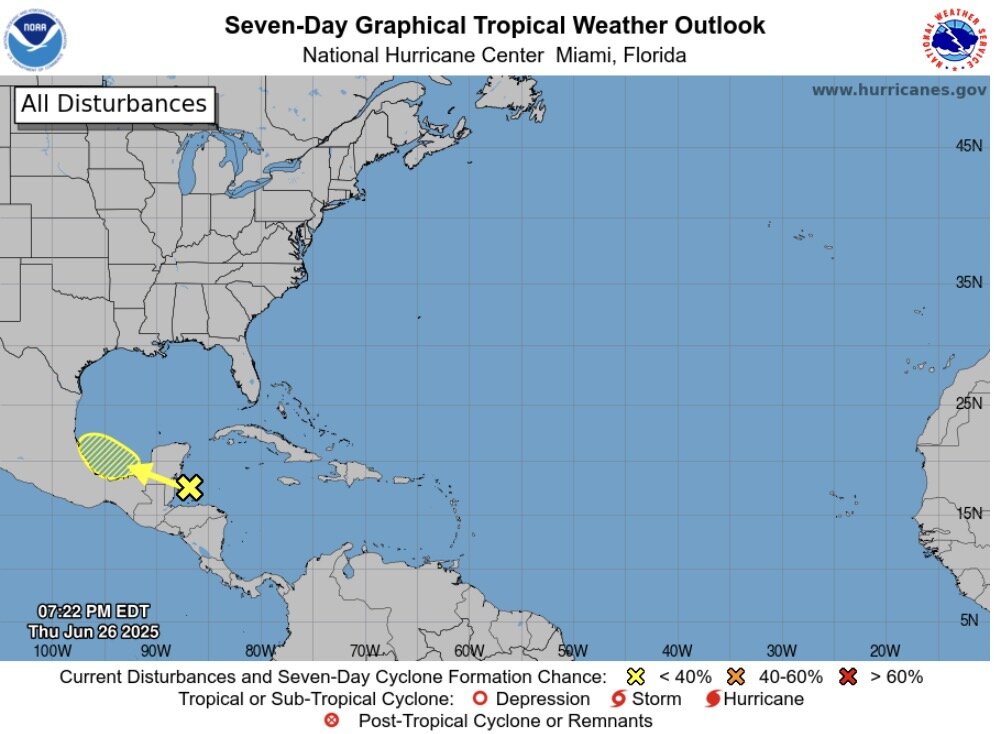
The fourth depression in the western Caribbean, near 86 degrees west and 19 degrees north, moves west at a speed of 10 to 18 km/h.
The Atlantic hurricane season runs from June 1 to November 30. The Atlantic basin includes the northern Atlantic, Caribbean Sea and Gulf of Mexico.
The next storm of the 2025 Atlantic hurricane season will be Barry. The first storm of the Atlantic hurricane season - Hurricane Andrea - will exist for 12 hours in the mid- Atlantic earlier this week.
Typhoon Andera develops in the wide waters west of the Azores and hundreds of kilometers east of Bermuda. Despite only being strong enough to be named in a short time, Andrea was still recorded in the record book as the most formed storm in the northeast in June.
Forecasts still show a season of elevated storm surges above average, with the National Oceanic and Atmospheric Administration forecasting up to 19 named storms this year.
June, even July, is usually quite quiet, said Brian McNoldy, a senior researcher at the Rosenstiel School of the University of Miami.
In addition, there were years when the storm season started slowly but at the end of the season it became active and caused a lot of damage.
The 1998 hurricane season saw Hurricane No. 1 Alex appear in late July, but that season was one of the deadliest on record, with 10 including a Category 5 super typhoon.
The storm is expected to intensify from early July, but major storms are still relatively rare during this time. Last July, Beryl became the first Category 5 super typhoon to be recorded in the Atlantic.