
According to new weather reports from the Philippine Atmospheric Administration (PAGASA), the Japan Meteorological Agency (JMA) and the US Joint Typhoon Warning Center (JTWC) on August 23, the tropical depression denoted as TD 19W is operating outside the Philippine Area of Responsibility (PAR). The system has begun moving northeast and shows signs of interacting with Typhoon Saudel.
TD 19W currently has maximum sustained winds of about 55 km/h, central atmospheric pressure of 1,000 hPa, according to data at 2:00 PM on August 23 (Philippines time).
According to the latest analysis, TD 19W is gradually shifting northeast as the system's circulation begins to be more clearly affected by Hurricane Saudel. Hurricane Saudel is creating a high-level air flow, contributing to the direction of movement and structure of the low pressure.
The latest satellite image shows that the center of low pressure TD 19W has become clearer. However, the system is being affected by dry air from the east and northeast air flow at the upper layer. These are considered factors that limit the development of the low pressure in the near future.
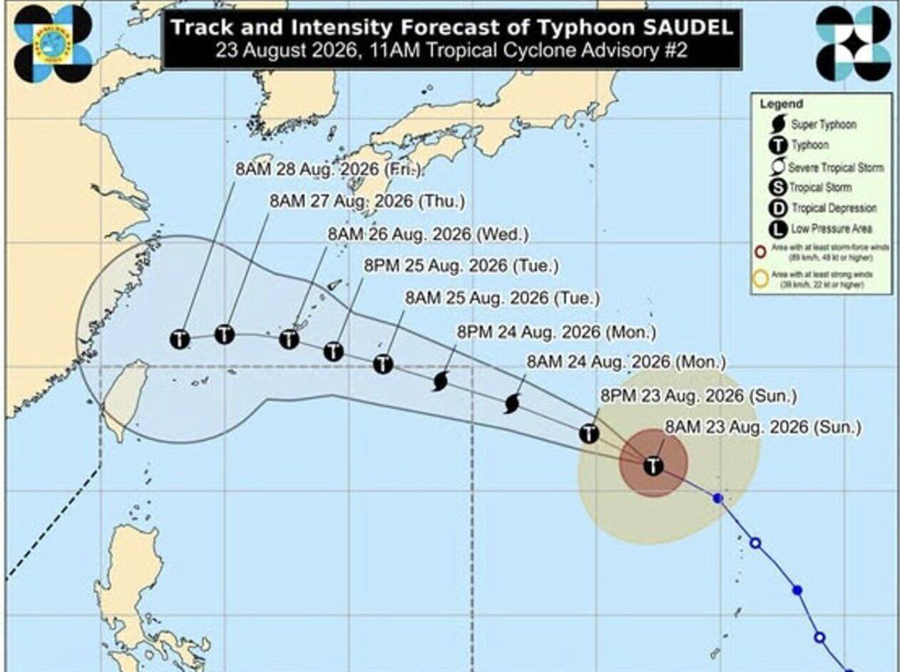
However, JMA and JTWC forecast that TD 19W could strengthen into a tropical storm in the next 24 hours, before being more clearly affected by the circulation of Typhoon Saudel.
According to forecast models, TD 19W will continue to move northeast in the next 3 days. After that, the system is likely to be absorbed into the circulation of Hurricane Saudel.
The possibility of TD 19W entering PAR is currently assessed at a low level. If it enters this area, the system is likely to have weakened significantly or will only be a low pressure area.
The interaction between TD 19W and Typhoon Saudel is being monitored by meteorological agencies as it may change the trajectory and structure of the two systems. However, current forecasts do not show that TD 19W is likely to enter PAR in a strong state.


