
On August 22 (Philippines time), according to the latest weather forecast from the Philippine Atmospheric, Geophysical and Astronomical Services Administration (PAGASA), Typhoon Saudel continued to strengthen as it moved northwest and is expected to enter the Philippine Area of Responsibility (PAR) on August 24.
At 10:00 PM on August 22, Typhoon Saudel was outside PAR, about 2,345km east of the northernmost part of Luzon Island. The strongest wind near the storm center reached 155 km/h, while gusts reached 190 km/h.
PAGASA forecasts that in the next 12 hours, Saudel will continue to move northwest. After that, the storm will change direction to west-northwest.
According to the Philippine meteorological agency, Saudel is likely to enter the northeastern boundary of PAR in the morning or afternoon of August 24. When entering this area, the storm will be named Obet or Pilandok locally, depending on which tropical system enters PAR first.
Currently, another tropical depression is also operating in the eastern Visayas region. This system is likely to enter PAR before Saudel, so PAGASA will base on the order of the systems entering the area to determine the local name for the storm.
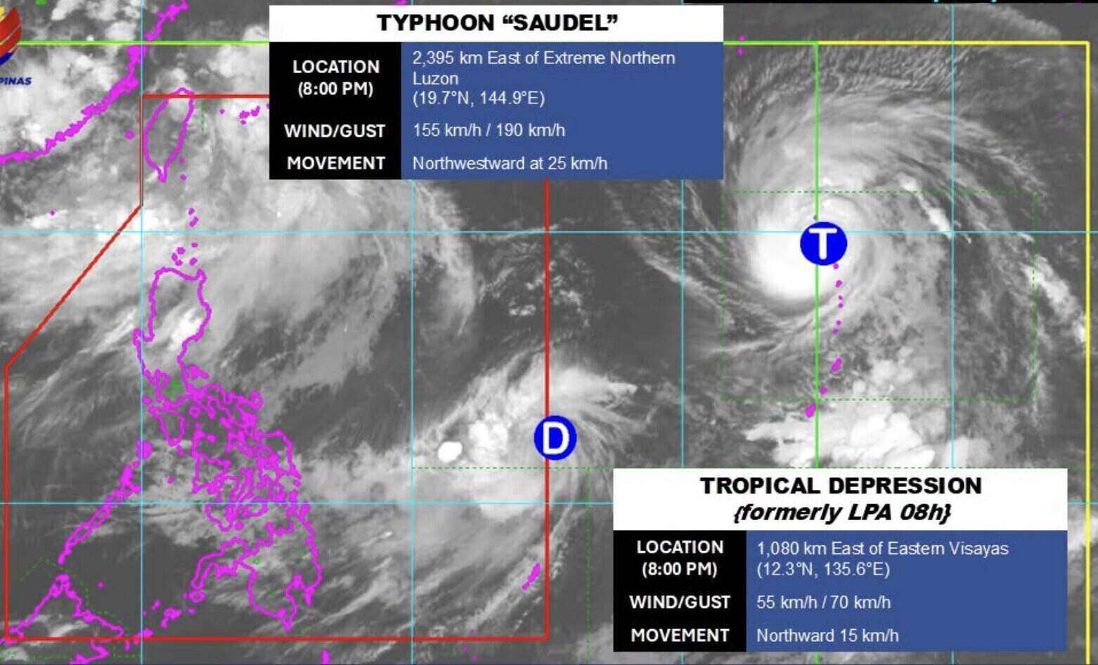
PAGASA forecasts that Saudel will continue to move in Philippine waters in the coming days, before leaving PAR on August 25.
Previously, Saudel was monitored as a tropical depression and then strengthened into a tropical storm. The system continued to intensify as it moved over the sea east of the Philippines.
According to the latest monitoring information, Saudel is likely to continue to strengthen in the near future. However, the storm's direction of movement still needs to be monitored as the system changes direction from northwest to west-northwest.
Saudel's approach to PAR is also being specifically monitored by PAGASA because the storm may affect the southwest monsoon (Habagat), thereby affecting the weather in some areas of the Philippines. Previous PAGASA forecasts showed that Saudel could strengthen the southwest monsoon from the beginning of next week.
Developments in the position, intensity and direction of storm Saudel will continue to be monitored.


