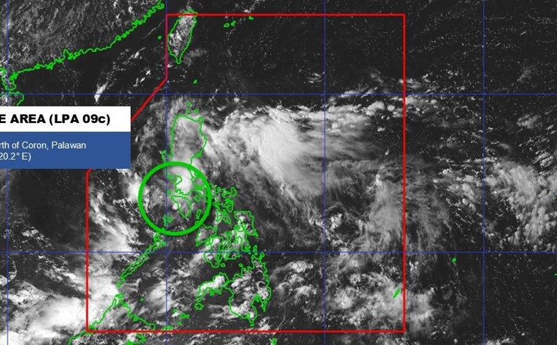
The Philippine Atmospheric, Geophysical and Astronomical Services Administration (PAGASA) said that at 3:00 p.m. on September 15, the center of low pressure 09c was at 12.9 degrees north latitude, 116.7 degrees east longitude, about 475km west of San Jose, Western Mindoro (Philippines), in the eastern sea area of the central East Sea.
The low pressure is moving westward and may leave the Philippine monitoring area (PAR) in the next few hours. However, the circulation of the low pressure is still causing scattered showers and thunderstorms in Metro Manila, Central Luzon, Calabarzon, Mimaropa, Bicol region and Western Visayas, posing a potential risk of flash floods and landslides when there is heavy to very heavy rain.
According to the Vietnam National Center for Hydro-Meteorological Forecasting, currently, the tropical convergence zone has an axis through the central East Sea connecting with the low pressure area. Due to the impact, the eastern sea area of the central and southern East Sea (including the eastern sea area of the dense Truong Sa area) will have showers and thunderstorms.
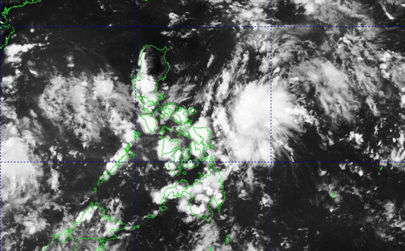
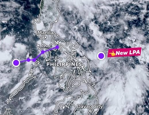
Also on the afternoon of September 15, a new low pressure has just formed in the eastern Visayas, about 170km from Northern Samar (Philippines). The system is identified by the Japan Meteorological Agency (JMA) and given the international tracking code Invest 99W.
In the next 48 hours, low pressure area 99W when moving near Luzon Island (Philippines) is likely to strengthen into a tropical depression with a probability of 40-50%.
Also according to PAGASA, during the week of September 15-21, there will be 2 low pressure areas in the Philippine forecast area. Low pressure 1 (09c) in the East Sea is heading towards Vietnam but the possibility of becoming a storm is low.
Low pressure 2 (Invest 99W) forming east of PAR, moving near Northern Luzon, is also likely to strengthen into a storm. This low pressure may then continue to move westward, towards the Vietnam - South China region next week.
It is forecasted that from now until October 10, 2025, storms and tropical depressions in the East Sea and affecting Vietnam are likely to be at a level similar to the average of many years.
According to the average data of many years, in the East Sea during this period, there will be about 2.2 storms or tropical depressions, 1.1 of which will make landfall in Vietnam.