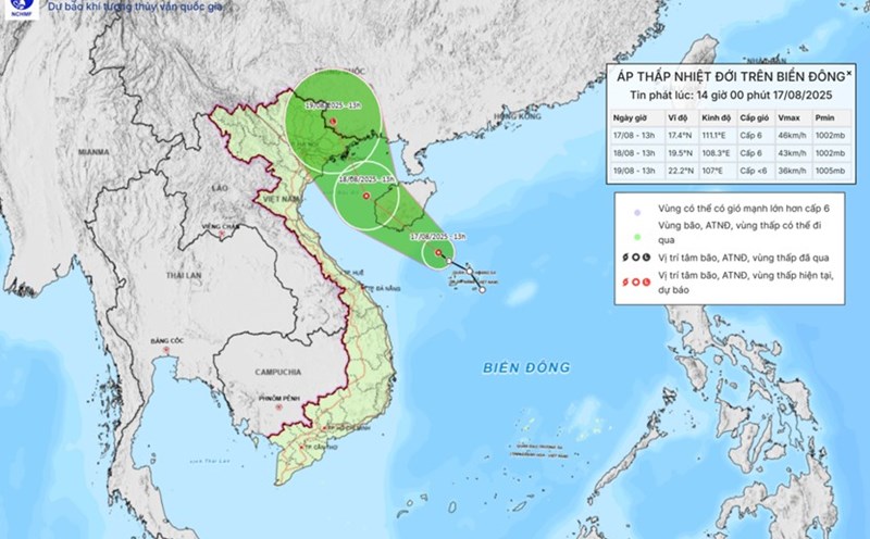
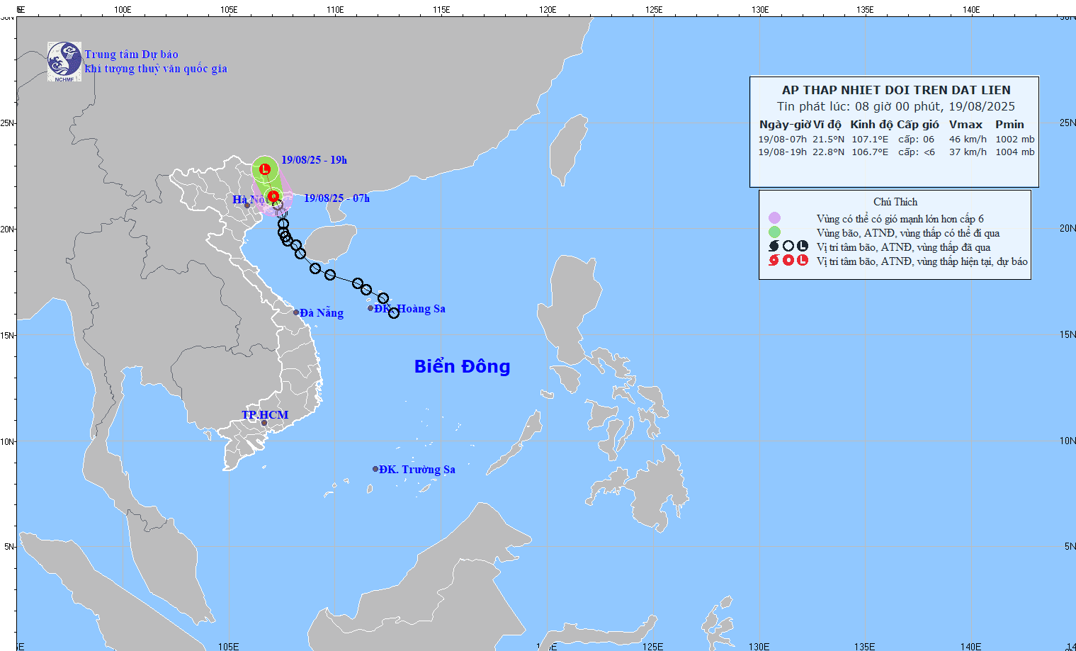
The Vietnam National Center for Hydro-Meteorological Forecasting said that at 7:00 a.m. on August 19, the center of the tropical depression was at about 21.5 degrees North latitude; 107.1 degrees East longitude, in the mainland area of Quang Ninh - Hai Phong provinces. The strongest wind near the center of the tropical depression is level 6 (39-49 km/h), gusting to level 8; moving in the North Northwest direction at a speed of about 15 km/h.
It is forecasted that by 7:00 p.m. on August 19, the center of the tropical depression will be at about 22.8 degrees North latitude; 106.7 degrees East longitude, in the Vietnam - China border area. The strongest wind is below level 6, moving in the North-Northwest direction, about 15 km/h and gradually weakening.
Due to the impact of the tropical depression, the northern area of the Gulf of Tonkin (including the special areas of Bach Long Vi, Cat Hai, Co To and Van Don) on August 19 will have thunderstorms and strong winds of level 6, gusts of level 8, waves 2.0-3.5m high, rough seas. Ship operating in the above-mentioned dangerous areas are likely to be affected by thunderstorms, whirlwinds, strong winds, and large waves.
On land, coastal areas of Quang Ninh and Hai Phong have strong winds of level 6, gusting to level 8.
Regarding the forecast of rain, on the day and night of August 19, the Northeast and Thanh Hoa will have moderate rain, heavy rain and thunderstorms with common rainfall of 40-70mm, locally very heavy rain over 150mm.
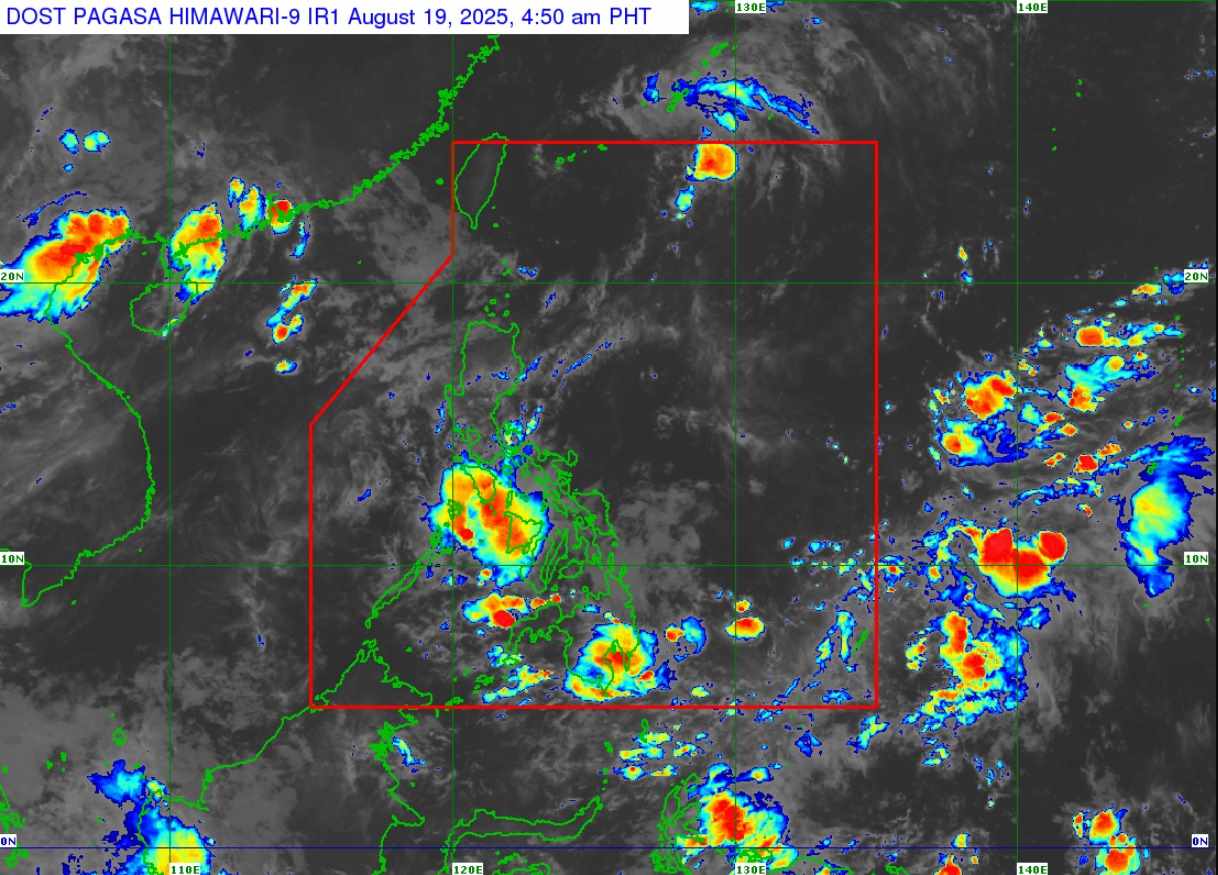
Meanwhile, the Philippine Atmospheric, Geophysical and Astronomical Services Administration (PAGASA) typhoon/low pressure forecast bulletin said that at 5:00 a.m. on August 19, tropical depression Huaning left the Philippine Forecast Area (PAR), moving towards Japan's Ryukyu Islands and had not yet affected any areas of the Philippines.
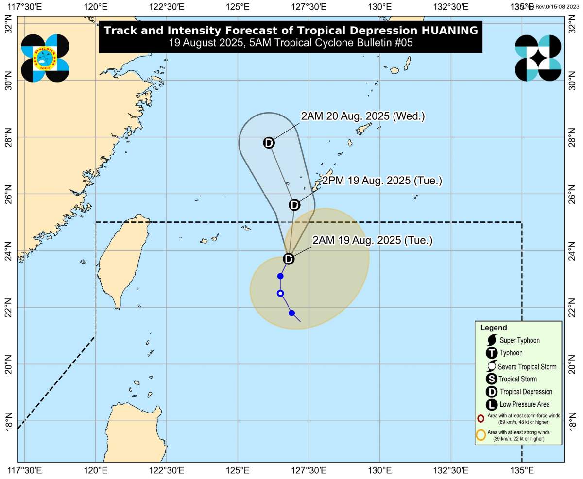
Huaning has maximum sustained winds of 55 km/h and gusts of 70 km/h. There are no rain warnings, tropical cyclone signals or dangerous sea conditions due to tropical depression Huaning. Huaning also did not increase the southwest monsoon.
Huaning is the 8th tropical depression/storm to hit the Philippines in 2025, and the 3rd tropical depression/storm in August, following tropical depression Fabian and storm Gorio (Podul).
In addition, PAGASA is also monitoring a new low pressure area (08e) outside the PAR, 1,810km east of Eastern Visayas as of 3am on August 19.
According to PAGASA, the low pressure is likely to develop into a tropical depression within the next 24 hours.
PAGASA weather forecaster Chenel Dominguez said the depression could eventually reach Northern Luzon, but its path is still uncertain.
According to PAGASA's storm/low pressure forecast, during the week of August 25-31, 3 new low pressure areas are expected to appear, of which 2 are located near the East Sea.