
The latest typhoon and low pressure bulletin on the afternoon of July 12 from the Philippine Atmospheric, Geophysical and Astronomical Services Administration (PAGASA) said that new low pressure 07a has formed outside the Philippine Area of Responsibility (PAR).
At 2 pm on July 12, the low pressure was about 1,800km east of Eastern Visayas, Philippines. Philippine weather forecasters predict that the new low pressure is unlikely to strengthen into a tropical storm in the next 24 hours.
The new low pressure was formed in the context of Typhoon Ba Vi (Philippines name is Inday) making landfall in China on the night of July 11.
The appearance of the new low pressure area 07a is also consistent with the short-term forecast announced by PAGASA on July 8, which said that after Typhoon Ba Vi, there will be 2 low pressure areas forming around the East Sea.
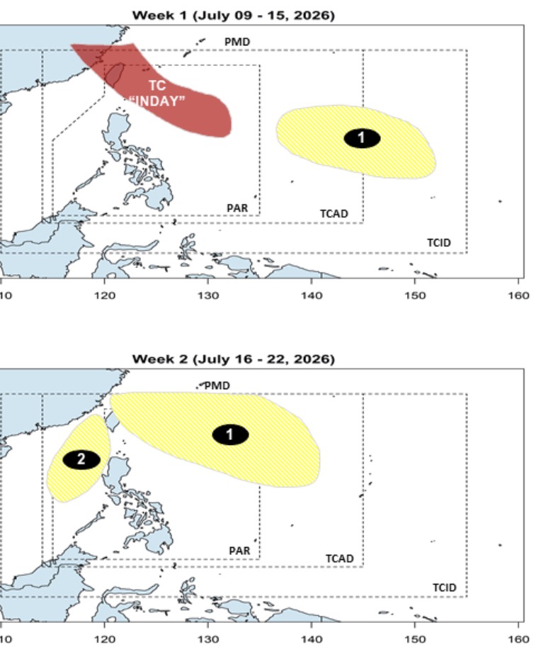
According to this forecast, the first low pressure will form in the east of the boundary of PAGASA's PMD forecast area in the week from July 9 to 15 with little chance of strengthening into a storm or tropical depression during the forecast period.
This low pressure area continues to expand its scope of impact to the week from July 16 to July 22. At that time, the low pressure area will enter PAR, moving closer to the Philippines and the Taiwan (China) region, but is still unlikely to strengthen into a storm or tropical depression.
Also in the week from July 16-22, a second low pressure area is likely to form in the north of the East Sea. Philippine weather forecasters believe that this system is unlikely to strengthen into a storm.


