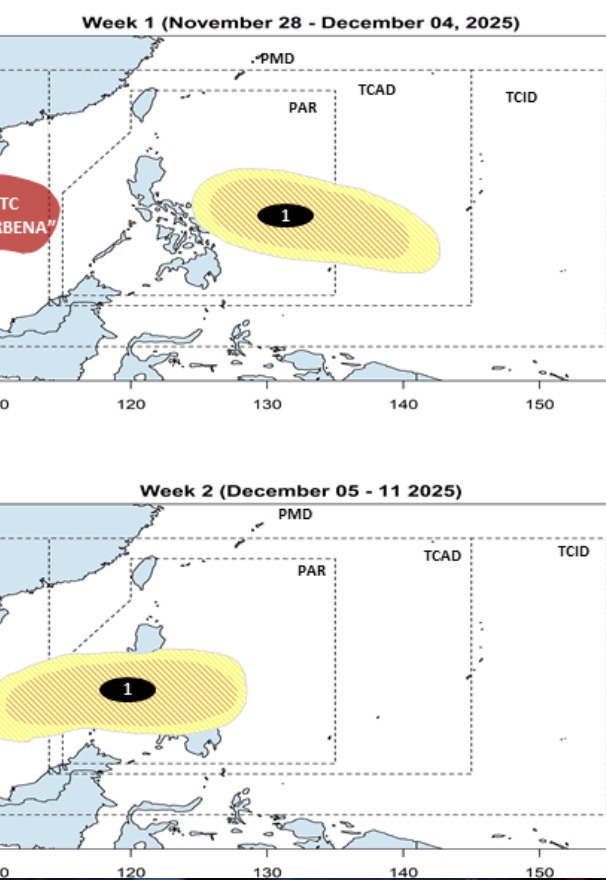
The latest storm and low pressure information on November 28 from the Philippine Atmospheric, Geophysical and Astronomical Services Administration (PAGASA) said that right after storm No. 15 Koto in the East Sea, a new low pressure near the East Sea is forecast to form during the week from November 28 to December 4.
The new low pressure is forecast to appear in the eastern border area of PAGASA's TCAD forecast area. The new low pressure is expected to move westward, entering the Philippine Forecast Area (PAR).
Philippine weather forecasters said that this low pressure is likely to strengthen into a low to moderate storm during the week from November 28 to November 4.
Notably, the new low pressure will continue to exist during the week from December 5 to December 11. During this period, a potential system of typhoons is expected to make landfall in Northern Mindanao - Visayas - Southern Luzon, Philippines. The possibility of the system becoming a typhoon remains low to moderate.
According to the latest weather forecast from PAGASA on November 28, there are three weather systems: the northeast monsoon, wind shear and easterly winds affecting Luzon, Philippines.
PAGASA weather expert Loriedin De La Cruz-Galicia noted that wind shear is forecast to cause cloudy skies, with high rainfall for the areas: Cagayan, Isabela, Apayao, Kalinga, Mountain Province, Ifugao, New Vizcaya, Quirino.
He warned against the possibility of flooding and landslides due to continuous heavy rain.
The northeast monsoon causes cloudy skies with rain in Ilocos, Batanes and the rest of the Cordillera.
Cloudy weather, scattered showers and thunderstorms are forecast for the easterly winds in Aurora and Quezon.
Weather expert De La Cruz-Galicia said that the Palawan area is expected to be cloudy, with high rainfall due to the influence of the low pressure trough of storm No. 15 Koto (known as Verbena in the Philippines) in the East Sea.


