The latest storm news on the morning of July 15 said that a tropical storm could form near the US Gulf Coast this week.
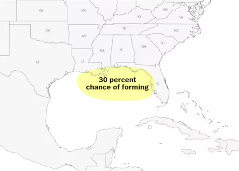
The storm is expected to move abnormally east to west, with a 30% chance of forming later this week, but is expected to move across the warm waters of the Gulf of Mexico, leading to rapid intensification.
Notably, it was forecasted that before the storm was named, heavy rains caused by the system could occur in Florida until July 16. The system will have a widespread impact on weather in Alabama, Mississippi and Louisiana over the weekend.
The United States has not recorded any hurricanes that have directly impacted the storm season. However, deadly flash floods caused by hurricane circulation in Texas and North Carolina are a warning that weak tropical systems could also have dangerous impacts.
In Florida, the worst-hit areas could see more than 15 inches (150 mm) of rain in the first half of the week.
The storm is forecast to move at sea on July 16, interacting with seawater with temperatures slightly higher than the average temperature at this time of year. The system could continue to bring heavy rains across Florida, with some of the rains spreading westward to southern Alabama, Mississippi and Louisiana.
The storm is forecast to move inland from July 17 to 18, with some reliable weather models showing Louisiana as the most likely to make landfall.
According to the forecast track, heavy rain and strong winds are possible as the storm makes landfall, with areas such as New Orleans; Gulfport and Biloxi, Mississippi; and Mobile, Alabama in potential impacts.
In terms of intensity, forecasters in the US say the latest system will reach tropical storm intensity depending on how long it will travel in the Gulf of Mexico in the second half of the week.
If it forms in the Gulf of Mexico, off the central coast of Florida, the storm will move 1 to 2 days over a wide, warm ocean area and strengthen as it moves west.
However, if the storm moves northward across Florida, its location near land and drier air may limit the storm's strengthening.
While no other storm has similar characteristics, the strength of Chantal, the most recent storm of this year's Atlantic hurricane season, has far exceeded forecasts and tended to strengthen as it moved off the southeastern coast of the United States in early July. Chantal then made landfall in South Carolina.
It is not yet clear whether the upcoming storm, expected to be named Dexter, will tend to strengthen similar to Typhoon Chantal.