The latest storm/low pressure information from the Philippine Atmospheric, Geophysical and Astronomical Services Administration said that at 3:00 a.m. on July 15, the center of the tropical depression was at about 26.8 degrees north latitude, 139.6 degrees east longitude, 1,925 km east-northeast of Luzon. Maximum winds near the center of the tropical depression are 55 km/h, gusting to 70 km/h. The tropical depression is moving north at a speed of 20 km/h.
PAGASA does not rule out the possibility of the tropical depression strengthening into a storm in the sea area northeast of the Philippines. After that, it is likely that this weekend, the storm will enter the northeastern area of the East Sea and have extremely unpredictable developments in intensity and direction of movement next week.
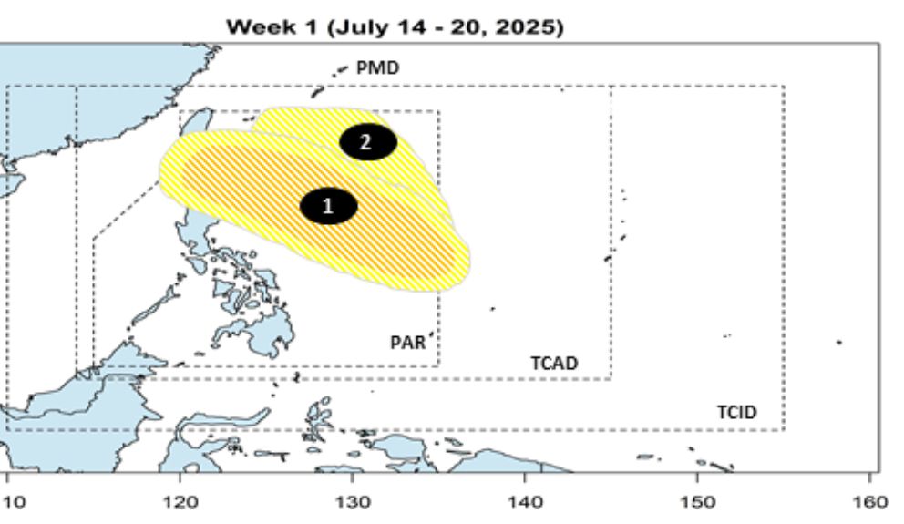
On July 14, PAGASA released a 2-week typhoon forecast bulletin. Accordingly, during the week of July 14-20, PAGASA forecasts a low pressure area to form east of the Philippine Forecast Area (PAR) and move north of Luzon. The possibility of this depression forming a storm is moderate to low.
A second low pressure may also form in the northeast of the PAR, but the possibility of becoming a storm is low.
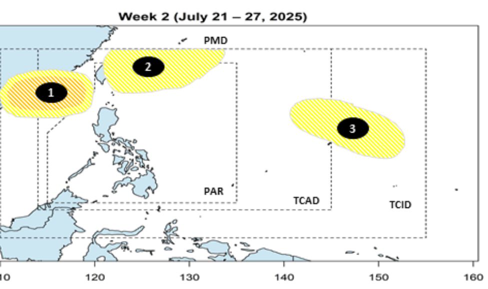
During the week of July 21-27, Depression 1 is forecast to continue moving northwest, approaching southern China, but the possibility of developing into a typhoon remains moderate to low.
Low pressure 2 is forecast to move towards Taiwan (China), Ryukyu Islands (Japan), and the possibility of strengthening into a storm is low.
The new low pressure - low pressure 3 - may form east of the storm monitoring area (TCAD) and the storm information area (TCID), but the possibility of developing into a storm is still low.
In general, the risk of tropical cyclones is still remarkable during the forecast period, although the possibility of strong storm formation is generally low to moderate.
However, the low pressure and strong southwest monsoon will cause widespread rain in many places in the Philippines such as Visayas, Mindanao and Palawan. Showers and thunderstorms accompanied by the risk of flash floods and landslides are still threatening many mountainous areas.
Meanwhile, in Vietnam, the rain forecast bulletin for the day and night of July 15 of the Vietnam National Center for Hydro-Meteorological Forecasting said that the mountainous and midland areas of the North will have scattered showers and thunderstorms, with some places having heavy rain. The common rainfall is 15-30mm, in some places over 70mm. Thunderstorms will mainly occur in the late afternoon and night.
In the afternoon and evening of July 15, the Central and Southern highlands will have scattered showers and thunderstorms, some places will have heavy rain (10-30mm), some places will have over 60mm.
Warning of the risk of local heavy rain over 70mm in some mountainous areas. During thunderstorms, there is a possibility of tornadoes, lightning, hail and strong gusts of wind.
Risk of flash floods on small rivers and streams; landslides on steep slopes and flooding in low-lying areas.