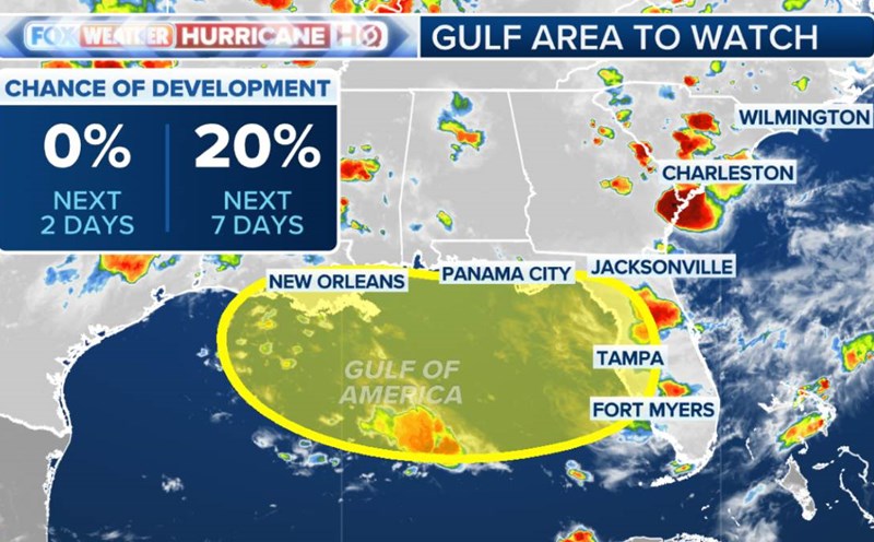
According to the Japan Meteorological Agency (JMA) typhoon forecast bulletin, Typhoon Nari is currently located about 130km south of Chichijima Island (in the Ogasawara Islands) and is moving north at a speed of 15km/h. The central pressure was recorded at 998 hPa, with strong winds of 93 km/h, higher than all previous forecasts.
According to meteorologists, storm Nari is undergoing a rare structural change process. As it moves north, the storm begins to interact with the media literary low pressure area, causing the convection surrounding the center of the storm to expand. A strip of dry air is also moving in from the south and west, signaling the formation of atmospheric fronts - the first step in the process of "exterio-tropical" 3.
Although there is still a warm core and deep convection in the center, Nari is about to transition to a post-tropical cyclone - a type of storm that often appears at high latitude, causing extreme weather over a wide area.
It is forecasted that on July 14, the center of the storm will approach the Kanto area (including Tokyo, Kanagawa, Chiba...) and continue to affect Tohoku from the night of July 15 to the morning of July 16. Heavy rain, thunderstorms and strong winds are warned in many coastal localities.
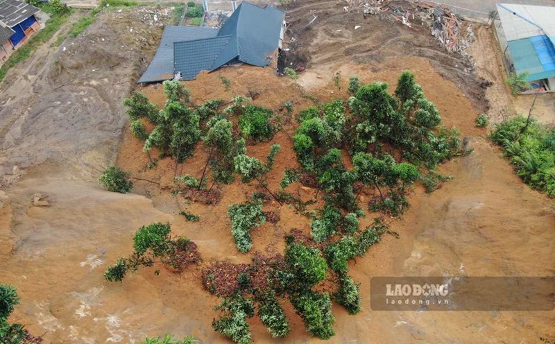
High waves and the risk of flash floods and landslides have also been reported in mountainous and island areas.
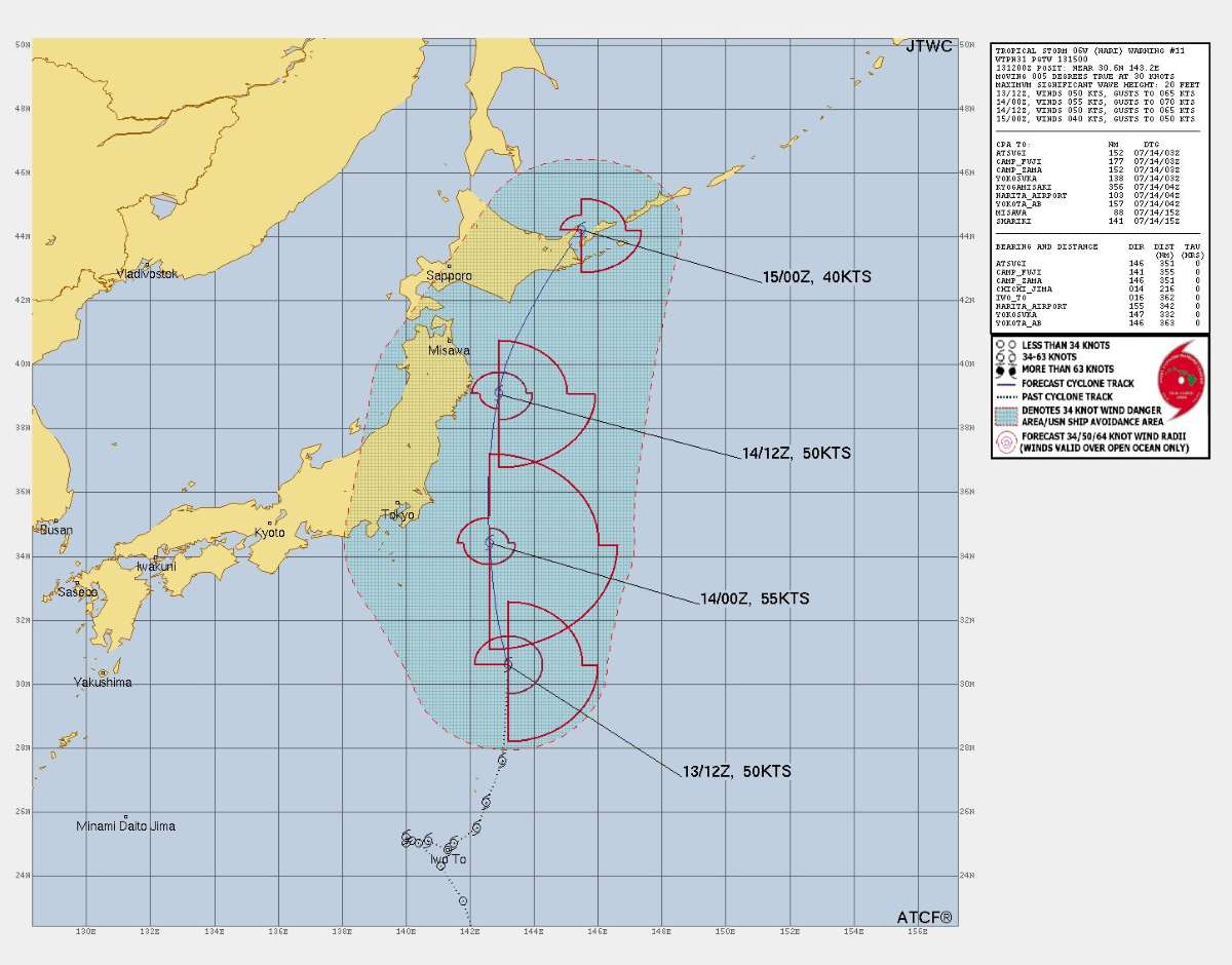
In the next 12-24 hours, storm Nari will continue to accelerate under the impact of strong high-level winds and unusually subtropical high pressure edges. Although it may strengthen slightly due to warm sea temperatures, when it enters the cold waters near Hokkaido in the early morning of July 16, Typhoon Nari will weaken rapidly and completely become an untropical storm, then move rapidly eastward, leaving the Western Pacific around July 18.
The storm Nari is challenging forecasters as it changes its path - a phenomenon that the meteorological community is monitoring closely. Japan is entering another high level of storm warning as the rainy season has not ended and the weather is unpredictable.