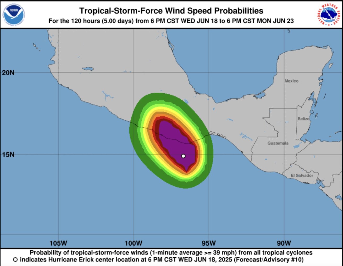
The latest hurricane report from the US National Hurricane Center (NHC) in Miami said that Erick has skyrocketed to Category 3 - a strong storm - as it approached the southern coast of Mexico.
Just hours after reaching Category 1 strength, Erick rapidly strengthened, with maximum sustained winds of up to 195 km/h at night, while operating offshore about 90 km south-southwest of Puerto Angel City.
According to the center's latest hurricane bulletin, Erick is also about 260 km southeast of Punta Maldonado and is moving northwest at a speed of about 15 km/h. Typhoon Erick is forecast to make landfall in Mexico on the morning of June 19, local time.
A storm is classified as a strong storm when it reaches Category 3 or higher, with winds of 180 km/h or more. Typhoon experts warn that Erick will continue to strengthen and that wind damage could be serious at the center of the storm.

The projected track shows that the center of Erick is likely to sweep across Acapulco resort, which was severely damaged by Hurricane Otis in October 2023.
Superstorm Otis rapidly intensified, leaving many people unable to respond, killing 52 people, leaving 32 missing and almost the entire hotel system in Acapulco severely damaged.
Hurricane Erick doubled in strength in less than a day due to ideal weather conditions for rapid intensification in the southern Pacific coast of Mexico. Erick, a typical but strong storm that gained as much as 80 km/h within 18 hours and continues to strengthen as it approaches land.
According to the US National Hurricane Center, last year's hurricane season saw 34 rapid intensifications, meaning an increase of at least 56 km/h within 24 hours. The rapid increase in the storm's intensity is a factor that makes it significantly difficult to predict the path and intensity of the storm.
Erick is the fifth storm in the eastern Pacific just over a month after the season began, a sign that this year's hurricane season in the basin is more active than average, according to Miami University's Brian McNoldy. He also predicted that Erick could become the strongest storm to hit the area so early of the year.
Normally, storm No. 5 appears around July 23. The Pacific typhoon season runs from May 15 to November 30 every year.
Experts say Erick is not like Hurricane Otis, which was caused by different formation times. Otis arrived at the end of the season, in October, when the ocean was more deeply stirred and warmer, creating ideal conditions for a super typhoon.
Meanwhile, Erick, which formed early in the season, was not warm enough to support a similar rapid intensification process. However, according to Secretary Secretary Emanuel of the Massachusetts Institute of Technology, the current sea surface temperatures are also hot enough for the storm to rapidly intensify.
All other weather conditions are ideal for Erick to thrive, said Kristen Corbosiero, a meteorologist at Albany State University. Normally, dry air can prevent the storm from rapidly intensifying, but currently, Erick has no dry air and the surrounding environment is very humid. The latest storm has also formed a clear eye, a sign of a rapidly strengthening storm system.


