The latest storm and low pressure information on August 18 from the Central Meteorological Agency (CWA) said that tropical depression Huaning in the east of the island could strengthen into a tropical storm at noon on August 19.
At 8:00 a.m. on August 18, the center of tropical depression Huaning was located 550 km east of Tai Dong district and was moving north-northeast at a speed of 15 km/h.
CWA weather forecaster Liu Pei-teng said the tropical depression that formed on the morning of August 18 could strengthen into a tropical storm on August 19, but the expected path shows that this storm will only have a minimal impact on Taiwan (China).
The island is forecast to see thunderstorms in the afternoon until August 20 and gradually decrease over the next 2 days.
According to the CWA bulletin, the low pressure in the East Sea near Hainan Island, China is unlikely to strengthen into a tropical storm.
The CWA is also monitoring cloud systems southeast of Guam to detect potential storm and low pressure developments in the next few days.
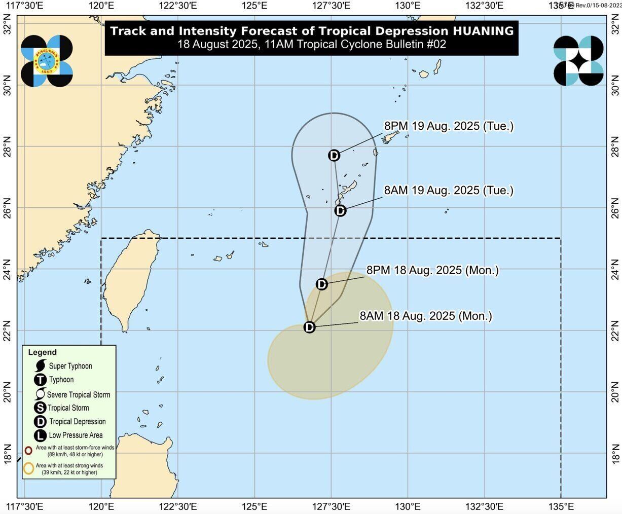
Meanwhile, the weather bulletin at 11:00 a.m. on August 18 of the Philippine Atmospheric, Geophysical and Astronomical Services Administration (PAGASA) said that tropical depression Huaning will mainly move north and leave the Philippine Forecast Area (PAR) on the night of August 18 or the morning of August 19.
Philippine weather forecasters say the tropical depression could approach or pass the Okinawa Islands in the morning of August 19 or the afternoon of August 20.
Huaning is likely to maintain a tropical depression state throughout the forecast period. However, the possibility of strengthening into a tropical storm has not been ruled out, but this is not the most likely scenario at this time.
A quick report on the tropical depression in the East Sea at 3:00 p.m. on August 18 from the National Center for Hydro-Meteorological Forecasting said that the center of the tropical depression was at about 19.6 degrees North latitude; 107.7 degrees East longitude, about 55km south of Bach Long Vi Special Zone. Strongest wind: Level 6-7 (39-61km/h), gust level 9. It is forecasted that in the next 3 hours, the tropical depression will move north-northeast at a speed of about 15km/h.