The latest storm news on August 19 from the US National Hurricane Center (NHC) said that after reducing the intensity over the weekend, Erin has strengthened back to a Category 4 hurricane, with maximum sustained winds of 209 km/h.
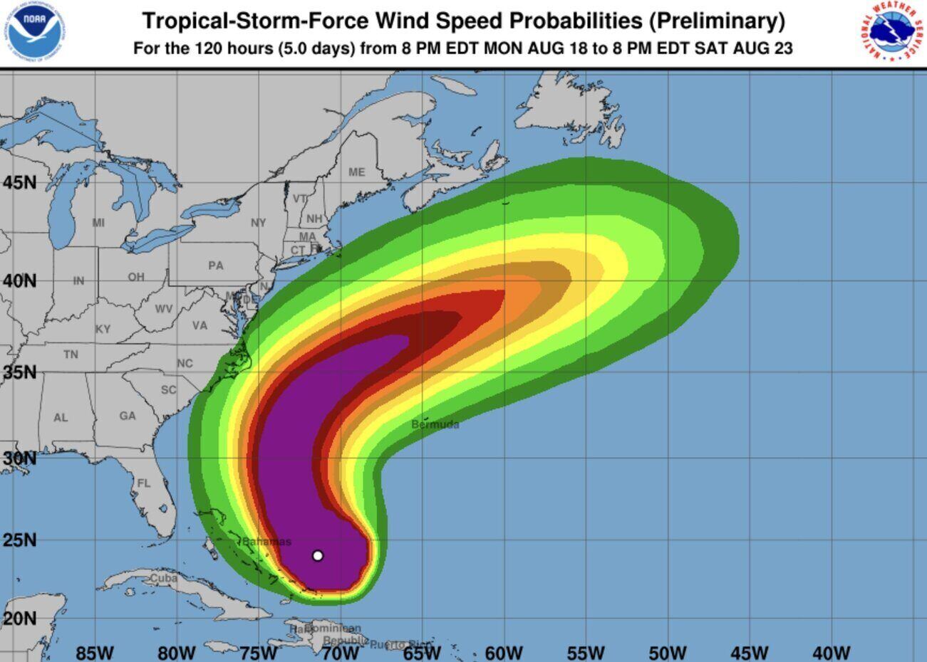
The latest storm forecast shows that the storm is strengthening, especially as it gradually moves north, following the path between the US and Bermuda.
"The center of Hurricane Erin is expected to pass east-southeast and central Bahamas through the day and night of August 19, moving between Bermuda and the East Coast of the United States in midweek," the bulletin said.
The first hurricane to form this year's Atlantic hurricane season and also the first to become a super typhoon, Erin is located 1,118km southwest of Bermuda and 1,295km south-southeast of Hatteras Island.
The Outer Banks breakwater has been put into a state of mandatory evacuation as officials warn of the possibility of flooding.
Although Erin is not expected to make landfall in the US, forecasters warn that the storm could cause dangerous waves and strong currents to the US East Coast, extending as far as the Atlantic coast of Canada.
According to the latest storm forecast, Outer Banks faces the biggest threat as coastal flooding could sink low-lying islands by midweek.
AccuWeather's weather bulletin said that some coastal areas of North Carolina may have gusts of 64 to 96 km/h from the night of August 20 to August 21 and waves 3 to 4.5 m high could be recorded at Outer Banks.
In addition to the US, a tropical storm warning has been issued since August 18 for the Turks & Caicos Islands as well as some areas of the Bahamas. Forecasters warn of the possibility of "urban flash flooding and inundation".
As it moves north into the Atlantic, Erin is expected to strengthen. Dangerous high waves are expected to form along the entire east coast of the United States.
Erin has been a tropical storm since August 11 and has changed in intensity since becoming a Category 1 hurricane on August 15. Hurricane Erin rapidly strengthened to dangerous Category 5 on August 16, with winds of up to 260 km/h before weakening. The storm is expected to remain a strong hurricane through midweek.
The Atlantic hurricane season officially began on June 1 and runs through late November. The Atlantic basin includes the Atlantic, Caribbean Sea and Gulf of Mexico. Based on the 30-year climate cycle from 1991 to 2020, the average Atlantic hurricane season has 14 named storms, seven hurricanes, and three major hurricanes or super typhoons. The storm is active and usually peaks between mid-August and mid-October.