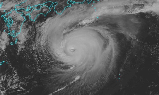
The latest storm information from the Philippine Atmospheric, Geophysical and Astronomical Services Administration (PAGASA) said that at 2:00 a.m. on October 9, tropical storm Nakri was active outside the Philippine Area of Respect (PAR). The center of the storm was determined to be at 21.9 degrees north latitude, 136.3 degrees east longitude, about 1,505km east of the northernmost tip of Luzon.
The storm has maximum sustained winds of 65 km/h, gusts of 80 km/h, moving northwest at a speed of 25 km/h. PAGASA said Nakri could enter the northeastern edge of the PAR in the afternoon or evening of October 9, and leave the area on the morning of October 10.
According to PAGASA's typhoon forecast, Typhoon Nakri is unlikely to directly affect the weather or sea conditions of the Philippines. Therefore, no storm warnings have been issued.
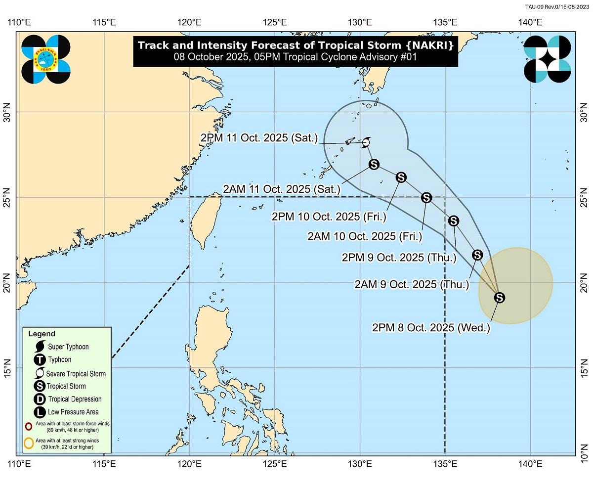
Meanwhile, according to the CWA (China), Typhoon Nakri formed on October 8 but the possibility of affecting Taiwan (China) is very low. The storm's path is mainly northwestward, entering the southern waters of Japan, then turning northeastward, away from land.
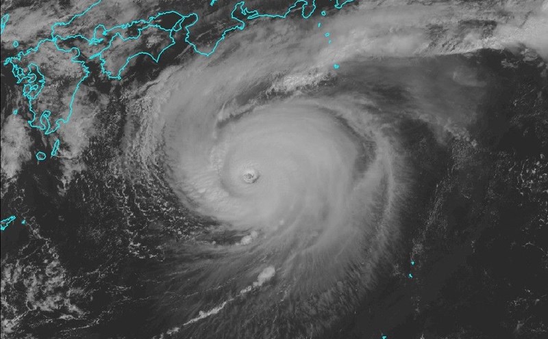
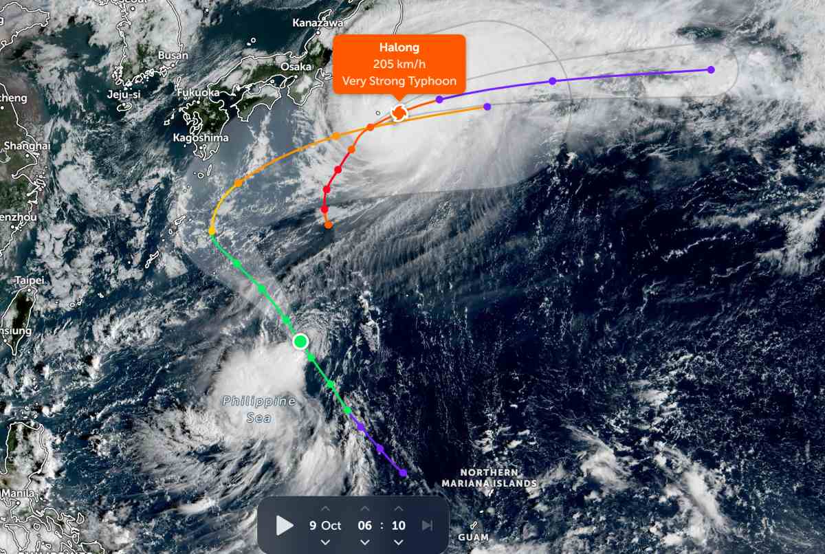
In parallel with Typhoon Nakri, Typhoon Ha Long is sweeping through the Izu area and southern Japan on the morning of October 9 with extremely strong winds.
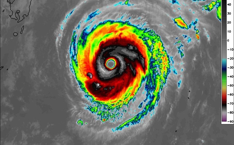
The latest storm information from the Japan Meteorological Agency (JMA) said that at 4:00 a.m. on October 9, the center of Typhoon Ha Long was located near Aogashima Island, moving northeast at a speed of 25 km/h, central pressure of 940 hPa, strong winds of 180 km/h, gusts of up to 252 km/h - super typhoon level. Within a radius of 130km around the center of the storm, gusts of wind reach over 90 km/h, causing dangerous high waves and heavy rain.
The JMA has issued a warning to the town of Hachijo and the villages of Aogashima, Toshima, Niijima, Kouzushima, Miyake and Mikurajima.
The JMA called for great caution, saying that strong winds and large waves from Typhoon Ha Long could cause a large-scale disaster that only happens once every few decades. The JMA has recorded the formation of heavy rain cloud bands.
Extreme winds and heavy rain are forecast to continue until noon on October 9 in the Izu Islands. Rainfall could reach 250mm/24 hours, or even increase if dense convective cloud bands are formed - increasing the risk of flash floods and landslides.
Experts say that the appearance of two strong storms - Ha Long and Nakri - consecutively in less than a week is a signal that the 2025 Northwest Pacific typhoon season is still at its peak.
The phenomenon of storms following storms like Ha Long - Nakri is not uncommon, but when it appears at the end of the rainy season, it often leads to unusual fluctuations in unseasonal rain, rough seas and the tropical convergence zone are more active, posing a potential risk of extreme weather in the area.