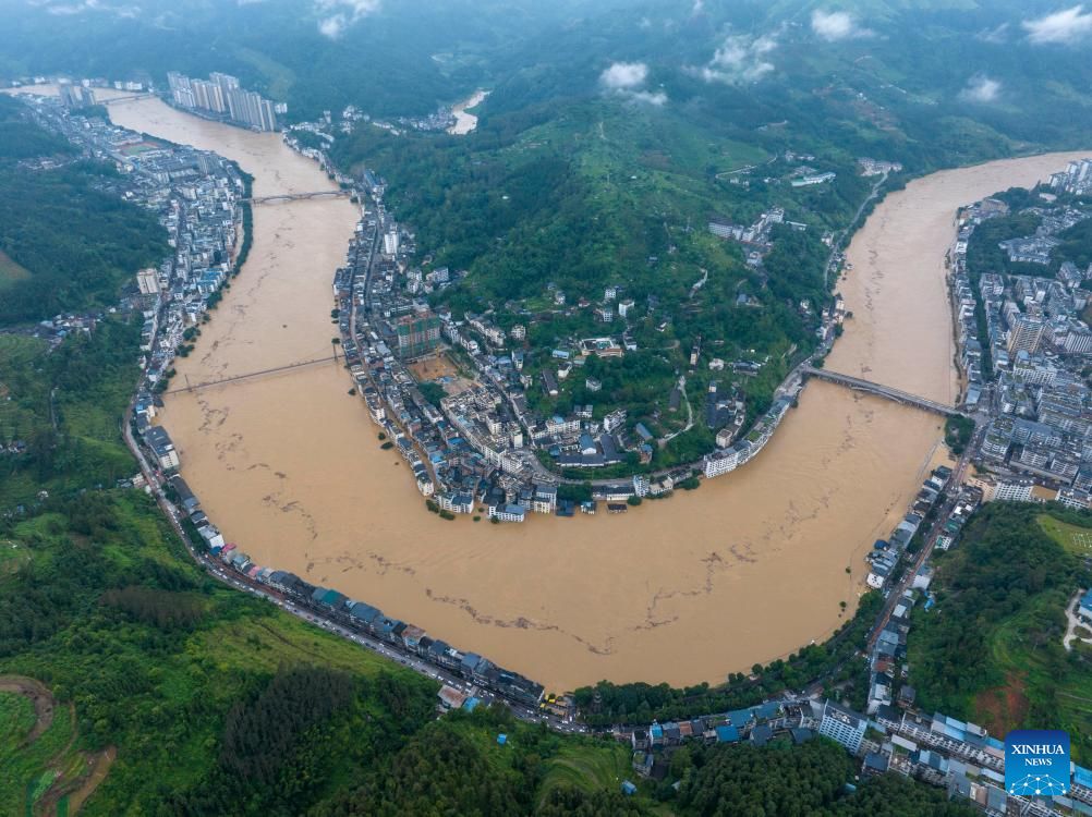
As of the morning of July 10, 25 rivers in Sichuan, Guizhou, Chongqing and Yunnan provinces have exceeded warnings, of which 10 are in a state of being at risk of breaking dykes or overflowing banks at any time, according to a warning from China's Ministry of Water Resources issued by CCTV Central Television.
Notably, the Xich Thuy River (Quy Chau) recorded its highest water level since it began measuring in 12, while the Tieu Thao River (Tu Xuyen) reached a record level for nearly 3 decades.
The reason is due to the combination of the remnants of storm No. 2 Today and the East Asian monsoon moving from India, causing prolonged heavy rains, some places up to nearly 230mm in just 24 hours. In Chieu Thong city, Yunnan province, heavy rain killed 2 people and forced thousands of people to evacuate.
As of July 10, more than 10,000 people in the affected provinces have been urgently evacuated from the danger zone.
Beijing could not help but be affected as on the morning of July 10, Trieu Duong district recorded up to 68.2mm of rain in just 1 hour.
Experts warn that climate change is causing more frequent and intense extreme rains, putting China's old flood prevention systems under pressure.
The $2,800 billion agricultural sector is also at risk of great damage if floods continue.
Meanwhile, Beijing health officials warn of a rising risk of water and food pollution due to a combination of heavy rain, heat and humidity.
China is still maintaining high-level flood warnings in many areas, while deploying rescue forces and continuous dyke checks to respond to the risk of widespread dyke rupture.
Regarding rain forecasts in Vietnam, the Vietnam National Center for Hydro-Meteorological Forecasting said that from the night of July 10 to early morning of July 11, the Northern provinces and Thanh Hoa experienced moderate to heavy rain, some places had very heavy rain. Some locations recorded heavy rainfall from 7pm to 3am such as Dao San (Lai Chau) with 127.6mm, Dong Cuu 1 (Phu Tho) with 85.8mm and Muong Lam (Son La) with 59.8mm.
It is forecasted that on July 11 and 12, the North and Thanh Hoa will continue to have moderate rain, heavy rain, and very heavy rain in some places. Rainfall is generally from 50 to 120mm, in some places it may exceed 250mm. The meteorological agency warns that there is a possibility of heavy rain with high intensity, over 150mm within just 3 hours.
In the area from Nghe An to Ha Tinh, during the day and night of July 11, there will be scattered showers and thunderstorms, some places may experience heavy rain with local rainfall of over 60mm.
From July 13, heavy rain in the North and Thanh Hoa is forecast to gradually decrease. However, during thunderstorms, people need to be on guard against dangerous weather phenomena such as tornadoes, lightning, hail and strong gusts of wind, flash floods, landslides.