After Tropical Storm Chantal caused flooding in the South Carolina, meteorologists are continuing to closely monitor an area at risk of a new tropical cyclone along the Southeast coast of the United States, from the southern Atlantic Ocean to the Gulf of Mexico, between January 15-18.
The storm forecast was given by AccuWeather experts in the context of the 2025 Atlantic hurricane season running ahead of history for nearly a month, with 3 named storms, while the third storm usually doesnt appear until early August.
The area under this warning coincides with where Typhoon No. 3 Chantal formed in early July. Chantal originated from a trapped low pressure trough and weak air flows on convective layers, then moved inland, causing widespread heavy rain in North and South Carolina.
Like that model, a weak front along with a light wind whirlwind is likely to facilitate a low pressure area forming in the US Southeast Atlantic coastal area, especially from the coast of Georgia to Florida, or in the northeastern Gulf of Mexico.
Although this time thejet stream is not as strong as at the beginning of the month and the upper-level winds are somewhat more stable (less disruptive), the possibility of storm formation is still considered low but cannot be ruled out.
If the depression develops in the Atlantic, the system could gradually drift northward, approaching the U.S. mainland along the East Coast.
In the case of formation in the Gulf of Mexico (more likely than now), the wind may move westward, affecting coastal states such as Louisiana, Mississippi or even Texas.
Even if a clear storm center is not formed, showers and thunderstorms can still occur in coastal areas, accompanied by rough seas and local flooding.
The next name on the 2025 hurricane list will be Dexter.
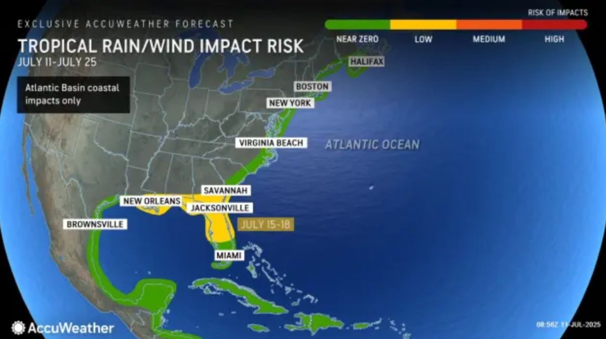
In addition to the area near Florida, AccuWeather is monitoring another area north of Bermuda, with the possibility of tropical activity between 13-15 July.
According to Alex DaSilva - head of AccuWeather's storm forecasting team, both areas have something in common: a weak front is stuck in place, creating conditions for the tornado to start forming.
Meanwhile, traditional areas such as Central America, the Caribbean or the west coast of Africa - where strong storms often appear in the later stages - are still being frustrated by dry air, Sahara dust and strong upper-level winds, causing the possibility of cyclone formation to be almost zero until at least mid-July.
According to the latest hurricane update, this year's Atlantic hurricane season is forecast to have 13 to 18 tropical storms, of which 7 to 10 may strengthen into major hurricanes (hurricane), and 3 to 5 are likely to reach extremely strong hurricane status (level 3 or higher).
With 3 storms appearing in July, 2025 is showing exactly as experts initially predicted: An early, intense and unpredictable storm season.


