According to the latest storm information from the Philippine Atmospheric, Geophysical and Astronomical Services Administration (PAGASA), at 3:00 a.m. on August 6, the center of the low pressure was at about 14.5 degrees north latitude, 126.8 degrees east longitude, about 550km east of Infanta, Quezon, Philippines.
It is forecasted that in the next 24 hours, the low pressure is unlikely to strengthen into a tropical depression, but this system will continue to cause widespread thunderstorms, accompanied by the risk of flash floods and landslides in many areas across the Philippines.
The hardest hit areas include the Cagayan Valley, Bicol region, Aurora, Quezon, Marinduque, Romblon and Eastern Visayas (including Northern Samar, Samar, Eastern Samar, Biliran and Leyte), with cloudy skies and thunderstorms. Warning of flash floods and landslides that may occur due to moderate to heavy rain, sometimes very heavy rain.
Areas such as the Zamboanga peninsula, Negros, Basilan, Tawi-Tawi, Sultan Kudarat and Sarangani are affected by the southwest monsoon, so the risk of flash floods and landslides remains alarming, especially in mountainous and low-lying areas.
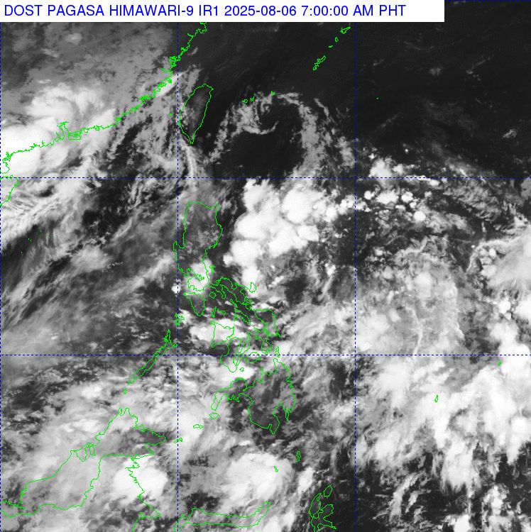
Metro Manila and the rest of Luzon will see scattered showers and thunderstorms in the late afternoon, mainly due to local disturbances. However, heavy rains in a short period of time can cause flooding in large cities.
Meanwhile, the Vietnam National Center for Hydro-Meteorological Forecasting said that on the day and night of August 6, the Gulf of Tonkin and the northern sea area of the North East Sea will have scattered showers and thunderstorms. During thunderstorms, there is a possibility of tornadoes and strong gusts of wind.
The North Gulf of Tonkin area, the sea area west of the North and Central East Sea (including Hoang Sa special zone) has strong southwest to south winds of level 5, sometimes level 6, gusting to level 7-8. Waves are 1.5-3.0m high. Rough seas.
Regarding the forecast of heavy rain from early morning of August 6 to morning of August 7: The mountainous and midland areas of the North will have moderate rain, heavy rain and thunderstorms; some places will have very heavy rain. Total rainfall is generally 30-70mm, locally over 150mm. The rain will mainly be in the late afternoon and night. Warning of heavy rain over 100mm in 3 hours.
Other places in the North will have showers and thunderstorms, some places will have heavy to very heavy rain. Rainfall is generally 10-40mm, locally over 70mm
The area from Thanh Hoa to North Quang Tri has some places with heavy rain, rainfall over 50mm. During thunderstorms, there is a possibility of tornadoes, lightning, hail and strong gusts of wind.
It is forecasted that from the afternoon of August 7, heavy rain in the mountainous and midland areas of the North will gradually decrease.


