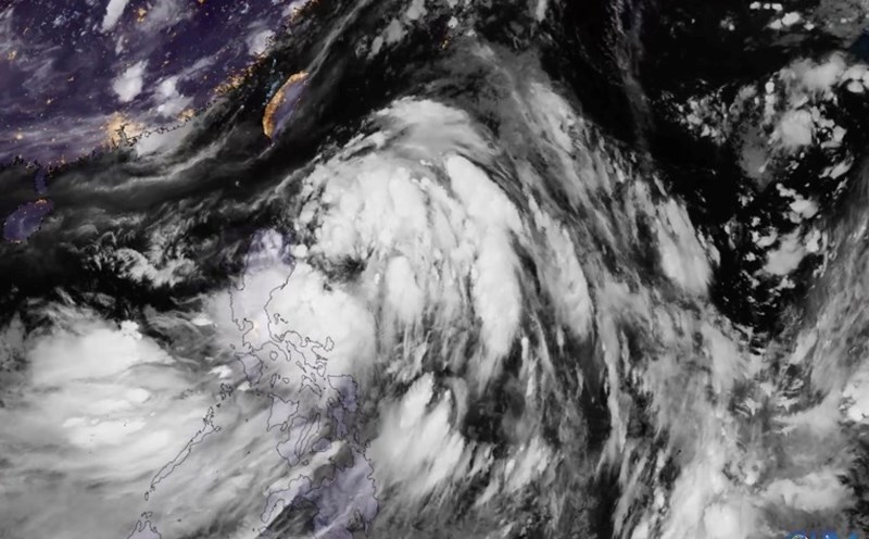
The latest storm and low pressure information on the morning of August 8 from the Philippine Atmospheric, Geophysical and Astronomical Services Administration (PAGASA) said that the low pressure near the Philippines entered the East Sea on the evening of August 8.
At 3:00 a.m. on August 8, the low pressure area, known as 08a, was 150 km northwest of Bacnotan, La Union, or 125 km southwest of Sinait, Ilocos Sur, still within the Philippine Forecast Area (PAR). Previously, at 8:00 p.m. on August 7, the low pressure was 75 km northwest of Bacnotan, La Union.
Philippine typhoon forecasters say that the low pressure in the East Sea 08a is likely to strengthen into a tropical depression or storm within the next 24 hours.
In addition to the low pressure in the East Sea, PAGASA is also monitoring a storm that formed on the night of August 7 and early morning of August 8 outside the PAR forecast area of the Philippines.
The storm near the South China Sea is internationally named Podul. At 3:00 a.m. on August 8, Typhoon Podul was 2,585 km east of Northern Luzon. The storm is moving west-northwest at a speed of 15 km/h. The storm has winds of 65 km/h and gusts of up to 80 km/h.
PAGASA forecasters had previously predicted that two to three storms would form within or enter the PAR in August.
In the weather forecast bulletin on the morning of August 8, PAGASA said that the southwest monsoon will affect the weather in most areas of the Philippines in the next 24 hours.
Due to the influence of the southwest monsoon, cloudy skies with scattered showers and thunderstorms will occur in the Visayas, Bicol region, Mimaropa, Zamboanga peninsula, Northern Mindanao, Caraga, Davao region and Quezon.
Cloudy to cloudy skies are forecast, accompanied by scattered showers or thunderstorms in the Manila urban area, the rest of Calabarzon and other parts of Mindanao. Other locations in Luzon will see localized thunderstorms.
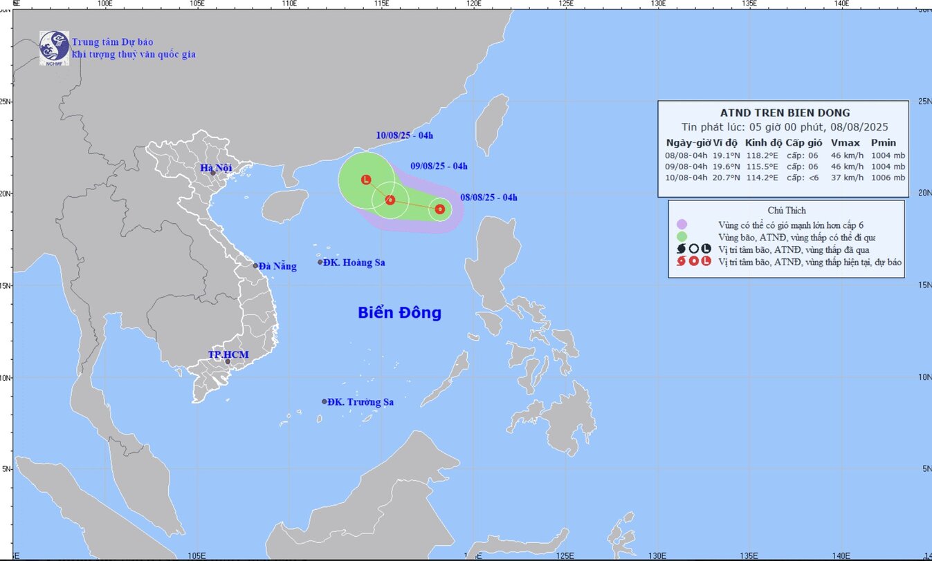
Meanwhile, the tropical depression news in the East Sea at 5:00 a.m. on August 8 from the Vietnam National Center for Hydro-Meteorological Forecasting said that in the early morning of August 8, the low pressure area in the northern East Sea area had strengthened into a tropical depression.
Location of the center of the tropical depression at 4:00 a.m.: 19.1 degrees north latitude; 118.2 degrees east longitude, in the sea east of the northern East Sea. The tropical depression in the East Sea has an intensity of level 6 (39-49 km/h), gusts of level 8, moving west-northwest, speed about 10-15 km/h.
It is forecasted that in the next 24 to 72 hours, the tropical depression will cause strong winds and large waves at sea. The northeastern sea area of the northern East Sea will have thunderstorms, strong winds of level 6, gusts of level 8. Waves are 2.0-3.0m high. Rough seas. Ship operating in the danger zone are likely to experience thunderstorms, whirlwinds, strong winds and large waves.