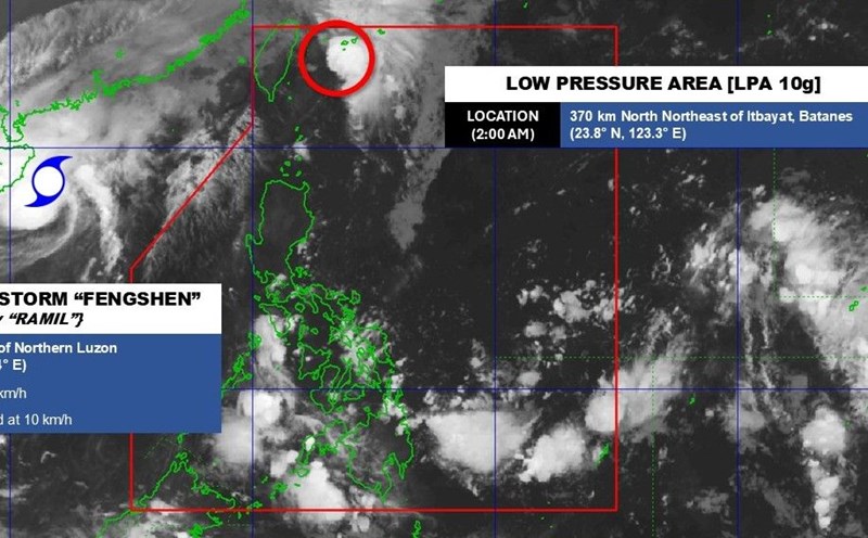
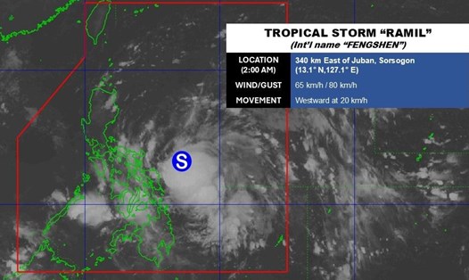
The latest storm information from the Philippine Atmospheric, Geophysical and Astronomical Services Administration (PAGASA) said that at 2:00 p.m. on October 22, the center of tropical depression Salome was at about 22.7 degrees north latitude; 123.2 degrees east longitude. Maximum sustained winds of 55 km/h, gusting to 70 km/h, 255 km northeast of Itbayat Island, Batanes Province. Central pressure 1006 hPa.
The range of strong winds extends up to 200km from the center, directly affecting the northernmost areas of Luzon. PAGASA has issued a warning for Typhoon signal No. 1, expected to last at least 36 hours with winds of 39-61 km/h, causing minor damage to houses, crops and coastal infrastructure.
PAGASA forecasts that Salome is likely to only maintain a tropical depression, before weakening into a low pressure on October 24. However, the possibility of strengthening into tropical storm Salome if the southern circulation meets favorable conditions for sea surface temperatures and moisture cannot be ruled out. In the worst case, the warning can be raised to Typhoon Signal No. 2, PAGASA warned.
In terms of movement, Salome is expected to gradually drift southwest, due to the impact of the Chinese continental high pressure system. According to the trajectory forecast, Salome may slide near or across Batanes Island overnight or tomorrow morning (October 23), then move near Babuyan Islands and Ilocos Norte in the afternoon of the same day, before leaving the Philippine Forecast Area (PAR) in the afternoon or evening of October 24.
Coastal areas of Batanes, Babuyan, Cagayan and Ilocos are warned of strong winds of level 6-7, waves 4-4.5m high, which is very dangerous for all types of ships.

In addition to the directly affected area, cold air and strong northeast monsoons will also cause Ilocos Norte, Ilocos Sur and Cagayan to experience level 6-7 gusts over the next two days.
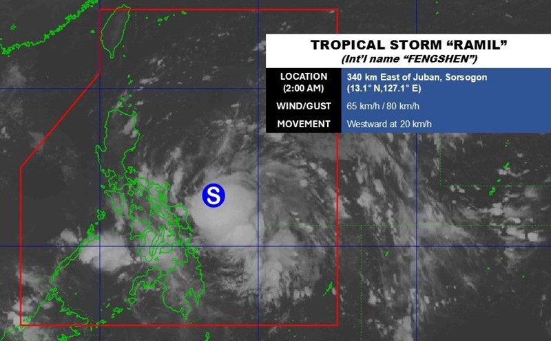
Although Salome is not as strong as Typhoon No. 12 (Fengshen), PAGASA stressed that this is an unpredictable low-pressure system that is likely to change rapidly in intensity when conditions are favorable.
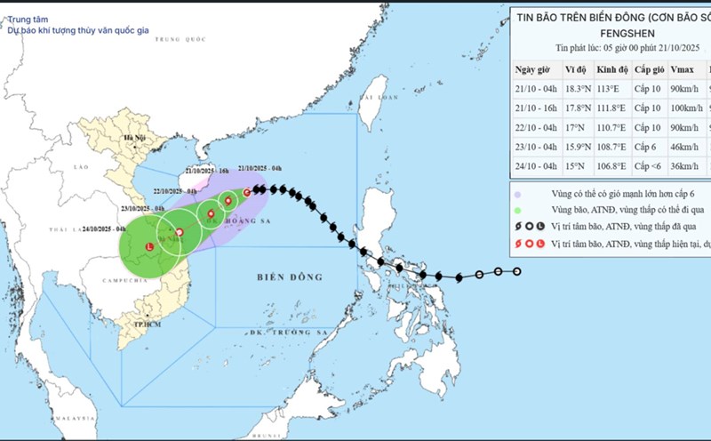
The latest storm information from the Vietnam National Center for Hydro-Meteorological Forecasting (NHCMF) on storm No. 12 said that at 3:00 p.m. on October 22, the center of the storm was at about 17.1 degrees north latitude; 110.0 degrees east longitude, about 210km east-northeast of Da Nang City.
The strongest wind is level 10 (89-102 km/h), gusting to level 12. In the next 3 hours, the storm will move west-southwest, at a speed of about 10km/h.
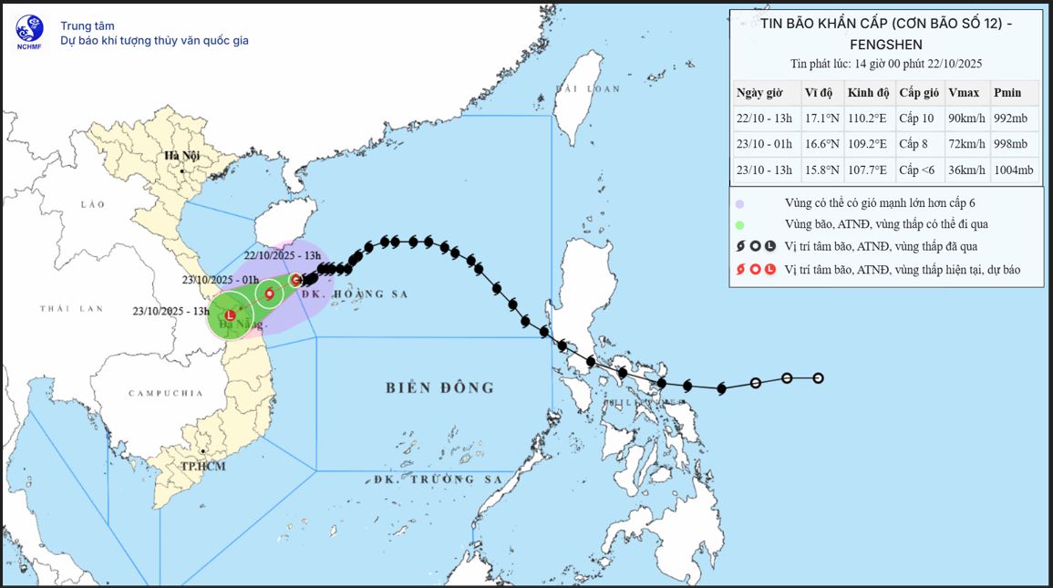
Due to the influence of storm No. 12 combined with strong cold air, from the evening of October 22, on the mainland along the coast of the provinces from Quang Tri to Da Nang City, the wind will gradually increase to level 6, sometimes level 7, gusting to level 8-9.
Regarding heavy rain forecast, from the night of October 22 to October 24, in the area from Ha Tinh to Quang Ngai, there will be heavy rain and thunderstorms with common rainfall of 100-250mm, locally very heavy rain over 350mm; in the area from South Quang Tri to Da Nang City, there will be heavy to very heavy rain with common rainfall of 400-600mm, locally over 800mm (high intensity rain concentrated from the night of October 22 to the end of October 23).