The latest storm information from the Philippine Atmospheric, Geophysical and Astronomical Services Administration (PAGASA) said that at 3:00 a.m. on October 23, the center of tropical storm Salome was located in the sea off the coast of Basco, Batanes province, Philippines, at about 20.5 degrees north latitude, 122.0 degrees east longitude, with the strongest winds of about 65 km/h, gusting to 90 km/h.
The storm is moving south-southwest at a speed of 20 km/h, strongly affected by the cold air mass from China.
PAGASA's storm forecast said that Typhoon Salome will continue to head southwest, likely sweeping through the Batanes and Babuyan islands this morning, then entering Ilocos Norte this afternoon or evening (October 23).
However, due to moving in cold and dry conditions and strong winds from the northern high pressure, the storm will quickly weaken into a tropical depression in the next 12 hours, then a low pressure area.
Salome is not good enough to grow further. Low sea surface temperatures and unfavorable atmospheric conditions will cause the storm to die early, said a PAGASA representative.
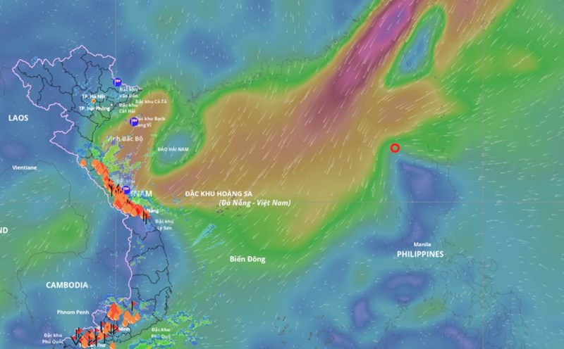
According to the Vietnam National Center for Hydro-Meteorological Forecasting (NCHMF), by 1:00 a.m. on October 24, the center of the storm/tropical depression Salome is forecast to be at 18.2 degrees north latitude, 118.7 degrees east longitude, in the eastern sea of the North East Sea, with an intensity of level 6-7, gusting to level 9, moving south-southwest, 20-25 km/h.
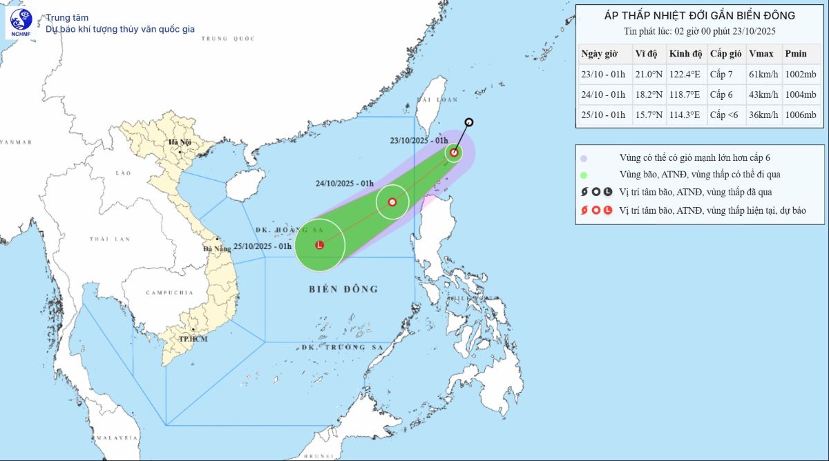
By 1:00 a.m. on October 25, the intensity gradually weakened, below level 6, about 250km east of Hoang Sa Special Zone.
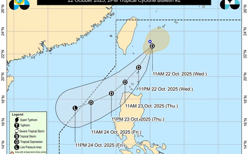
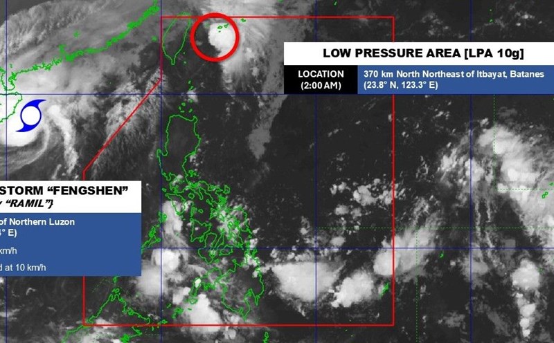
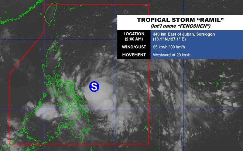
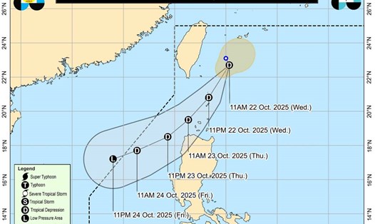
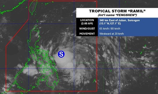
Salome is the 19th typhoon to hit the Philippines in 2025, and the fourth in October, following a series of consecutive typhoons including typhoon Paolo ( Mat Matmo), typhoon Quedan (Nakri) and typhoon Ramil (typhoon 12 Fengshen).
Meteorological experts said that the appearance of storm Salome occurred in the context of the La Nina phenomenon forming in the Pacific Ocean, which is expected to cause rainfall in the Philippines and Southeast Asia to increase higher than normal in the last months of the year.
Regarding Typhoon No. 12 Fengshen, on the morning of October 23, the storm weakened into a tropical depression. At 1:00 a.m. on October 23, the center of the tropical depression was at about 16.3 degrees north latitude; 109.0 degrees east longitude, in the sea from South Quang Tri to Quang Ngai, about 80km east-northeast of Da Nang City.
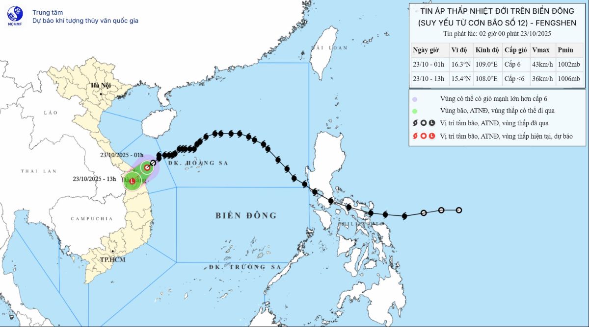
The strongest wind near the center of the tropical depression is level 6 (39-49 km/h), gusting to level 8. Moving southwest, speed 10-15 km/h.
Due to the influence of the tropical depression circulation and cold air combined with winter wind disturbances and terrain effects, from the night of October 22 to the night of October 24, in the area from Ha Tinh to Quang Ngai, there will be heavy rain and thunderstorms with common rainfall of 100-200mm, locally very heavy rain over 300mm; the area from South Quang Tri to Da Nang City will have heavy to very heavy rain with common rainfall of 200-400mm, locally over 700mm.
Warning of the risk of heavy rain (over 150 mm/3 hours) in coastal communes/wards from South Quang Tri to Da Nang City.