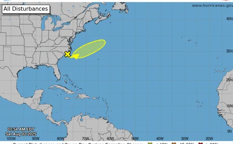
The latest storm information from the Philippine Atmospheric, Geophysical and Astronomical Services Administration (PAGASA) said that at 3:00 a.m. on August 5, the center of low pressure 08a was at about 13.8 degrees North latitude, 132.5 degrees East longitude, 895km east of Southeast Luzon.
"The possibility of the low pressure developing into a tropical storm in the next 24 hours is very low. However, the low pressure is forecast to bring rain, especially across Luzon, the Bicol Region and Eastern Visayas," said PAGASA typhoon forecaster Chenel Dominguez.
Dominguez urged people to monitor PAGASA's weather forecasts for the low pressure.
Meanwhile, the whole Philippines is still going through a monsoon interruption. Scattered showers or thunderstorms are forecast for the southwest monsoon in the Batanes and Babuyan Islands.
PAGASA also issued a storm/low pressure forecast for the next 2 weeks. Accordingly, during the week of August 4-10, there is a possibility of forming 2 low pressure areas in the PAR, but the probability of them developing into storms is low.
Low pressure 1 (low pressure 08a) is in the PAR, while low pressure 2 is likely to appear northeast of low pressure 08a.
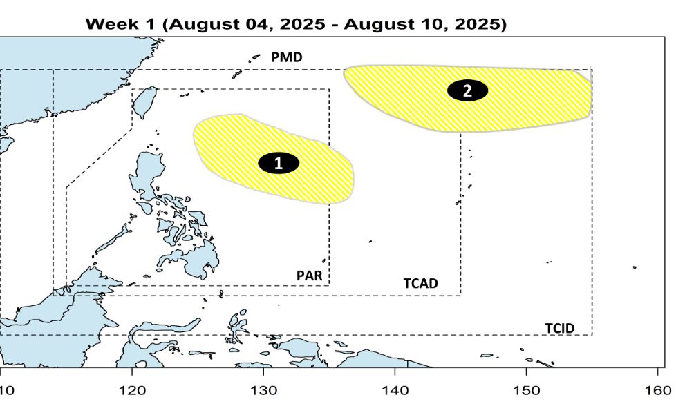
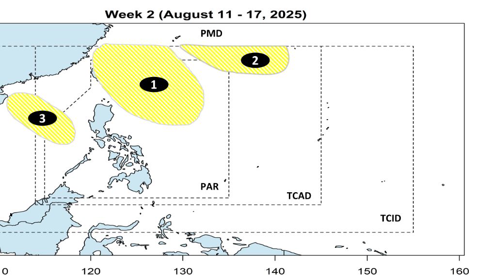
During the week of August 11-17, low pressure 1 (08a) is forecast to move near the northeastern part of Luzon, while low pressure 2 will move towards the northeastern edge of the PAR, but the possibility of them strengthening into a storm is still low.
In addition, a low pressure area 3 may form west of the PAR, near the East Sea, but there is also a very low probability of becoming a storm.
Meanwhile, according to the Vietnam National Center for Hydro-Meteorological Forecasting, on August 5, in the northern sea area of the North East Sea and the North of the Gulf of Tonkin, there will be scattered showers and thunderstorms. During thunderstorms, there is a possibility of tornadoes and strong gusts of wind.
The North East Sea area (including Hoang Sa special zone), the West of the area between the East Sea and the North Gulf of Tonkin has strong southwest winds of level 5, sometimes level 6, gusting to level 7-8; waves from 1.5-3.0m high, rough seas.
All ships operating in the above areas are at risk of being affected by tornadoes and strong gusts of wind.
Regarding rain forecast, in the early morning and morning of August 5, the mountainous and midland areas of the North will have scattered showers and thunderstorms, locally heavy rain (10-20mm, some places over 30mm).
From the afternoon of August 5 to the night of August 6, other places in the North will have moderate rain, locally heavy rain to very heavy rain (30 70mm, some places over 150mm).
In the evening and night of August 5, Thanh Hoa and Nghe An are likely to experience scattered showers and thunderstorms, locally heavy rain (10-30mm, some places over 60mm).
Regarding the forecast of hot weather, on August 5, the Northern Delta and the South of Phu Tho province will have hot weather. Highest temperature: 35-36 degrees Celsius, some places above 36 degrees Celsius. From August 6, the heat will gradually subside.
September 5-6: From Thanh Hoa to Da Nang, the East of the provinces from Quang Ngai to Dak Lak and Khanh Hoa will have hot and severe heat. Highest temperature: 36-38 degrees Celsius, some places above 38 degrees Celsius.
Warning of hot weather in the area from Thanh Hoa to Da Nang, the East of the provinces from Quang Ngai to Dak Lak and Khanh Hoa is likely to last for many days to come.