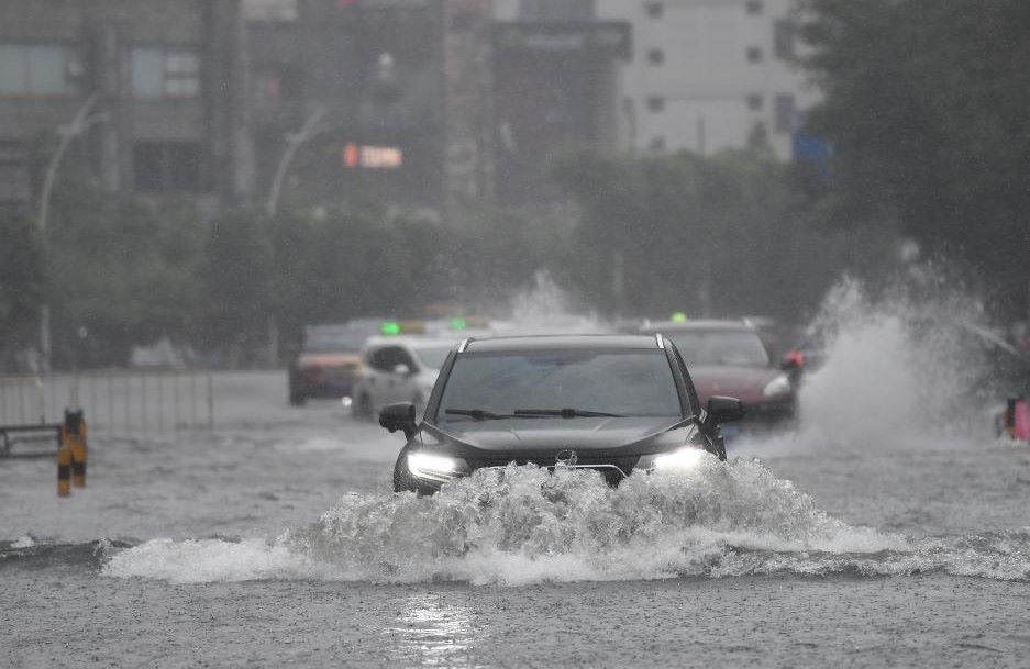
Northern China, including Heilongjiang and Inner Mongolia, have issued red warnings of storms due to prolonged heavy rain, which has caused rivers to rise, causing the risk of flooding agricultural land and flash floods in the mountains.
According to the Tung Hoa - Lieu Ha Irrigation Committee under the Chinese Ministry of Water Resources, from July 24-26, there will be heavy rain in some areas in the Tung Hoa and Lieu Ha river basins, causing water levels in many rivers across the region to rise significantly.
According to the Hac Long Giang Meteorological Station, some towns in Dorbod district, Mongolia's autonomous region, may experience accumulated rainfall of up to 100mm within 3 hours.
Inner Mongolia has also issued a red alert for flash floods in mountains. At 8:20 p.m. on July 25, meteorological agencies forecast over 100mm of rain in 3 hours.
The possibility of flash floods on the mountain will be very high from 8:00 p.m. on July 25 to 8:00 p.m. on July 26 in some areas, including some districts and counties of the capital Hohhot and the border city of Ulanqab.
The Department of Irrigation and the meteorological agency of the northeastern Chinese province of Jilin have also issued an orange warning for the high possibility of natural disasters and flooding, including river floods and flooding of agricultural land in the southwest of the Xuang Spring region, the capital of Jilin, and the central western part of the city of Sichuan.
A yellow alert for flash flood risk was issued later, including the central area of Truong Xuan and the north of Cat Lam city.
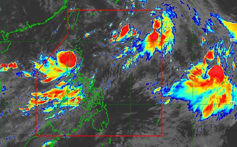
China has a four-tier weather warning system with red being the most severe warning level, followed by orange, yellow and blue.
On July 26, the Vietnam National Center for Hydro-Meteorological Forecasting warned of the risk of flash floods, landslides, and land subsidence on steep slopes and small streams in the provinces of Phu Tho, Thanh Hoa, Ha Tinh, Son La, Nghe An, Lai Chau, Dien Bien, and Lao Cai.
Regarding the weather forecast at sea, on the night of July 26 and July 27, the eastern sea area of the North East Sea, the central East Sea and the sea area from Gia Lai to Ho Chi Minh City will have southwest winds of level 6, gusting to level 7-8, rough seas; waves 2-4m high.
The sea area from Dong Thap to Ca Mau and the South East Sea area (including Truong Sa special zone) has southwest winds of level 5, sometimes level 6, gusting to level 7-8, rough seas; waves 2-3.5m high.
In the Gulf of Tonkin, the North and Central East Sea (including Hoang Sa special zone), the sea area from South Quang Tri to Quang Ngai will have scattered showers and thunderstorms. During thunderstorms, there is a possibility of tornadoes and strong gusts of wind of level 7-8.
On the night of July 27 and July 28, the sea area south of the North East Sea (including Hoang Sa special zone), the Central East Sea area and the sea area from Gia Lai to Ho Chi Minh City will have strong southwest winds of level 6, gusting to level 7-8; waves 2-4m high; rough seas.