On March 26, the Philippine Atmospheric, Geophysical and Astronomical Services Administration (PAGASA) said that during the week from March 26 to April 1, a low pressure will appear in eastern Mindanao.
On the afternoon of March 26, the center of the low pressure was at about 7.6 degrees north latitude, 128.7 degrees east longitude, 315km east of Tagum city.
PAGASA forecasts a low chance of the depression strengthening into a storm in the next 24 hours, although its path may enter the East Sea.
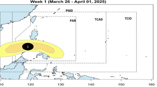
PAGASA warns that areas affected by the low pressure will have rain, so beware of flash floods or landslides that may occur during moderate to heavy rains.
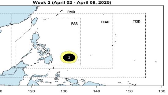
PAGASA forecasts that during the week of April 2-8, another low pressure is expected to appear in the Philippine Forecast Area (PAR). This low pressure is also unlikely to strengthen into a storm.
Last week, PAGASA spokeswoman Ana Liza Solis said that there is a forecast of 0 to 1 tropical storm affecting the Philippines in April.
Forecasting for the 2025 typhoon season, PAGASA said the number of typhoons is "above average", from 16 to 19 typhoons.
Low pressure and storms forming in the Philippines often move into the East Sea. When the storm forms east of the Philippines, many will continue to move west or northwest, entering the East Sea. Northeast monsoons and atmospheric flows also often push storms towards the East Sea.
Each year, about 20-25 storms and tropical depressions form in the West Pacific region. Of which, about 50-70% of storms will pass through the Philippines and enter the East Sea.
When low pressure and storms enter the East Sea, storms may continue to affect Vietnam, China, Taiwan (China) and neighboring countries.