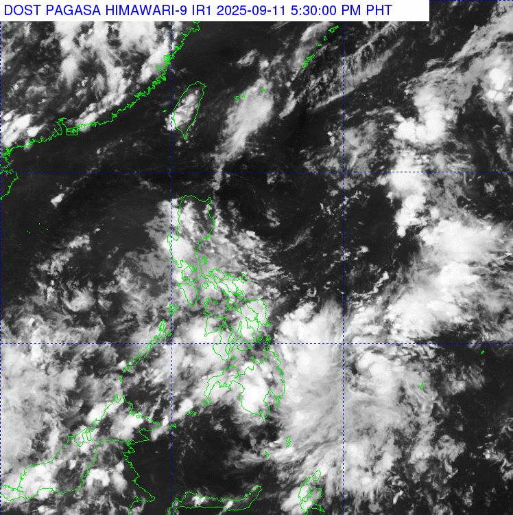
The Philippine Atmospheric, Geophysical and Astronomical Services Administration (PAGASA) said that at 2:00 p.m. on September 11, low pressure area LPA 09c was being monitored in the Philippine Forecast Area (PAR).
The center of the low pressure is located at 7.6 degrees north latitude, 134.8 degrees east longitude, 990km east of Southeast Mindanao. PAGASA forecasts that this low pressure is only likely to strengthen into a tropical depression in the next 24 hours.
Regarding the forecast for storms/low pressure next week, in the period from September 10-16, forecast models have not recorded any clear tropical cyclones in the Philippine forecast area. However, there were 2 low pressure areas.
Low pressure 1 will form at the eastern edge of the PAR, likely approaching Visayas, Mindanao and southern Luzon, before entering the East Sea.
Low pressure 2 forms east of other monitoring areas (TCID and TCAD).
Both of these depressions are likely to develop into tropical depressions or storms at low to medium intensity.
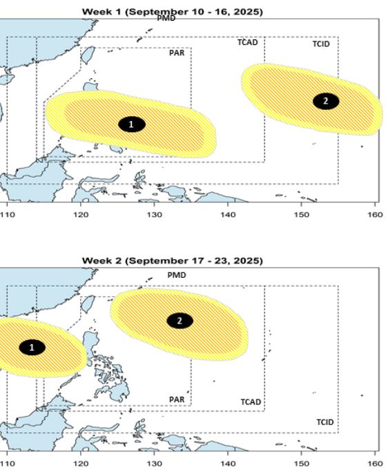
During the week of September 17-23, the above low pressure 1 is likely to leave PAR, enter the East Sea and head towards the coast of Vietnam. Meanwhile, low pressure 2 is forecast to move northeast of PAR. PAGASA's typhoon forecaster assesses the possibility of typhoon formation as low to moderate, but it is still necessary to closely monitor the developments.
PAGASA stressed that the possibility of tropical cyclone formation in the coming days is present and the situation may change rapidly. Therefore, the latest storm bulletins will be issued regularly if there are new developments.
In the context of the rainy season, experts warn people in the Philippines as well as coastal areas of the East Sea to pay attention to rain forecast information and guard against extreme weather risks when the low pressure area moves.