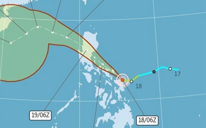
The latest storm information on October 19 from the Philippine Atmospheric, Geophysical and Astronomical Services Administration (PAGASA) said that Typhoon Fengshen (Phong Than, named Ramil in the Philippines) is in the Philippine Forecast Area (PAR).
Typhoon Fengshen is moving west-northwest at a speed of 20 km/h over the coastal waters of Mauban, Quezon, Philippines. The wind speed is maintained at 65 km/h near the center of the storm, with gusts of up to 90 km/h.
According to PAGASA's latest typhoon forecast on the morning of October 19, Fengshen will continue moving west-northwest or northwest when it makes landfall in the vicinity of Quezon province on the morning of October 19.
After making landfall, Typhoon Fengshen will pass through the mainland of South - Central Luzon before overflooding the coastal waters of Pangasinan or Zambales on the afternoon of October 19.
The storm will then continue to move mainly northwest until it leaves the Philippine Forecast Area (PAR) in the morning or afternoon of October 20.
During the sweep across the Philippine mainland, Typhoon Fengshen is forecast to maintain its intensity or weaken slightly due to the friction effect on the mountainous terrain.
It is forecasted that when entering the East Sea, storm No. 12 Fengshen will strengthen again, reaching the level of severe tropical depression in the central East Sea.
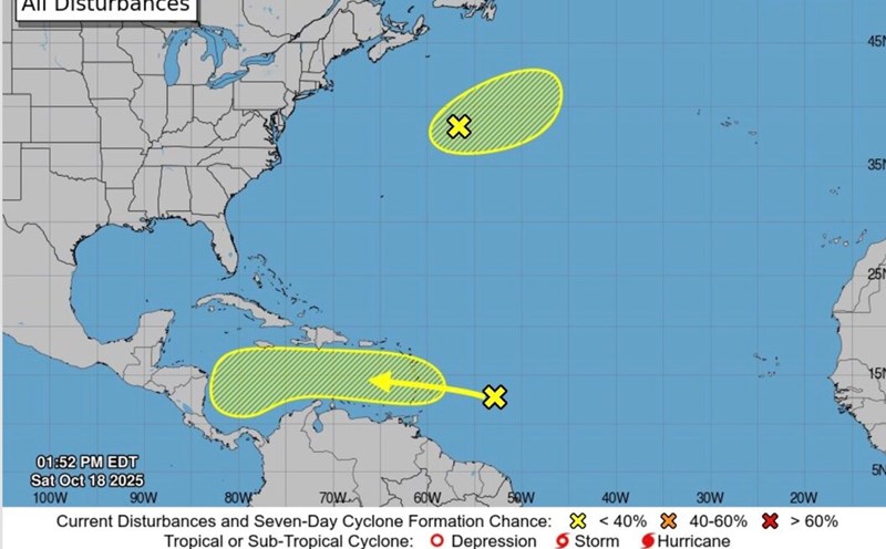
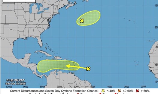
Typhoon Fengshen bulletins in the Philippines said that there are currently no clear forecasts for the path and intensity of Typhoon Fengshen other than the slow movement of the storm until October 20.
The bulletin notes that the first of at least five expected landfall in the Philippines by Typhoon Fengshen occurred at 4:10 p.m. on October 18 in Gubat town, Sorsogon.
At the time of first landfall, Typhoon Fengshen had maximum sustained winds of 65 km/h and gusts of up to 90 km/h. This figure decreased slightly compared to the strong winds of 75 km/h recorded on the morning of October 18, while gusts remained unchanged at 90 km/h.
PAGASA's previous forecast at 11 noon on October 18 shows that the storm could make a first landfall in Northern Samar, Catanduanes or Albay.
Due to the impact of Typhoon Fengshen in the Philippines, more than 4,300 passengers and truck drivers (both drivers and assistants) and more than 1,200 vehicles were stranded at 21 ports in Northeast Luzon, South Tagalog, Bicol and Eastern Visayas, according to the Philippine Coast Guard (PCG).
Bicol is home to the highest number of people stranded, with 3,626 people. There were 1,022 cargo ships, 5 boats... stranded at the ports of Tobaco, Pioduran, Pasacao, Virac, Cataingan, Aroroy, Mobo, San Pascual, Claveria, Cawayan, Castilla, Matnog, Pilar and Bacacay.
In South Tagalog, 107 passengers and 20 cargo were stranded at Real, Atimonan and Alabat ports, while in Eastern Visayas, 655 passengers and 165 cargo were stranded at Sta Clara, Dapdap and Looc ports.
Continuous heavy rains have caused flooding and landslides in some areas of Eastern Visayas. According to the Eastern Visayas Natural Disaster Risk Reduction and Management Office (PDRRMO), in the capital Borongan, some villages were flooded, making it impossible for main roads to pass.
In Biliran province, continuous rains also caused flooding in some barangay in Almeria, while a main road in Barangay Bulalaco, Kawayan town, was also flooded due to rising water. Flooding was also reported in the Cabani and Ol-og villages of Maripipi.
About 210 families of 802 individuals from flood and landslide-prone areas in Naval town were evacuated early to the town's gymnasium on the afternoon of October 17. A landslide was also reported in Villa Vicenta, Caibiran.