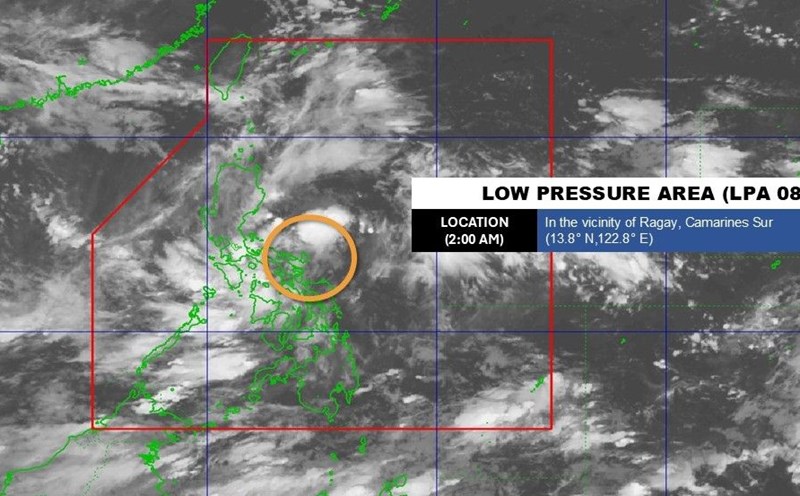
According to the storm forecast on August 27 of the Philippine Atmospheric, Geophysical and Astronomical Services Administration (PAGASA), in September, there will be an average of 2-4 storms forming or entering the Philippine Forecast Area (PAR), including storms that are likely to directly affect the East Sea and mainland of neighboring countries, including Vietnam.
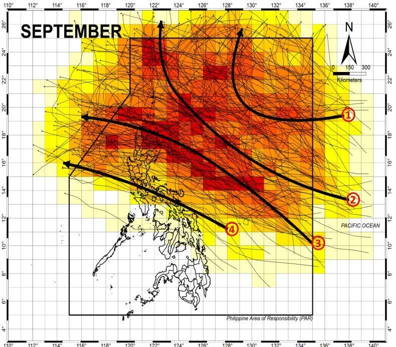
According to PAGASA, the trajectory of September storms can be divided into 4 main groups.
First, tropical cyclones circulating northeast of the PAR (not making landfall) moving towards Japan or South Korea are unlikely to intensify southwest monsoon activity as it passes.
Second, tropical cyclones moving northwest of the PAR, not making landfall, moving towards Taiwan (China), could intensify southwest monsoon activity as it passes.
Third, tropical storms make landfall through northern and northernmost Luzon; moving towards Hong Kong (China) or mainland China.
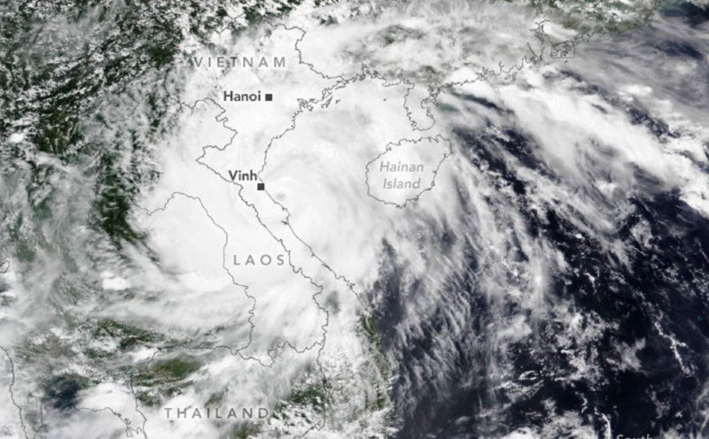
Fourth, tropical storms make landfall in Southern Luzon. This is a group of storms that are likely to directly affect Vietnam. After passing through the Philippines, the storm will move straight into the East Sea, continuing towards the Central or Northern region of Vietnam.
PAGASA noted that September is the period when the southwest monsoon is still active, resonate with the storm circulation that can cause heavy rain, flash floods, and landslides in many areas. Fishermen and boats operating in the East Sea need to pay special attention to be away from the shore, because September storms are often accompanied by high waves and strong gusts of wind.
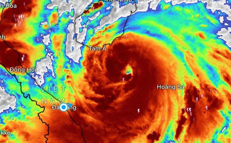
According to storm data statistics from 1977-2021, the East Sea is one of the sea areas with the most dense storm density in the region. September recorded an average of 4.8 storms forming in the Northwest Pacific, many of which entered the East Sea. This explains why September is always considered the "peak season" and often causes major storms that directly affect Vietnam.
Meteorological experts recommend that local people and authorities closely monitor weather forecasts from meteorological agencies.
Proactively develop natural disaster prevention scenarios, especially in coastal, mountainous and midland areas.
Fishermen should limit going out to sea for long periods of time and prepare safe shelters.
With diverse frequency and trajectories, this year's September storm is predicted to create complex and unpredictable developments. Proactive response early will help minimize damage, especially in the context of the East Sea still being the " focus" of many strong storms in 2025.