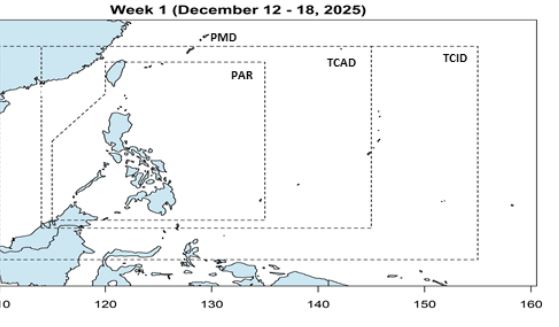
The Philippine Atmospheric, Geophysical and Astronomical Services Administration (PAGASA) said on December 12 that it is forecasted that during the week of December 12-18, 2025, there will be no low pressure or storm in the Philippine Forecast Area (PAR).
However, during the week of December 19-25, a low pressure area is likely to appear in the southeastern Philippines. This low pressure is likely to strengthen into a storm.
Other long-term storm forecast models show that from now until the end of 2025, the western Pacific will be dry, the strong northeast monsoon and strong cold air will make it almost impossible for storms/depressions to form.
Not only the western Pacific, but almost the entire Northern Hemisphere is likely to end 2025 without a new tropical cyclone. Relative droughts, along with strong winds above, are causing long-term forecast models to lean towards the possibility of no storms or tropical depressions forming in the second half of December.
On social media, many people shared simulated maps from the GFS model at the 250-300 hour mark and then thought that "there will be a storm". However, meteorological experts warn that such distant signals are often unconvincing. Convective rain areas appearing at the end of the easterly wind zone are just wind shear, not storms.
This wind shear is enough to completely prevent the organization and development of any tropical disturbances. In this condition, only weak disturbances and small low pressure areas may appear along the convergence zone, but cannot develop into storms.
The winter wind is forecast to continue to dominate the weather until the end of Christmas. The cold air mass from China is set to overflow again early next week.
When cold air collides with a layer of moist hot air from the tropics, it creates a convergence zone of easterly winds, causing showers and thunderstorms mainly in northern and northeastern Luzon (Philippines).
These factors generally hinder the formation of storms due to strong wind shear - an unfavorable environment for tropical cyclones to develop.
In the north, a strong low pressure area over eastern China - sometimes called Shanghai Low - is causing heavy snow in many places in China and Japan. The formation of this system will promote the next cold front to the Southeast Asian region.
In Vietnam, the National Center for Hydro-Meteorological Forecasting said that on December 13, cold air will affect the Northeast and then spread to the North Central, Northwest and Central Central regions.
The weather in the North will turn cold; mountainous and midland areas will be very cold, high mountainous areas will have severe cold. The Northern Delta has some places with severe cold.
Temperature in the mountainous and midland areas of the North is 7-10 degrees Celsius, in high mountainous areas it is below 5°C. Northern Delta: 11-14 degrees Celsius. North Central region: 12-15 degrees Celsius.
Hanoi area: On December 13, there will be moderate rain, heavy rain and thunderstorms; with the risk of tornadoes, lightning, hail, strong gusts of wind. The weather will turn cold, some places will be very cold. The lowest temperature is 12-14 degrees Celsius.


