According to the latest storm report from the Daily Telegraph, Typhoon Alfred is moving slowly and is expected to make landfall between Maroochydore and Coolangatta in Australia on the afternoon of March 7. Previous bulletins predicted that storm Alfred would make landfall on the night of March 6 or the morning of March 7.
On the morning of March 6, the strong Category 2 storm was located 325 km east of Brisbane and 300 km east of Gold Coast. The storm is moving west-southwest at a speed of 7 km/h.
The latest rare typhoon warning area in Australia has been issued from Double Island Point in Queensland to Grafton in New South Wales, including Brisbane, Gold Coast, Sunshine Coast, Byron Bay and Ballina.
Forecasters say that Typhoon Alfred will make landfall on the afternoon of March 7, but it could also make landfall later if the storm continues to weaken.
Sky News Weather meteorologist Alison Osborne said that the slower speed of storm Alfred is likely to cause worse flooding, especially in northern New South Wales.
Hurricane experts also note that moving more slowly does not mean the storm weakens. Typhoon Alfred is expected to maintain its Category 2 intensity as it approaches the Australian coast.
Initially, experts predicted that the storm would make landfall early on the morning of March 7, coinciding with high tides. However, a technical report from the Australian Bureau of Meteorology said the storm could make landfall no later than on 8 March.
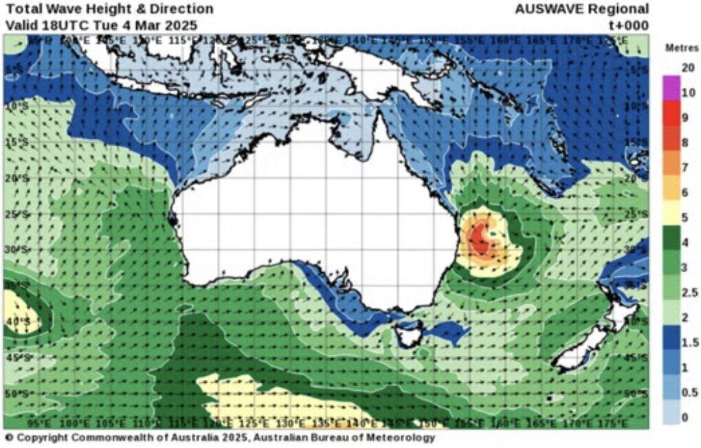
Premier Premier Premier Premier Australia David Crisafulli warned on the morning of March 6 that a 12.3-meter wave had been recorded at Main Beach on the Gold Coast. Note that Alfred is "certainly very strong", Mr. Crisafulli said that the storm moved in a circle overnight, slowing down the expected landfall time.
The Australian Bureau of Meteorology's hurricane bulletin warns that strong gusts of wind could appear on March 6 and 7.
"Skystorms with a destructive power of up to 155 km/h may form in coastal locations, near and south of the storm's eye" - the bulletin noted.
Currently, strong winds of up to 120 km/h are forming near the coast around Coolangatta to Ballina. Due to the impact of storm Alfred, heavy rains are possible along southeastern Queensland and northeastern New South Wales from the night of March 6.
This is the first time in more than five decades that a tropical storm has hit directly on Australia's relatively temperate east coast.
Storms and tropical depressions typically occur in the northern tropical region of Queensland but rarely in the temperate border area with New South Wales. The last time a hurricane hit the Gold Coast was in 1974, when Hurricane Zoe brought major flooding to the area.