The latest storm news from 9News said that tropical storm Alfred has just turned around, approaching the southeastern coast of Australia.
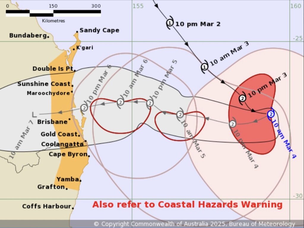
"Tropical Storm Alfred is moving west towards the southeast coast of Australia. Alfred is a Category 2 storm and is expected to maintain this intensity as it approaches the southeastern coast of Australia on March 5. Alfred is expected to make landfall late on March 6 or early on January 7, the Australian Bureau of Meteorological Affairs said.
According to the bulletin, storm Alfred currently has winds of 95 km/h near the center and can reach up to 130 km/h at times.
Ward strengthened into a Category 2 storm as it approached the southeastern coast of Australia, prompting authorities to ask residents to evacuate and declare a state of emergency.
The latest storm forecast says that Alfred will make landfall on March 6 or 7 between the Brisbane and Sunshine Coast. Local authorities have warned that Alfred could be one of the most destructive storms in the region in decades.
If it moves on track, Alfred will be the first storm to affect Brisbane since storm Nancy in 1990.
Due to the impact of storm Alfred, heavy rain could reach 300-600 mm, some areas could see up to 700 mm. Wind gusts are expected to exceed 120 km/h, accompanied by large waves that could cause coastal erosion and flooding.
According to the Independent, Alfred's approach to the southeastern coast of Australia is considered unusual mainly due to the forecast of the storm making landfall near Brisbane - an area rarely directly affected by tropical storms.
Storms and tropical depressions often form in warm waters in northern Australia and then dissipate before reaching the southern seas. The last time a hurricane made landfall directly near Brisbane was in 2014.