A low pressure area is active off the east coast of Luzon Island (Philippines) with the symbol Invest 93W and is being closely monitored by the US Joint Typhoon Warning Center (JTWC).
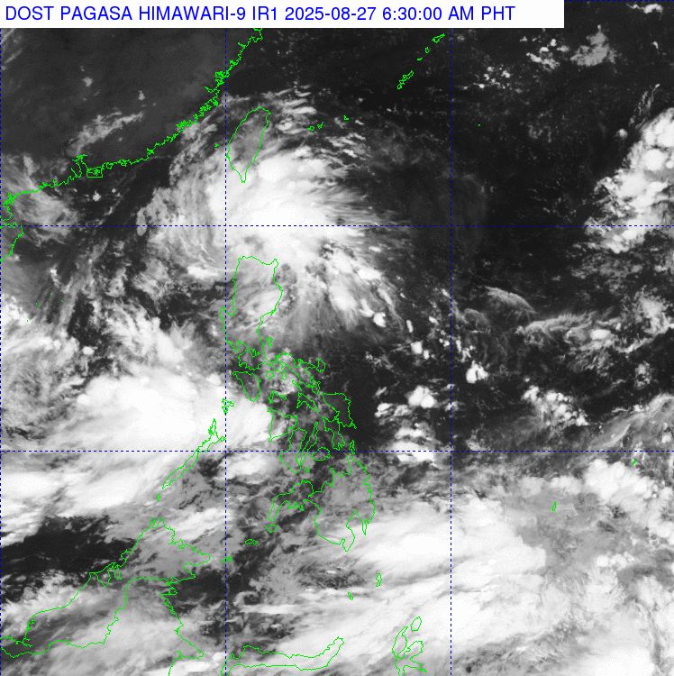
At 3:00 a.m. on August 27, the center of the low pressure was at about 14.8 degrees North latitude, 122.2 degrees East longitude, in Patnanungan, Quezon, Philippines.
Satellite images and radar data show that in the next 24 hours, the low pressure has no conditions to develop into a storm.
However, after crossing Luzon and reaching the sea area west of Mindoro on August 28, the depression is forecast to integrate with another disturbance in the East Sea. At that time, the unified system may gradually strengthen, move westward and likely become a tropical depression before approaching the mainland of Vietnam this weekend.
According to the JTWC, the probability of tropical cyclone formation in the next 7 days is assessed at an average level, about 50%.
Meanwhile, according to the storm/low pressure forecast of the Typhoon page in the Northwest Pacific, the low pressure tends to move in the West Northwest direction and enter the eastern East Sea area on August 27.
After entering the East Sea, the low pressure area will continue to move mainly in the West Northwest direction, towards the Hoang Sa archipelago and is likely to strengthen into a tropical depression.
Due to many factors, the development of the tropical depression will be extremely complicated in terms of trajectory, direction of movement and intensity.
However, it is not excluded that the tropical depression will continue to develop and directly impact the mainland of Vietnam, triggering and causing heavy rain in the mainland areas from the North - North and Central Central regions from around August 30 to around September 1.
According to the latest storm news from JTWC, in addition to the East Sea, many other areas of the Pacific Ocean are also experiencing notable disturbances.
In southeastern Okinawa (Japan), a low trough combined with high-altitude pressure creates a chaotic weather area. However, the probability of development is low, only about 10% in 7 days.
In the central Pacific, south of the Hawaiian Islands, a tropical wave is developing in a favorable environment. It is forecast to become a tropical depression this weekend before entering the West Pacific, but then encountering strong winds at high altitudes is unfavorable. The chance of formation within 7 days is about 60%.
Meanwhile, in Southeast Guam, a low pressure area is expected to form this weekend, with favorable conditions for development. If it strengthens, the system could become a tropical depression as it moves near the Marianas Islands. The probability of development is 40%.
Thus, the focus of current monitoring is the Invest 93W low pressure area, with the risk of becoming a tropical depression and directly affecting Vietnam in the next few days.
Meteorological agencies recommend that fishermen and boats operating in the East Sea regularly update weather forecasts to take timely response measures.
Regarding today's Hanoi weather forecast, the Vietnam National Center for Hydro-Meteorological Forecasting said that the lowest temperature is 24-26 degrees Celsius, the highest temperature is 27-29 degrees Celsius. The weather is cloudy, with moderate rain, heavy rain and thunderstorms, locally very heavy rain; from the afternoon, heavy rain will gradually decrease. Southeast to East wind level 2-3. During thunderstorms, there is a possibility of tornadoes, lightning and strong gusts of wind.