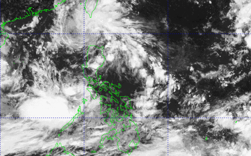
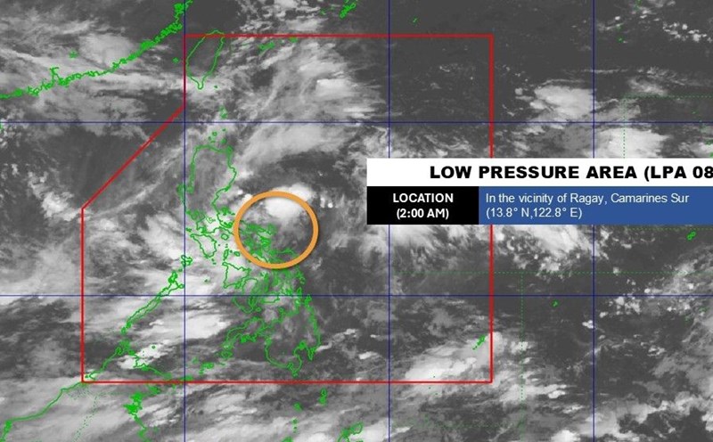
The latest storm information from the Philippine Atmospheric, Geophysical and Astronomical Services Administration (PAGASA) said that at 1:00 p.m. on August 28, the center of tropical depression Jacinto was at about 15.3 degrees North latitude; 115.7 degrees East longitude. The tropical depression is moving in a West-Northwest direction at a speed of 20 km/h. Jacinto is forecast to leave the Philippine Forecast Area (PAR) tonight, then head towards the sea off the central coast of Vietnam.
Meanwhile, according to the storm forecast of the Vietnam National Center for Hydro-Meteorological Forecasting, at 1:00 p.m. on August 28, the tropical depression was in the North East Sea, about 420km East Southeast of Hoang Sa Special Zone. Intensity level 6-7 (39-61 km/h), gust level 9. The tropical depression is moving southwest at a speed of about 10-15 km/h.
It is forecasted that by 1:00 p.m. on August 29, the center of the tropical depression will be at 16.7 degrees North latitude, 112.3 degrees East longitude; in the sea area of Hoang Sa special zone. Intensity level 7, gust level 9; Moving in the West Northwest direction, 15-20km/h and possibly stronger. The North East Sea area (including Hoang Sa special zone), the North Central East Sea area is at risk of level 3 natural disasters.
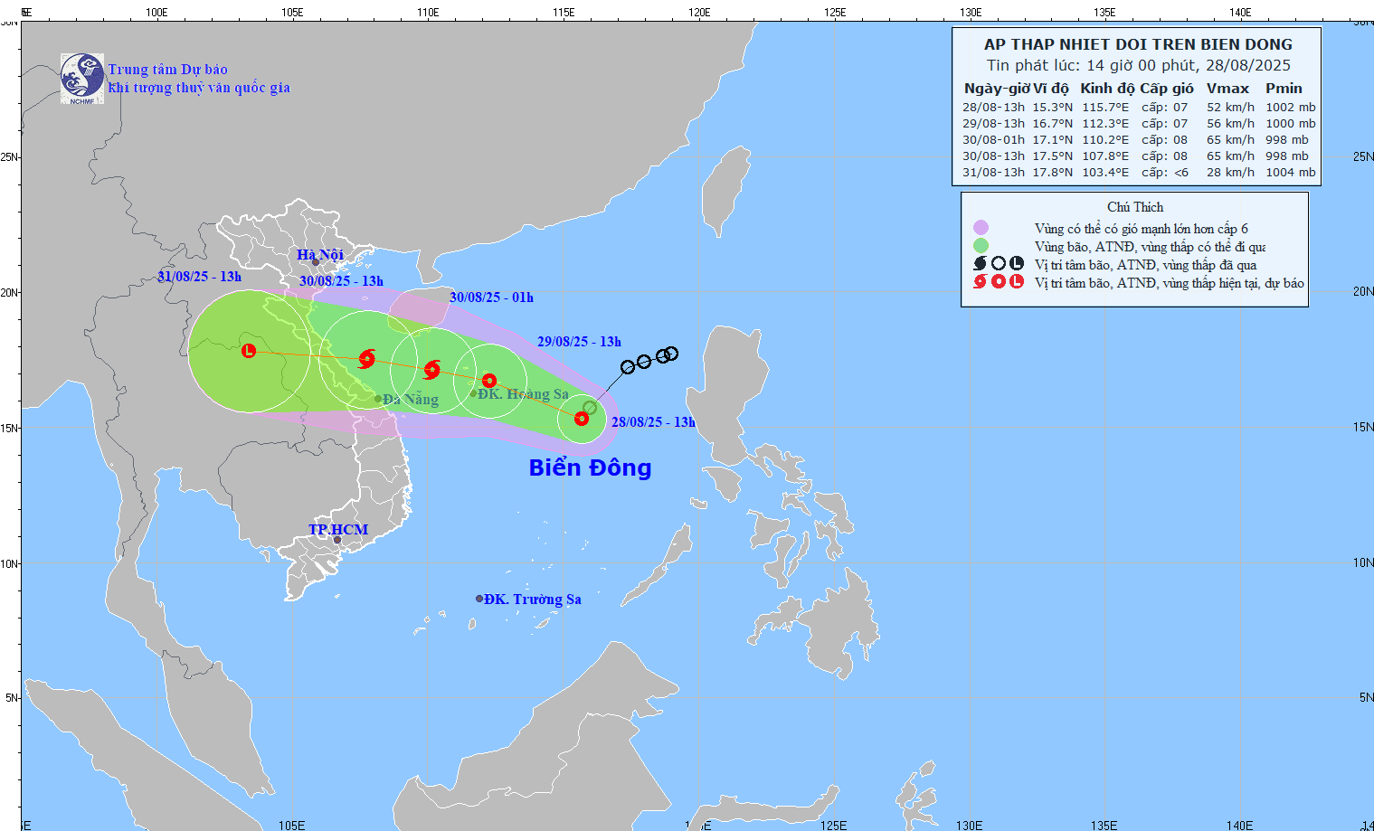
It is forecasted that by 1:00 p.m. on August 30, the center of the tropical depression will be at 17.5 degrees North latitude, 107.8 degrees East longitude; in the waters from Nghe An to Da Nang. Intensity level 8, gust level 10. Moving in the West Northwest direction, 20 km/h. The western sea area of the North East Sea, the sea area from Nghe An to Da Nang is at risk of level 3 natural disasters.
From the next 48 to 72 hours, the tropical depression will continue to move mainly in the West direction, traveling about 20km per hour and gradually weakening.
Also on August 28, the US Joint Typhoon Warning Center (JTWC) said that many other areas in the West Pacific are recording the formation of new tropical disturbances.
Interference A (Southern Okinawa, Japan): Attached to a low pressure trough, the possibility of strengthening into a storm is almost non-existent (0%). However, the disturbance could still bring heavy rain to the Ryukyu Islands, including Okinawa, this weekend.
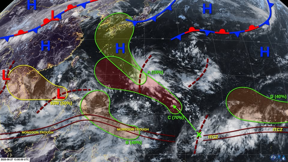
Interruption B (Southern Koror): A low pressure area is forecast to form over the weekend, potentially becoming a short-term tropical depression. The probability of formation in the next 7 days is average (40%).
Intermittent C (Dong Nam Guam): A tropical wave that is producing strong thunderstorms. The system is likely to develop into a tropical depression or storm early next week (70%) as it moves northwest toward the sea east of the Philippines.
Disturbance D (South Hawaii): The low pressure area is small with scattered rain, the probability of storm formation is average (40%), but will weaken as it moves into the West Pacific.
Weather forecasters warn that with the continuous appearance of new low pressure, tropical depressions and disturbances, the East Sea - West Pacific will experience a period of intense storm and tropical depression activity in late August and early September.